Estimation of forest cover change using Sentinel-2 multi-spectral imagery in Georgia (the Caucasus)
Giorgi Mikeladze (1) , Alexander Gavashelishvili (1), Ilia Akobia (2), Vasil Metreveli (1)
iForest - Biogeosciences and Forestry, Volume 13, Issue 4, Pages 329-335 (2020)
doi: https://doi.org/10.3832/ifor3386-013
Published: Aug 07, 2020 - Copyright © 2020 SISEF
Research Articles
Abstract
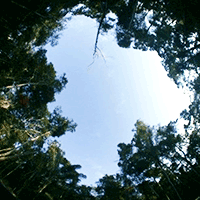
Our objective was to use Sentinel-2A multispectral data in order to cost-effectively detect change in forest cover in Georgia (the Caucasus). Generalized additive models (GAMs) were used to fit forest cover measures to Sentinel-2A spectral band values modified using different topographic correction methods. Canopy closure (calculated from upward-looking fisheye photographs taken beneath forest canopy) was the best forest cover measure accounted for by the Sentinel-2 spectral data that were topographically corrected using the Minnaert Correction (R2 = 0.882). Spectral bands best explaining canopy closure were Band 3 (Green), Band 8 (NIR) and Band 12 (SWIR). Our model is able to reasonably detect spatial and temporal changes in canopy closure, even in highly rugged terrain and diverse vegetation cover, and it has potential to be improved to the extent that it can be applied by managers of natural resources. Based on free open source applications in combination with cheap gadgets our approach might play an important role in monitoring the forests of countries with low economic indicators.
Keywords
Generalized Additive Models, Forest Cover, Satellite Imagery, Sentinel-2, Fisheye, Topographic Correction
Authors’ Info
Authors’ address
Alexander Gavashelishvili 0000-0001-9677-6038
Vasil Metreveli 0000-0002-9558-0655
Center of Biodiversity Studies, Institute of Ecology, Ilia State University, Cholokashvili Str. 5, 0162 Tbilisi (Georgia)
Department of Geoinformatics, Institute of Botany, Ilia State University, Botanical Str. 1, 0105 Tbilisi (Georgia)
Corresponding author
Paper Info
Citation
Mikeladze G, Gavashelishvili A, Akobia I, Metreveli V (2020). Estimation of forest cover change using Sentinel-2 multi-spectral imagery in Georgia (the Caucasus). iForest 13: 329-335. - doi: 10.3832/ifor3386-013
Academic Editor
Maurizio Marchi
Paper history
Received: Feb 25, 2020
Accepted: Jun 03, 2020
First online: Aug 07, 2020
Publication Date: Aug 31, 2020
Publication Time: 2.17 months
Copyright Information
© SISEF - The Italian Society of Silviculture and Forest Ecology 2020
Open Access
This article is distributed under the terms of the Creative Commons Attribution-Non Commercial 4.0 International (https://creativecommons.org/licenses/by-nc/4.0/), which permits unrestricted use, distribution, and reproduction in any medium, provided you give appropriate credit to the original author(s) and the source, provide a link to the Creative Commons license, and indicate if changes were made.
Web Metrics
Breakdown by View Type
Article Usage
Total Article Views: 43671
(from publication date up to now)
Breakdown by View Type
HTML Page Views: 36285
Abstract Page Views: 3553
PDF Downloads: 3083
Citation/Reference Downloads: 11
XML Downloads: 739
Web Metrics
Days since publication: 2008
Overall contacts: 43671
Avg. contacts per week: 152.24
Citation Metrics
Article Citations
Article citations are based on data periodically collected from the Clarivate Web of Science web site
(last update: Mar 2025)
Total number of cites (since 2020): 6
Average cites per year: 1.00
Publication Metrics
by Dimensions ©
Articles citing this article
List of the papers citing this article based on CrossRef Cited-by.
References
Forest canopy cover and height from MISR in topographically complex Southwestern US landscapes assessed with high quality reference data. IEEE Journal of Selected Topics in Applied Earth Observations and Remote Sensing 5: 44-58.
CrossRef | Gscholar
Topographic normalization of Landsat thematic mapper digital imagery. Photogrammetric Engineering and Remote Sensing 55: 1303-1309.
Gscholar
Mapping tree density at a global scale. Nature 525 (7568): 201-205.
CrossRef | Gscholar
Indirect measurement of forest canopy structure from in situ optical sensors. In: “Remote Sensing of Forest Environments” (Wulder MA, Franklin SE eds). Springer, Boston, MA, USA, pp. 77-113.
Gscholar
Gap Light Analyzer (GLA), version 2.0: imaging software to extract canopy structure and gap light transmission indices from true-color fisheye photographs. Simon Fraser University, Burnaby, BC, and the Institute of Ecosystem Studies, Millbrook, New York, USA.
Online | Gscholar
Solar radiation in forests: theory for hemispherical photography. In: “Hemispherical Photography in Forest Science: Theory, Methods, Applications” (Fournier RA, Hall RJ eds). Series “Managing Forest Ecosystems”. Springer, Netherlands, pp. 15-52.
Gscholar
The Lambertian assumption and Landsat data. Photogrammetric Engineering and Remote Sensing 46: 1183-1189.
Gscholar
The comparison of canopy density measurement using UAV and hemispherical photography for remote sensing based mapping. In: Proceedings of the “4th International Conference on Science and Technology”. Yogyakarta (Indonesia) 7-8 Aug 2018. Institute of Electrical and Electronics Engineers - IEEE, IEEEXplore, pp. 1-5.
CrossRef | Gscholar

