
Remote sensing-supported vegetation parameters for regional climate models: a brief review
iForest - Biogeosciences and Forestry, Volume 3, Issue 4, Pages 98-101 (2010)
doi: https://doi.org/10.3832/ifor0543-003
Published: Jul 15, 2010 - Copyright © 2010 SISEF
Review Papers
Collection/Special Issue: NFZ Summer School 2009 - Birmensdorf (Switzerland)
Long-term ecosystem research: understanding the present to shape the future
Guest Editors: Marcus Schaub (WSL, Switzerland)
Abstract
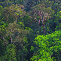
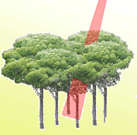
Land surface plays a key role in a climate system. Thus, the land surface description will become increasingly important for climate modelling by its feedbacks on the climate. Various forms of active/passive remotely sensed data are nowadays being used to provide continuous and up-to-date information on the earth’s surface on both global and regional scales. This information is useful to be included in climate models. This review summarizes how LAI and albedo, two of the most important land surface parameters, could be derived from remote sensing. Whereas the high acquisition frequency, accessibility, and spatial continuality are referred to potential advantages, the scaling is still a drawback which may cause further problems such as incompatibility of different remote sensing data sources for a specific climate model. Moreover, issues like shadow and atmospheric effects are often problematic, especially when optical remote sensing is applied. Here, suggestions for improvement are made and open questions are pointed out.
Keywords
Regional climate models, Forest and vegetation parameters, Active and passive remote sensing
Authors’ Info
Authors’ address
Dept. of Remote Sensing and Landscape Information Systems, University of Freiburg, Tennenbacher straße 4, D-79106 Freiburg (Germany)
Institute of Environment and Earth Sciences, Faculty of Forestry, University of West Hungary, 9400 Sopron (Hungary)
Corresponding author
Paper Info
Citation
Latifi H, Galos B (2010). Remote sensing-supported vegetation parameters for regional climate models: a brief review. iForest 3: 98-101. - doi: 10.3832/ifor0543-003
Academic Editor
Marcus Schaub
Paper history
Received: May 25, 2010
Accepted: May 31, 2010
First online: Jul 15, 2010
Publication Date: Jul 15, 2010
Publication Time: 1.50 months
Copyright Information
© SISEF - The Italian Society of Silviculture and Forest Ecology 2010
Open Access
This article is distributed under the terms of the Creative Commons Attribution-Non Commercial 4.0 International (https://creativecommons.org/licenses/by-nc/4.0/), which permits unrestricted use, distribution, and reproduction in any medium, provided you give appropriate credit to the original author(s) and the source, provide a link to the Creative Commons license, and indicate if changes were made.

Web Metrics
Breakdown by View Type
Article Usage
Total Article Views: 60691
(from publication date up to now)
Breakdown by View Type
HTML Page Views: 49461
Abstract Page Views: 4928
PDF Downloads: 4873
Citation/Reference Downloads: 45
XML Downloads: 1384
Web Metrics
Days since publication: 5825
Overall contacts: 60691
Avg. contacts per week: 72.93
Citation Metrics
Article Citations
Article citations are based on data periodically collected from the Clarivate Web of Science web site
(last update: Mar 2025)
Total number of cites (since 2010): 7
Average cites per year: 0.44
Publication Metrics
by Dimensions ©
Articles citing this article
List of the papers citing this article based on CrossRef Cited-by.
References
Estimation of surface reflectance and vegetation index using NOAA/AVHRR: methods and results at global scale. Communication for the 6th International Symposium on Physical Measurements and Signatures in Remote Sensing, ISPRS. Val d’Isere, France.
Gscholar
Biogeophysical effects of historical land cover changes simulated by six Earth system models of intermediate complexity. Climate Dynamics 26: 587-600.
CrossRef | Gscholar
Global high resolution versus limited area model climate change projections over Europe: quantifying confidence level from PRUDENCE results. Climate Dynamics 25: 653-670.
CrossRef | Gscholar
Updated regional precipitation and temperature changes for the 21st century from ensembles of recent AOGCM simulations. Geophysical Research Letters 32: L21715.
Gscholar
Derivation of global GCM boundary conditions from 1km land use satellite data. MPI-M, Report 289, Hamburg, Germany.
Gscholar
An improved land surface parameter dataset for global and regional climate models. MPI-M, Report 336, Hamburg, Germany.
Gscholar
Estimating dynamics of CO2 flux in agro-ecosystems based on synergy of remote sensing and process modelling - a methodological study. In: “Global environmental change in the ocean and on land” (Shyomi et al. eds). Terrapub 2004, pp. 375-390.
Gscholar
A comprehensive model intercomparison study investigating the water budget during the BALTEX-PIDCAP Period. Meteorology and Atmospheric Physics 77: 19-43.
CrossRef | Gscholar
Satellitengeschützte fernentkundung und modellierung des globalen CO2-austausch der landvegetation: eine synthese. Examensarbeit 49, MPI-M Hamburg, Germany.
Gscholar
Estimation of LAI using LiDAR remote sensing in forest. ISPRS Workshop on Laser Scanning and SilviLaser 2007, Espoo-Finland.
Gscholar
Remote sensing of albedo using the BRDF in relation to land surface properties. In: “Observing land from space: science, customers and technology” (Verstraete MM, et al. eds). Kluwer Academic Publishers, pp. 175-186.
Gscholar
Ecological challenges of climate change in Europe’s continental, drought-threatened Southeast. In: “Regional aspects of climate-terrestrial-hydrologic interactions in non-boreal Eastern Europe” (Groisman PY, Sergiy VI eds). NATO Science Series, Springer Verlag, pp. 35-46.
Gscholar
Forest LAI estimation comparison using LiDAR and hyperspectral data in boreal and temperate forests. In: “Remote Sensing and Modeling of Ecosystems for Sustainability VI” (Gao W, Jackson TJ). Proceedings of the SPIE, vol. 7454, pp. 74540-74548.
Gscholar
Review the evolution of, and revolution in, land surface schemes designed for climate models. International Journal of Climatology. 23: 479-510.
Gscholar
Remote sensing of forest environments: concepts and case studies. Kluwer Academic Publishers, Boston, USA.
Gscholar
Related Content

Ciesielski M, Sterenczak K
Vol. 12, pp. 498-510 (online: Dec 2019)

Jackson CM, Adam E
Vol. 13, pp. 286-300 (online: Aug 2020)
Martin H, Labbé S, Baldet P, Archaux F, Philippe G
Vol. 10, pp. 215-219 (online: Feb 2017)
Corona P, Lamonaca A, Chirici G
Vol. 1, pp. 6-12 (online: Feb 2008)
Mancino G, Nolè A, Urbano V, Amato M, Ferrara A
Vol. 2, pp. 154-161 (online: Jul 2009)
Cavalli A, Francini S, Cecili G, Cocozza C, Congedo L, Falanga V, Spadoni GL, Maesano M, Munafò M, Chirici G, Scarascia Mugnozza G
Vol. 15, pp. 220-228 (online: Aug 2022)
Jayasekara D, Dhananjani T, Mendis V, Jayawickrama H, Prasad T, Gunarathna MM, Gunarathna P, Mahaulpatha D
Vol. 18, pp. 45-53 (online: Apr 2025)
Figueiredo De Souza RL, Dionizio EA, Lopes Cavalcante RB
Vol. 19, pp. 85-93 (online: Apr 2026)
Martin H, Monnet JM, De Boisvilliers M, Chevalier R, Villar M
Vol. 13, pp. 409-416 (online: Oct 2020)
Pirotti F
Vol. 4, pp. 100-106 (online: Jun 2011)


