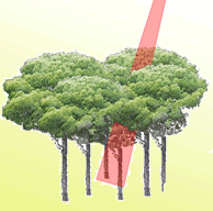
Accurate and updated knowledge of forest tree heights is fundamental in the context of forest management. However, measuring canopy height over large forest areas using traditional inventory techniques is laborious, time-consuming and excessively expensive. In this study, image-based point clouds produced from stereo aerial photographs (AP) were used to estimate forest height, and compared to Airborne Laser Scanning (ALS) data. We generated image-based Canopy Height Models (CHM) using different image-matching algorithms (SGM: Semi-Global Matching; eATE: enhanced Automatic Terrain Extraction), which were compared with a pure ALS-derived CHM. Additionally, plot-level height and density metrics were extracted from CHMs and used as explanatory variables for predicting the Lorey’s mean height (LMH), which was measured at 296 reference points on the ground. CHMSGM and CHMALS showed similar results in predicting LMH at sample plot locations (RMSE% = 8.54 vs. 7.92, respectively), while CHMeATE had lower accuracy (RMSE% = 13.23). Similarly, CHMSGM showed a lower normalized median absolute deviation (NMAD) from CHMALS (0.68 m) compared to CHMeATE (1.1 m). Our study revealed that image-based point clouds using SGM in the presence of high-resolution ALS-derived digital terrain model (DTM) provide comparable results with ALS data, while the performance of image-based point clouds using eATE is poorer than ALS for forest height estimation. The findings of this study provide a viable and cost-effective option for assessing height-related forest structural parameters. The proposed methodology can be usefully applied in all those countries where AP are updated on a regular basis and pre-existing historical ALS-derived DTMs are available.
Keywords
, , , , ,
Citation
Ullah S, Adler P, Dees M, Datta P, Weinacker H, Koch B (2017). Comparing image-based point clouds and airborne laser scanning data for estimating forest heights. iForest 10: 273-280. - doi: 10.3832/ifor2077-009
Academic Editor
Matteo Garbarino
Paper history
Received: Apr 06, 2016
Accepted: Oct 30, 2016
First online: Feb 23, 2017
Publication Date: Feb 28, 2017
Publication Time: 3.87 months
© SISEF - The Italian Society of Silviculture and Forest Ecology 2017
Open Access
This article is distributed under the terms of the Creative Commons Attribution-Non Commercial 4.0 International (https://creativecommons.org/licenses/by-nc/4.0/), which permits unrestricted use, distribution, and reproduction in any medium, provided you give appropriate credit to the original author(s) and the source, provide a link to the Creative Commons license, and indicate if changes were made.

Breakdown by View Type
(Waiting for server response...)
Article Usage
Total Article Views: 59204
(from publication date up to now)
Breakdown by View Type
HTML Page Views: 48366
Abstract Page Views: 4352
PDF Downloads: 5235
Citation/Reference Downloads: 29
XML Downloads: 1222
Web Metrics
Days since publication: 3411
Overall contacts: 59204
Avg. contacts per week: 121.50
Article Citations
Article citations are based on data periodically collected from the Clarivate Web of Science web site
(last update: Mar 2025)
Total number of cites (since 2017): 10
Average cites per year: 1.11
Publication Metrics
by Dimensions ©
Articles citing this article
List of the papers citing this article based on CrossRef Cited-by.
(1)
Bohlin J, Wallerman J, Fransson JE (2012)Forest variable estimation using photogrammetric matching of digital aerial images in combination with a high-resolution DEM. Scandinavian Journal of Forest Research 27 (7): 692-699.
CrossRef |
Gscholar
(2)
Brandtberg T (1999)Automatic individual tree based analysis of high spatial resolution aerial images on naturally regenerated boreal forests. Canadian Journal of Forest Research 29 (10): 1464-1478.
CrossRef |
Gscholar
(3)
Dees M, Straub C, Koch B (2012)Can biodiversity study benefit from information on the vertical structure of forests? Utility of LiDAR remote sensing. Current Science (Bangalore) 102 (8): 1181-1187.
Online |
Gscholar
(4)
ERDAS_IMAGINE (2012)LPS eATE. Hexagon Geospatial, Madison, AL, USA.
Online |
Gscholar
(5)
Fieber KD, Davenport IJ, Tanase MA, Ferryman JM, Gurney RJ, Becerra VM, Walker JP, Hacker JM (2015)Validation of canopy height profile methodology for small-footprint full-waveform airborne LiDAR data in a discontinuous canopy environment. ISPRS Journal of Photogrammetry and Remote Sensing 104: 144-157.
CrossRef |
Gscholar
(6)
Gehrke S, Morin K, Downey M, Boehrer N, Fuchs T (2010)Semi-global matching: an alternative to LIDAR for DSM generation. In: Proceedings of the “2010 Canadian Geomatics Conference and Symposium of Commission I (vol. 2)”. ISPR, Canada, pp. 6.
Online |
Gscholar
(7)
Gobakken T, Naesset E (2008)Assessing effects of laser point density, ground sampling intensity, and field sample plot size on biophysical stand properties derived from airborne laser scanner data. Canadian Journal of Forest Research 38 (5): 1095-1109.
CrossRef |
Gscholar
(8)
Gross J, Ligges U (2012)Nortest: tests for normality. R package version 1: 0-2, R Foundation for Statistics Computing, Vienna, Austria.
Online |
Gscholar
(9)
Hirschmuller H (2005)Accurate and efficient stereo processing by semi-global matching and mutual information. In: Proceedings of the IEEE Computer Society Conference “Computer Vision and Pattern Recognition 2005 (CVPR 2005)”. IEEE, vol. 2, pp. 807-814.
CrossRef |
Gscholar
(10)
Hirschmüller H (2008)Stereo processing by semiglobal matching and mutual information., IEEE Transactions on Pattern Analysis and Machine Intelligence 30 (2): 328-341.
CrossRef |
Gscholar
(11)
Hobi ML, Ginzler C (2012)Accuracy assessment of digital surface models based on WorldView-2 and ADS80 stereo remote sensing data. Sensors 12 (5): 6347-6368.
CrossRef |
Gscholar
(12)
Hyyppä J, Inkinen M (1999)Detecting and estimating attributes for single trees using laser scanner. The Photogrammetric Journal of Finland 16 (2): 27-42.
Gscholar
(13)
Hyyppä J, Hyyppä H, Leckie D, Gougeon F, Yu X, Maltamo M (2008)Review of methods of small footprint airborne laser scanning for extracting forest inventory data in boreal forests. International Journal of Remote Sensing 29 (5): 1339-1366.
CrossRef |
Gscholar
(14)
Höhle J, Höhle M (2009)Accuracy assessment of digital elevation models by means of robust statistical methods. ISPRS Journal of Photogrammetry and Remote Sensing 64 (4): 398-406.
CrossRef |
Gscholar
(15)
Jan J-F (2005)Comparison of forest canopy height derived using LIDAR data and aerial photos. Taiwan Journal for Science 20: 13-27. -
Online |
Gscholar
(16)
Järnstedt J, Pekkarinen A, Tuominen S, Ginzler C, Holopainen M, Viitala R (2012)Forest variable estimation using a high-resolution digital surface model. ISPRS Journal of Photogrammetry and Remote Sensing 74: 78-84.
CrossRef |
Gscholar
(17)
Koch B, Heyder U, Weinacker H (2006)Detection of individual tree crowns in airborne lidar data. Photogrammetric Engineering and Remote Sensing 72 (4): 357-363.
CrossRef |
Gscholar
(18)
Kublin E (2003)Einheitliche Beschreibung der Schaftform-Methoden und Programme-BDATPro [A uniform description of stem profiles - methods and programs - BDATPro]. European Journal of Forest Research 122 (3): 183-200. [in German]
Gscholar
(19)
Kuhn M (2008)The caret package. R Foundation for Statistical Computing, Vienna, Austria.
Online |
Gscholar
(20)
Lorey T (1878)Die mittlere Bestandeshöhe [The average canopy height]. Allgemeine Forst-und Jagdzeitung 54: 149-155. [in German]
Gscholar
(21)
Magnusson M (2006)Evaluation of remote sensing techniques for estimation of forest variables at stand level. Doctoral thesis, Swedish University of Agricultural Sciences, Umeå, Sweden, pp. 38.
Online |
Gscholar
(22)
Maltamo M, Packalen P (2014)Species-specific management inventory in Finland. In: “Forestry Applications of Airborne Laser Scanning”. Springer Science+Business Media, Dordrecht, Netherlands, pp. 241-252.
CrossRef |
Gscholar
(23)
Naesset E (2002)Predicting forest stand characteristics with airborne scanning laser using a practical two-stage procedure and field data. Remote Sensing of Environment 80 (1): 88-99.
CrossRef |
Gscholar
(24)
Naesset E, Okland T (2002)Estimating tree height and tree crown properties using airborne scanning laser in a boreal nature reserve. Remote Sensing of Environment 79 (1): 105-115.
CrossRef |
Gscholar
(25)
Naesset E (2004)Effects of different flying altitudes on biophysical stand properties estimated from canopy height and density measured with a small-footprint airborne scanning laser. Remote Sensing of Environment 91 (2): 243-255.
CrossRef |
Gscholar
(26)
Naesset E (2007)Airborne laser scanning as a method in operational forest inventory: status of accuracy assessments accomplished in Scandinavia. Scandinavian Journal of Forest Research 22 (5): 433-442.
CrossRef |
Gscholar
(27)
Naesset E (2014)Area-based inventory in Norway-from innovation to an operational reality. In: “Forestry Applications of Airborne Laser Scanning”. Springer Science+Business Media, Dordrecht, Netherlands, pp. 215-240.
CrossRef |
Gscholar
(28)
Nelson R, Krabill W, MacLean G (1984)Determining forest canopy characteristics using airborne laser data. Remote Sensing of Environment 15 (3): 201-212.
CrossRef |
Gscholar
(29)
Nilsson M (1996)Estimation of tree heights and stand volume using an airborne lidar system. Remote Sensing of Environment 56 (1): 1-7.
CrossRef |
Gscholar
(30)
Ota T, Ogawa M, Shimizu K, Kajisa T, Mizoue N, Yoshida S, Takao G, Hirata Y, Furuya N, Sano T, Sokh H, Ma V, Ito E, Toriyama J, Monda Y, Saito H, Kiyono Y, Chann S, Ket N (2015)Aboveground biomass estimation using structure from motion approach with aerial photographs in a seasonal tropical forest. Forests 6 (11): 3882-3898.
CrossRef |
Gscholar
(31)
Packalén P, Pitkänen J, Maltamo M (2008)Comparison of individual tree detection and canopy height distribution approaches: a case study in Finland. In: Proceedings of the Conference “SilviLaser 2008”. Edinburgh (UK) 17-19 Sept 2008, pp 22-29.
Online |
Gscholar
(32)
Pitkänen J, Maltamo M, Hyyppä J, Yu X (2004)Adaptive methods for individual tree detection on airborne laser based canopy height model. International Archives of Photogrammetry, Remote Sensing and Spatial Information Sciences 36 (8): 187-191.
Online |
Gscholar
(33)
R Core Team (2014)R: a language and environment for statistical computing. R Foundation for Statistical Computing. Vienna, Austria.
Online |
Gscholar
(34)
Rahlf J, Breidenbach J, Solberg S, Naesset E, Astrup R (2014)Comparison of four types of 3D data for timber volume estimation. Remote Sensing of Environment 155: 325-333.
CrossRef |
Gscholar
(35)
Rothermel M, Haala N (2011)Potential of dense matching for the generation of high quality digital elevation models. In: Proceedings of the “ISPRS Hannover Workshop 2011: High-Resolution Earth Imaging for Geospatial Information”. ISPRS - International Archives of the Photogrammetry, Remote Sensing and Spatial Information Sciences XXXVIII-4/W19: 271-276.
CrossRef |
Gscholar
(36)
Rönnholm P, Hyyppä J, Hyyppä H, Haggrén H, Yu X, Kaartinen H (2004)Calibration of laser-derived tree height estimates by means of photogrammetric techniques. Scandinavian Journal of Forest Research 19 (6): 524-528.
CrossRef |
Gscholar
(37)
Scharstein D, Szeliski R (2002)A taxonomy and evaluation of dense two-frame stereo correspondence algorithms. International Journal of Computer Vision 47(1-3): 7-42.
Online |
Gscholar
(38)
St-Onge B, Jumelet J, Cobello M, Véga C (2004)Measuring individual tree height using a combination of stereophotogrammetry and lidar. Canadian Journal of Forest Research 34 (10): 2122-2130.
CrossRef |
Gscholar
(39)
Stepper C, Straub C, Pretzsch H (2015)Assessing height changes in a highly structured forest using regularly acquired aerial image data. Forestry 88 (3): 304-316.
CrossRef |
Gscholar
(40)
Straub C, Stepper C, Seitz R, Waser LT (2013a)Potential of UltraCamX stereo images for estimating timber volume and basal area at the plot level in mixed European forests. Canadian Journal of Forest Research 43 (8): 731-741.
CrossRef |
Gscholar
(41)
Straub C, Tian J, Seitz R, Reinartz P (2013b)Assessment of Cartosat-1 and WorldView-2 stereo imagery in combination with a LiDAR-DTM for timber volume estimation in a highly structured forest in Germany. Forestry 86 (4): 463-473.
CrossRef |
Gscholar
(42)
Tesfamichael S, Van Aardt J, Ahmed F (2010)Estimating plot-level tree height and volume of
Eucalyptus grandis plantations using small-footprint, discrete return lidar data. Progress in Physical Geography 34 (4): 515-540.
CrossRef |
Gscholar
(43)
Véga C, St-Onge B (2008)Height growth reconstruction of a boreal forest canopy over a period of 58 years using a combination of photogrammetric and lidar models. Remote Sensing of Environment 112 (4): 1784-1794.
CrossRef |
Gscholar
(44)
Weinacker H, Koch B, Weinacker R (2004)TREESVIS: a software system for simultaneous ED-real-time visualisation of DTM, DSM, laser raw data, multispectral data, simple tree and building models. International Archives of Photogrammetry, Remote Sensing and Spatial Information Sciences 36: 90-95.
Online |
Gscholar
(45)
White JC, Wulder MA, Vastaranta M, Coops NC, Pitt D, Woods M (2013)The utility of image-based point clouds for forest inventory: A comparison with airborne laser scanning. Forests 4 (3): 518-536.
CrossRef |
Gscholar
(46)
White JC, Arnett JT, Wulder MA, Tompalski P, Coops NC (2015a)Evaluating the impact of leaf-on and leaf-off airborne laser scanning data on the estimation of forest inventory attributes with the area-based approach. Canadian Journal of Forest Research 45 (11): 1498-1513.
CrossRef |
Gscholar
(47)
White JC, Stepper C, Tompalski P, Coops NC, Wulder MA (2015b)Comparing ALS and image-based point cloud metrics and modelled forest inventory attributes in a complex coastal forest environment. Forests 6 (10): 3704-3732.
CrossRef |
Gscholar
(48)
Yamamoto K, Takahashi T, Miyachi Y, Kondo N, Morita S, Nakao M, Shibayama T, Takaichi Y, Tsuzuku M, Murate N (2017)Estimation of mean tree height using small-footprint airborne LiDAR without a digital terrain model. Journal of Forest Research 16 (6): 425-431.
CrossRef |
Gscholar
(49)
Yu X, Hyyppä J, Kaartinen H, Maltamo M (2004)Automatic detection of harvested trees and determination of forest growth using airborne laser scanning. Remote Sensing of Environment 90 (4): 451-462.
CrossRef |
Gscholar
(50)
Zielewska-Büttner K, Adler P, Ehmann M, Braunisch V (2016)Automated detection of forest gaps in spruce dominated stands using canopy height models derived from stereo aerial imagery. Remote Sensing 8 (3): 175.
Gscholar