Integrating area-based and individual tree detection approaches for estimating tree volume in plantation inventory using aerial image and airborne laser scanning data
Emily T Shinzato (1) , Yosio E Shimabukuro (1), Nicholas C Coops (2), Piotr Tompalski (2), Esthevan AG Gasparoto (3)
iForest - Biogeosciences and Forestry, Volume 10, Issue 1, Pages 296-302 (2016)
doi: https://doi.org/10.3832/ifor1880-009
Published: Dec 15, 2016 - Copyright © 2016 SISEF
Research Articles
Abstract
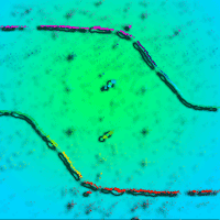
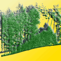
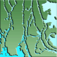
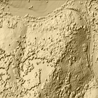
Remote sensing has been increasingly used to assist forest inventory. Airborne Laser Scanning (ALS) systems can accurately estimate tree height in forests, and are being combined with more traditional optical images that provide further details about the horizontal structure of forests. To predict forest attributes two main techniques are applied to process ALS data: the Area Based Approach (ABA), and the Individual Tree Detection (ITD). The first part of this study was focused on the effectiveness of integrating ALS data and aerial imagery to estimate the wood volume in Eucalyptus urograndis plantations using the ABA approach. To this aim, we analyzed three different approaches: (1) using only ALS points cloud metrics (RMSE = 6.84%); (2) using only the variables derived from aerial images (RMSE = 8.45%); and (3) the integration of both 1 and 2 (RMSE = 5.23%), which underestimated the true volume by 2.98%. To estimate individual tree volumes we first detected individual trees and corrected the density estimate for detecting mean difference, with an error of 0.37 trees per hectare and RMSE of 12.68%. Next, we downscaled the total volume prediction to single tree level. Our approach showed a better result of the overall volume in comparison with the traditional forest inventory. There is a remarkable advantage in using the Individual Tree Detection approach, as it allows for a spatial representation of the number of trees sampled, as well as their volume per unit area - an important metric in the management of forest resources.
Keywords
Forest Inventory, Airborne Laser Scanning, Treetop Detection, Eucalyptus Plantation, Area-based Approach, LiDAR
Authors’ Info
Authors’ address
Yosio E Shimabukuro
Department of Remote Sensing, National Institute for Space Research - INPE, São Paulo (Brazil)
Piotr Tompalski
Department of Forest Resources Management, University of British Columbia, Victoria, BC (Canada)
Department of Forest Sciences, Luiz de Queiroz College of Agriculture, University of São Paulo , Piricicaba (Brazil)
Corresponding author
Paper Info
Citation
Shinzato ET, Shimabukuro YE, Coops NC, Tompalski P, Gasparoto EAG (2016). Integrating area-based and individual tree detection approaches for estimating tree volume in plantation inventory using aerial image and airborne laser scanning data. iForest 10: 296-302. - doi: 10.3832/ifor1880-009
Academic Editor
Piermaria Corona
Paper history
Received: Sep 21, 2015
Accepted: Aug 26, 2016
First online: Dec 15, 2016
Publication Date: Feb 28, 2017
Publication Time: 3.70 months
Copyright Information
© SISEF - The Italian Society of Silviculture and Forest Ecology 2016
Open Access
This article is distributed under the terms of the Creative Commons Attribution-Non Commercial 4.0 International (https://creativecommons.org/licenses/by-nc/4.0/), which permits unrestricted use, distribution, and reproduction in any medium, provided you give appropriate credit to the original author(s) and the source, provide a link to the Creative Commons license, and indicate if changes were made.

Web Metrics
Breakdown by View Type
Article Usage
Total Article Views: 53714
(from publication date up to now)
Breakdown by View Type
HTML Page Views: 43694
Abstract Page Views: 4183
PDF Downloads: 4378
Citation/Reference Downloads: 44
XML Downloads: 1415
Web Metrics
Days since publication: 3481
Overall contacts: 53714
Avg. contacts per week: 108.01
Citation Metrics
Article Citations
Article citations are based on data periodically collected from the Clarivate Web of Science web site
(last update: Mar 2025)
Total number of cites (since 2017): 13
Average cites per year: 1.44
Publication Metrics
by Dimensions ©
Articles citing this article
List of the papers citing this article based on CrossRef Cited-by.
References
Quantificação dos recursos florestais - árvores, arvoredos e florestas [Quantification of forest resources - trees, grove and forests]. Oficina de Textos, São Paulo, Brazil, pp. 384. [in Portuguese]
Gscholar
The semi-individual tree crown approach. In: “Forestry Applications of Airborne Laser Scanninng: Concepts and Case Studies” (Maltamo M ed). Springer Science + Business Media, Dordrecht, Netherlands, pp. 113-133.
Gscholar
Escolha de espécies de eucalipto [Choosing Eucalyptus species]. Circular Técnica IPEF, Piracicaba, Brazil, vol. 47, pp. 1-30. [in Portuguese]
Gscholar
An introduction to statistical learning with applications in R. Springer Science+Business Media, New York, USA, pp. 426.
Gscholar
An international comparison of individual tree detection and extraction using airborne laser scanning. Remote Sensing 4: 950-974.
CrossRef | Gscholar
Forest inventory parameters and carbon mapping from airborne LiDAR. Dissertation, The University of Twente, Enschede, The Netherlands, pp. 89.
Gscholar
A model-based approach for the recovery of forest attributes using airborne laser scanning data. In: “Forestry Applications of Airborne Laser Scanninng: Concepts and Case Studies” (Maltamo M ed). Springer Science + Business Media, Dordrecht, Netherlands, pp. 193-211.
CrossRef | Gscholar
Tree top detection using local maxima filtering: a parameter sensitivity analysis. In: Proceedings of the “10th International Conference on LiDAR Application for Assessing Forest Ecossystems”. Freiburg (Germany) Sep 2010. Silvaser 2010, Freiburg, Germany, pp. 9.
Online | Gscholar
Mensuração automática de copas de Araucaria angustifolia (Bertol.) Kuntze a partir de dados LiDAR para estimativa de variáveis dendrométricas [Automatic measurement of Araucaria angustifolia’s crowns (Bertol.) Kuntze from LiDAR data to estimate dendrometric variables]. Dissertation, State University of Santa Catarina, Brazil, pp. 174. [in Portuguese]
Gscholar
Detecting and measuring individual trees using airborne laser scanner. Photogrammetric Engineering and Remote Sensing 68 (9): 925-932.
Gscholar
Automatisierung des massen, sorten und wertberechnung stenender waldbestände Schriftenreihe Bad [Automation of the mass, varieties and value for calculating forest stock series]. Wurtt-Forstl, Koblenz, Germany.
Gscholar
Avaliação econômica de dois sistemas de colheita florestal mecanizada de eucalipto [Economic evaluation of two systems of mechanized forest harvest of Eucaliptus]. Master Thesis, Faculty of Agronomic Sciences Ciências, UNESP, Botucatu, SP, Brazil, pp. 105. [in Portuguese]
Online | Gscholar
A best practices guide for generating forest inventory attributes from airborne laser scanning data using an area-based approach (Version 2.0). Information Report FI-X-010, Natural Resources Canada, Canadian Forest Service and Canadian Wood Fiber Centre, Victoria, BC, Canada, pp. 41.
Online | Gscholar
Related Content
Sačkov I, Hlásny T, Bucha T, Juriš M
Vol. 10, pp. 459-467 (online: Apr 2017)
Sefercik UG, Atesoglu A
Vol. 10, pp. 491-497 (online: Apr 2017)

D’Amico G, Vangi E, Francini S, Giannetti F, Nicolaci A, Travaglini D, Massai L, Giambastiani Y, Terranova C, Chirici G
Vol. 14, pp. 144-154 (online: Apr 2021)
Seidel D, Ammer C
Vol. 7, pp. 227-232 (online: Aug 2014)

Ciesielski M, Sterenczak K
Vol. 12, pp. 498-510 (online: Dec 2019)
Spiazzi Favarin JA, Sabadi Schuh M, Marchesan J, Alba E, Soares Pereira R
Vol. 17, pp. 229-235 (online: Aug 2024)
Ritter T, Tockner A, Krassnitzer R, Witzmann S, Gollob C, Nothdurft A
Vol. 17, pp. 269-276 (online: Oct 2024)
Smreček R, Michnová Z, Sačkov I, Danihelová Z, Levická M, Tuček J
Vol. 11, pp. 181-188 (online: Feb 2018)

Jiménez E, Vega JA, Fernández-Alonso JM, Vega-Nieva D, Ortiz L, López-Serrano PM, López-Sánchez CA
Vol. 10, pp. 590-596 (online: Jun 2017)
Smreček R, Danihelová Z
Vol. 6, pp. 48-54 (online: Feb 2013)


