Rapid assessment of wind storm-caused forest damage using satellite images and stand-wise forest inventory data
D Jonikavičius (1) , G Mozgeris (2)
iForest - Biogeosciences and Forestry, Volume 6, Issue 3, Pages 150-155 (2013)
doi: https://doi.org/10.3832/ifor0715-006
Published: Apr 08, 2013 - Copyright © 2013 SISEF
Research Articles
Collection/Special Issue: IUFRO 7.01.00 - COST Action FP0903, Kaunas (Lithuania - 2012)
Biological Reactions of Forest to Climate Change and Air Pollution
Guest Editors: Elena Paoletti, Andrzej Bytnerowicz, Algirdas Augustaitis
Abstract
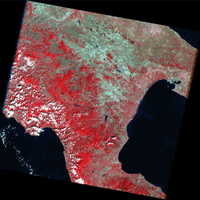
This paper introduces a method for rapid forest damage assessment using satellite images and stand-wise forest inventory data. Two Landsat 5 Thematic Mapper (TM) images from June and September 2010 and data from a forest stand register developed within the frameworks of conventional stand-wise forest inventories in Lithuania were used to assess the forest damage caused by wind storms that occurred on August 8, 2010. Satellite images were geometrically and radiometrically corrected. The percentage of damage in terms of wind-fallen or broken tree volume was then predicted for each forest compartment within the zone potentially affected by the wind storm, using the non-parametric k-nearest neighbor technique. Satellite imagery-based difference images and general forest stand characteristics from the stand register were used as the auxiliary data sets for prediction. All auxiliary data were available from existing databases, and therefore did not involve any added data acquisition costs. Simultaneously, aerial photography of the area damaged by the wind storm was carried-out and color infrared (CIR) orthophotos with a resolution of 0.5 x 0.5 m were produced. A precise manual interpretation of the effects of the wind storm was used to validate satellite image-based estimates. The total wind damaged volume in pine dominating forest (~1.180.000 m3) was underestimated by 2.2%, in predominantly spruce stands (~233.000 m3) by 2.6% and in predominantly deciduous stands (~195.000 m3) by 4.2%, compared to validation data. The overall accuracy of identification of wind-damaged areas was around 95-98%, based solely on difference data from satellite images gathered on two dates.
Keywords
Forest Damage, Satellite Images, Change Detection, k-Nearest Neighbour
Authors’ Info
Authors’ address
Laboratory of Geomatics, Institute of Land Management and Geomatics, Aleksandras Stulginskis University, Studentu 11, LT-53361 Akademija, Kaunas distr. (Lithuania)
Institute of Forest Management and Wood Science, Aleksandras Stulginskis University, Studentu 11, LT-53361 Akademija, Kaunas distr. (Lithuania)
Corresponding author
Paper Info
Citation
Jonikavičius D, Mozgeris G (2013). Rapid assessment of wind storm-caused forest damage using satellite images and stand-wise forest inventory data. iForest 6: 150-155. - doi: 10.3832/ifor0715-006
Academic Editor
Agostino Ferrara
Paper history
Received: Jul 31, 2012
Accepted: Feb 26, 2013
First online: Apr 08, 2013
Publication Date: Jun 01, 2013
Publication Time: 1.37 months
Copyright Information
© SISEF - The Italian Society of Silviculture and Forest Ecology 2013
Open Access
This article is distributed under the terms of the Creative Commons Attribution-Non Commercial 4.0 International (https://creativecommons.org/licenses/by-nc/4.0/), which permits unrestricted use, distribution, and reproduction in any medium, provided you give appropriate credit to the original author(s) and the source, provide a link to the Creative Commons license, and indicate if changes were made.
Web Metrics
Breakdown by View Type
Article Usage
Total Article Views: 58243
(from publication date up to now)
Breakdown by View Type
HTML Page Views: 48164
Abstract Page Views: 3806
PDF Downloads: 4600
Citation/Reference Downloads: 83
XML Downloads: 1590
Web Metrics
Days since publication: 4688
Overall contacts: 58243
Avg. contacts per week: 86.97
Citation Metrics
Article Citations
Article citations are based on data periodically collected from the Clarivate Web of Science web site
(last update: Mar 2025)
Total number of cites (since 2013): 16
Average cites per year: 1.23
Publication Metrics
by Dimensions ©
Articles citing this article
List of the papers citing this article based on CrossRef Cited-by.
References
Users guide to the most similar neighbor imputation program version 2. Gen. Tech. Rep. RMRS-GTR-96, Rocky Mountain Research Station, USDA Forest Service, Ogden, UT, USA, pp. 35.
Gscholar
Explorations in geographic information systems technology. Volume 1. Change and time series analysis. United Nations Institute for Training and Research, United Nations Environment Program Global Resource Information Database, pp. 86.
Gscholar
Combined use of NFI sample plots and Landsat TM data to provide forest information on municipality level. In: Proceedings of IUFRO conference “Remote sensing and forest monitoring” (Zawila-Niedzwinski T, Brach M eds). Rogow (Poland) 1-3 Jun. 1999. Office for Official Publications of the European Communities, Luxembourg, pp. 167-174.
Gscholar
Utilising satellite imagery and digital detection of clear cuttings for timber supply management. International Archives of Photogrammetry and Remote Sensing, vol. XXXIII, Part B7, pp. 481-488.
Gscholar
Spectral interpretation of changes in forest using satellite scanner images. Acta Forestalia Fennica 222: 112.
Gscholar
Estimation of volumes for mature forests using the k-nearest neighbor technique and satellite image. In: Proccedings of the 4 International Conference “Rural development 2009”. Akademija (Lithuania) 15-17 October 2009, vol. 4 (2), pp. 235-240.
Gscholar
Estimation of forest parameters using the non-parametric techniques and satellite images at compartment level. In: Proceedings of the annual 16 International Conference “Research for rural development 2010”. Jelgava (Latvia) 19-21 May 2010, pp. 194-200.
Gscholar
Forest change detection using medium resolution single acquisition time satellite images. In: Proceedings of the “Biennial International Symposium Forest and Sustainable Development”. University of Brasov, Faculty of Silviculture and Forest Engineering, Brasov (Rumania) 15-16 October 2010. Transilvania University Press, pp. 421-426.
Gscholar
Remote sensing and image interpretation (6 edn). John Wiley and Sons Inc., USA, pp. 756.
Gscholar
Using remotely sensed data to construct and assess forest attribute maps and related spatial products, Scandinavian Journal of Forest Research 25 (4): 340-367.
Gscholar
Most similar neighbor: an improved sampling inference procedure for natural resource planning. Forest Science 41: 337-359.
Gscholar
Estimation and use of continuous surfeces of forest parameters: options for Lithuanian forest inventory. Baltic Forestry 14 (2): 176-184.
Gscholar
Systemy informacji geograficznej w urzdzaniu lasu na Litwie - dekada praktycznego stosowania. Sylwan 1: 58-63.
Gscholar
Estimation of forest variables using satellite image data and airborne LiDAR. PhD thesis, Department of Forest Resource Management and Geomatics, Swedish University of Agricultural Sciences, Umea, Sweden. Acta Universitatis Agriculturae Sueciae, Silvestrias, pp. 17.
Gscholar
Monitoring of local reflectance changes in boreal forests using satellite data, Dissertation, Biometry and Forest Management Department, Swedish University of Agricultural Sciences, Umea, Sweden.
Gscholar
Multi-source national forest inventory of Finland. In: Proceedings of the IUFRO S4.02 “Ilvessalo Symposium on National Forest Inventories”. Finnish Forest Research Institute, University of Helsinki, Helsinki, Finland, pp. 52-60.
Gscholar
The Finnish multisource national forest inventory - small area estimation and map production. In: “Forest inventory: methodology and applications” (Kangas A, Maltamo M eds). Springer, Berlin, Germany, pp. 191-220.
Gscholar
Change detection and controlling forest information using multi-temporal Landsat TM imagery. Acta Forestalia Fennica 258: 64.
Gscholar

