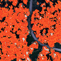
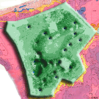
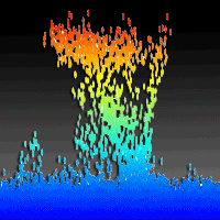
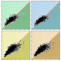
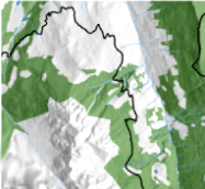
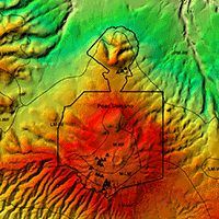
Knowledge of forest biomass is an essential parameter for managing the forest in a sustainable way, as forest biomass data availability and reliability are necessary for forestry and forest planning, but also for the carbon market as well as to support the local economy in the mountain and inner areas. However, the accurate quantification of the above-ground biomass (AGB) is still a challenge both at the local and global levels. The use of remote sensing techniques with Unmanned Aerial Vehicle (UAV) platforms can be an excellent trade-off between resolution, scale, and frequency data of AGB estimation. In this study, we evaluated the combined use of RGB images from UAV, LiDAR data and ground truth data to estimate AGB in a forested watershed in Southern Italy. A low-cost AGB estimation method was adopted using a commercial fixed-wing drone equipped with an RGB camera, combined with the canopy information derived by LiDAR and validated by field data. Two modelling methods (stepwise regression, SR and random forest, RF) were used to estimate forest AGB. The output was an accurate maps of AGB for each model. The RF model showed better accuracy than the Steplm model, and the R2 increased from 0.81 to 0.86, and the RMSE and MAE values were decreased from 45.5 to 31.7 Mg ha-1 and from 34.2 to 22.1 Mg ha-1 respectively. We demonstrated that by increasing the computing efficiency through a machine learning algorithm, readily available images can be used to obtain satisfactory results, as proven by the accuracy of the Random forest above biomass estimation model.
Keywords
, , , ,
Citation
Maesano M, Santopuoli G, Moresi FV, Matteucci G, Lasserre B, Scarascia Mugnozza G (2022). Above ground biomass estimation from UAV high resolution RGB images and LiDAR data in a pine forest in Southern Italy. iForest 15: 451-457. - doi: 10.3832/ifor3781-015
Academic Editor
Carlotta Ferrara
Paper history
Received: Feb 10, 2021
Accepted: Sep 18, 2022
First online: Nov 03, 2022
Publication Date: Dec 31, 2022
Publication Time: 1.53 months
© SISEF - The Italian Society of Silviculture and Forest Ecology 2022
Open Access
This article is distributed under the terms of the Creative Commons Attribution-Non Commercial 4.0 International (https://creativecommons.org/licenses/by-nc/4.0/), which permits unrestricted use, distribution, and reproduction in any medium, provided you give appropriate credit to the original author(s) and the source, provide a link to the Creative Commons license, and indicate if changes were made.

Breakdown by View Type
(Waiting for server response...)
Article Usage
Total Article Views: 35310
(from publication date up to now)
Breakdown by View Type
HTML Page Views: 27719
Abstract Page Views: 4121
PDF Downloads: 2993
Citation/Reference Downloads: 14
XML Downloads: 463
Web Metrics
Days since publication: 1184
Overall contacts: 35310
Avg. contacts per week: 208.76
Article Citations
Article citations are based on data periodically collected from the Clarivate Web of Science web site
(last update: Mar 2025)
Total number of cites (since 2022): 10
Average cites per year: 2.50
Publication Metrics
by Dimensions ©
Articles citing this article
List of the papers citing this article based on CrossRef Cited-by.
(1)
Anaya JA, Chuvieco E, Palacios-Orueta A (2009)Aboveground biomass assessment in Colombia: a remote sensing approach. Forest Ecology and Management 257: 1237-1246.
CrossRef |
Gscholar
(2)
Chen L., Ren C, Zhang B, Wang Z, Xi Y (2018)Estimation of forest above-ground biomass by geographically weighted regression and machine learning with Sentinel imagery. Forests 9 (10): 582.
CrossRef |
Gscholar
(3)
Chirici G, Corona P, Marchetti M, Mastronardi A, Maselli F, Bottai L, Travaglini D (2012)K-NN FOREST: a software for the non-parametric prediction and mapping of environmental variables by the k nearest neighbors algorithm. European Journal of Remote Sensing 45: 433-442.
CrossRef |
Gscholar
(4)
Dang ATN, Nandy S, Srinet R, Luong NV, Ghosh S, Kumar AS (2019)Forest aboveground biomass estimation using machine learning regression algorithm in Yok Don National Park, Vietnam. Ecological Informatics 50: 24-32.
CrossRef |
Gscholar
(5)
Dhanda P, Nandy S, Kushwaha S, Ghosh S, Murthy YK, Dadhwal V (2017)Optimizing spaceborne LiDAR and very high resolution optical sensor parameters for biomass estimation at ICESat/GLAS footprint level using regression algorithms. Progress in Physical Geography 41 (3): 247-267.
CrossRef |
Gscholar
(6)
Di Lallo G, Maesano M, Masiero M, Mugnozza GS, Marchetti M (2016)Analyzing strategies to enhance small and low intensity managed forests certification in Europe using SWOT-ANP. Small-scale Forestry 15 (3): 393-411.
CrossRef |
Gscholar
(7)
Fox J, Weisberg S (2019)An R companion to applied regression (3rd edn). Sage, Thousand Oaks CA, USA, pp. 608.
Online |
Gscholar
(8)
Hawrylo P, Tompalski P, Wezyk P (2017)Area-based estimation of growing stock volume in Scots pine stands using ALS and airborne image-based point clouds. Forestry 90 (5): 686-696.
CrossRef |
Gscholar
(9)
He Q, Chen E, An R, Li Y (2013)Above-ground biomass and biomass components estimation using LiDAR data in a coniferous forest. Forests 4 (4): 984-1002.
CrossRef |
Gscholar
(10)
Ingram JC, Dawson TP, Whittaker RJ (2005)Mapping tropical forest structure in south eastern Madagascar using remote sensing and artificial neural networks. Remote Sensing of Environment 94: 491-507.
CrossRef |
Gscholar
(11)
INFC (2005)Linee generali del progetto per il secondo inventario forestale nazionale italiano [General lines of the project for the second Italian national forest inventory]. MiPAF - Ispettorato Generale del Corpo Forestale dello Stato, CRA-ISAFA, Trento. [in Italian]
Gscholar
(12)
Jayathunga S, Owari T, Tsuyuki S (2018)The use of fixed-wing UAV photogrammetry with LiDAR DTM to estimate merchantable volume and carbon stock in living biomass over a mixed conifer-broadleaf forest. International Journal of Applied Earth Observation 73: 767-777.
CrossRef |
Gscholar
(13)
Krisanski S, Del Perugia B, Taskhiri MS, Turner,ì P (2018)Below-canopy UAS photogrammetry for stem measurement in radiata pine plantation, in: Proceedings of “SPIE Remote Sensing for Agriculture, Ecosystems, and Hydrology XX”. Berlin (Germany) 10 Oct 2018, pp. 1078 309.
CrossRef |
Gscholar
(14)
Ku NW, Popescu SC (2019)A comparison of multiple methods for mapping local-scale mesquite tree aboveground biomass with remotely sensed data. Biomass and Bioenergy 122: 270-279.
CrossRef |
Gscholar
(15)
Kumar L, Onisimo M (2017)Remote sensing of above-ground biomass. Remote Sensing 9 (9): 935.
CrossRef |
Gscholar
(16)
Lefsky MA, Harding D, Cohen WB, Parker G, Shugart HH (1999)Surface LiDAR remote sensing of basal area and biomass in deciduous forests of eastern Maryland, USA. Remote Sensing of Environment 67: 83-98.
CrossRef |
Gscholar
(17)
Li B, Wang W, Bai L, Chen N, Wang W (2019)Estimation of aboveground vegetation biomass based on Landsat-8 OLI satellite images in the Guanzhong Basin, China. International Journal of Remote Sensing 40 (10): 3927-3947.
CrossRef |
Gscholar
(18)
Liu K, Wang J, Zeng W, Song J (2017)Comparison and evaluation of three methods for estimating forest above ground biomass using TM and GLAS data. Remote Sensing 9 (4): 341.
CrossRef |
Gscholar
(19)
Louhaichi M, Borman MM, Johnson DE (2001)Spatially located platform and aerial photography for documentation of grazing impacts on wheat. Geocarto International 16 (1): 65-70.
CrossRef |
Gscholar
(20)
Lu D, Chen Q, Wang G, Liu L, Li G, Moran E (2016)A survey of remote sensing-based aboveground biomass estimation methods in forest ecosystems. International Journal of Digital Earth 9 (1): 63-105.
CrossRef |
Gscholar
(21)
Lu N, Zhou J, Han Z, Li D, Cao Q, Yao X, Cheng T (2019)Improved estimation of aboveground biomass in wheat from RGB imagery and point cloud data acquired with a low-cost unmanned aerial vehicle system. Plant Methods 15 (1): 1-17.
CrossRef |
Gscholar
(22)
Maesano M, Ottaviano M, Lidestav G, Lasserre B, Matteucci G, Scarascia Mugnozza G, Marchetti M (2018)Forest certification map of Europe. iForest - Biogeosciences and Forestry 11 (4): 526-533.
CrossRef |
Gscholar
(23)
Maxwell AE, Warner TA, Fang F (2018)Implementation of machine-learning classification in remote sensing: an applied review. International Journal of Remote Sensing 39: 2784-2817.
CrossRef |
Gscholar
(24)
Moresi FV, Maesano M, Matteucci G, Romagnoli M, Sidle RC, Scarascia Mugnozza G (2019)Root biomechanical traits in a montane Mediterranean forest watershed: variations with species diversity and soil depth. Forests 10 (4): 341.
CrossRef |
Gscholar
(25)
Mura M, McRoberts RE, Chirici G, Marchetti M (2015)Estimating and mapping forest structural diversity using airborne laser scanning data. Remote Sensing of Environment 170: 133-142.
CrossRef |
Gscholar
(26)
O’Brien RM (2007)O’Brien RM (2007) A caution regarding rules of thumb for variance inflation factors. Quality and Quantity 41: 673-690.
CrossRef |
Gscholar
(27)
Pastorella F, Giacovelli G, Maesano M, Paletto A, Vivona S, Veltri A, Pellicone G, Scarascia Mugnozza G (2016)Social perception of forest multifunctionality in southern Italy: the case of Calabria Region. Journal of Forest Science 62 (8): 366-379.
CrossRef |
Gscholar
(28)
QGIS Development Team (2018)QGIS Geographic Information System. Open Source Geospatial Foundation Project, web site.
Online |
Gscholar
(29)
R Core Team (2019)R: a language and environment for statistical computing. R Foundation for Statistical Computing, Vienna, Austria.
Online |
Gscholar
(30)
Sačkov I, Santopuoli G, Bucha T, Lasserre B, Marchetti M (2016)Forest inventory attribute prediction using lightweight aerial scanner data in a selected type of multilayered deciduous forest. Forests 7 (12): 307.
CrossRef |
Gscholar
(31)
Shang C, Treitz P, Caspersen J, Jones T (2019)Estimation of forest structural and compositional variables using ALS data and multi-seasonal satellite imagery. International Journal of Applied Earth Observation and Geoinformation 78: 360-371.
CrossRef |
Gscholar
(32)
Shao G, Gallion J, Saunders MR, Frankenberger JR, Fei S (2018)Improving Lidar-based aboveground biomass estimation of temperate hardwood forests with varying site productivity. Remote Sensing of Environment 204: 872-882.
CrossRef |
Gscholar
(33)
Silveira EM, Silva SHG, Acerbi-Junior FW, Carvalho MC, Carvalho LMT, Scolforo JRS, Wulder MA (2019)Object-based random forest modelling of aboveground forest biomass outperforms a pixel-based approach in a heterogeneous and mountain tropical environment. International Journal of Applied Earth Observation and Geoinformation 78: 175-188.
CrossRef |
Gscholar
(34)
Sivasankar T, Lone JM, Sarma KK, Qadir A, Raju PLN (2019)Estimation of above ground biomass using support vector machines and ALOS/PALSAR data. Vietnam Journal of Earth Sciences 41 (2): 95-104.
CrossRef |
Gscholar
(35)
Sun X, Li G, Wang M, Fan Z (2019)Analyzing the uncertainty of estimating forest aboveground biomass using optical imagery and spaceborne LiDAR. Remote Sensing 11 (6): 722.
CrossRef |
Gscholar
(36)
Tabacchi G, De Natale F, Di Cosmo L, Floris A, Gagliano C, Gasparini P, Genchi L, Scrinzi G, Tosi V (2005)Le stime di superficie 2005 - Prima parte [Surface estimates 2005 - First part]. Inventario Nazionale delle Foreste e dei Serbatoi Forestali di Carbonio, MiPAF - Corpo Forestale dello Stato - Ispettorato Generale, CRA-ISAFA, Trento, Italy. [in Italian]
Gscholar
(37)
Watts AC, Ambrosia VG, Hinkley EA (2012)Unmanned aircraft systems in remote sensing and scientific research: classification and considerations of use. Remote Sensing 4 (6): 1671-1692.
CrossRef |
Gscholar
