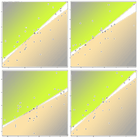
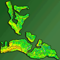
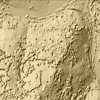
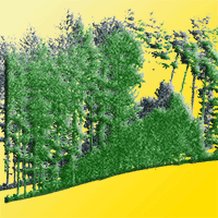
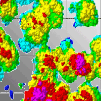
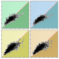
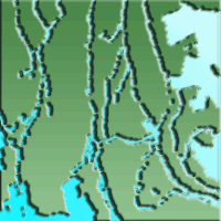
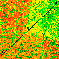
In order to consider forest biomass as a real alternative for energy production, it is critical to obtain accurate estimates of its availability using non-destructive sampling methods. In this study, we estimate the biomass available in a Scots pine-dominated forest (Pinus sylvestris L.) located in Spain. The biomass estimates were obtained using LiDAR data combined with a multispectral camera and allometric equations. The method used to fuse the data was based on back projection, which assures a perfect match between both datasets. The results present estimates for each of the seven different biomass components: above ground, below ground, log, needles, and large, medium and small branches. The accuracy of the models varied between R2 values of 0.46 and 0.67 with RMSE% ranging from 15.72% to 35.43% with all component estimates below 20%, except for the model estimating biomass of big branches. The models in this study are suitable for the estimation of biomass and demonstrate that computation is possible at a fine scale for the different biomass components. These remote sensing methods are sufficiently accurate to develop biomass resource cartography for multiple energy uses.
Keywords
, , , , ,
Citation
Hernando A, Puerto L, Mola-Yudego B, Manzanera JA, García-Abril A, Maltamo M, Valbuena R (2019). Estimation of forest biomass components using airborne LiDAR and multispectral sensors. iForest 12: 207-213. - doi: 10.3832/ifor2735-012
Academic Editor
Davide Travaglini
Paper history
Received: Jan 22, 2018
Accepted: Feb 06, 2019
First online: Apr 25, 2019
Publication Date: Apr 30, 2019
Publication Time: 2.60 months
© SISEF - The Italian Society of Silviculture and Forest Ecology 2019
Open Access
This article is distributed under the terms of the Creative Commons Attribution-Non Commercial 4.0 International (https://creativecommons.org/licenses/by-nc/4.0/), which permits unrestricted use, distribution, and reproduction in any medium, provided you give appropriate credit to the original author(s) and the source, provide a link to the Creative Commons license, and indicate if changes were made.

Breakdown by View Type
(Waiting for server response...)
Article Usage
Total Article Views: 50127
(from publication date up to now)
Breakdown by View Type
HTML Page Views: 39149
Abstract Page Views: 6062
PDF Downloads: 3910
Citation/Reference Downloads: 10
XML Downloads: 996
Web Metrics
Days since publication: 2491
Overall contacts: 50127
Avg. contacts per week: 140.86
Article Citations
Article citations are based on data periodically collected from the Clarivate Web of Science web site
(last update: Mar 2025)
Total number of cites (since 2019): 16
Average cites per year: 2.29
Publication Metrics
by Dimensions ©
Articles citing this article
List of the papers citing this article based on CrossRef Cited-by.
(1)
Anderson N, Mitchell D (2016)Forest operations and woody biomass logistics to improve efficiency, value, and sustainability. BioEnergy Research 9: 518-533.
CrossRef |
Gscholar
(2)
Asikainen A, Liiri H, Peltola S, Karjalainen T, Laitila J (2008)Forest energy potential in Europe (EU27). Working Papers of the Finnish Forest Research Institute, Finnish Forest Institute, Joensuu, Finland, pp. 1.
Online |
Gscholar
(3)
Baltsavias EP (1999)Airborne laser scanning: basic relations and formulas. ISPRS Journal of Photogrammetry and Remote Sensing 54: 199-214.
CrossRef |
Gscholar
(4)
Bright BC, Hicke JA, Hudak AT (2012)Estimating aboveground carbon stocks of a forest affected by mountain pine beetle in Idaho using LiDAR and multispectral imagery. Remote Sensing of Environment 124: 270-281.
CrossRef |
Gscholar
(5)
Brosofske KD, Froese RE, Falkowski MJ, Banskota A (2014)A review of methods for mapping and prediction of inventory attributes for operational forest management. Forest Science 60: 733-756.
CrossRef |
Gscholar
(6)
Chirici G, Mura M, McInerney D, Py N, Tomppo EO, Waser LT, Travaglini D, McRoberts RE (2016)A meta-analysis and review of the literature on the k-Nearest Neighbors technique for forestry applications that use remotely sensed data. Remote Sensing of Environment 176: 282-294.
CrossRef |
Gscholar
(7)
Cohen WB, Spies TA (1992)Estimating structural attributes of Douglas-fir Western Hemlock forest stands from Landsat and Spot imagery. Remote Sensing of Environment 41: 1-17.
CrossRef |
Gscholar
(8)
Crookston NL, Finley AO (2008)yaImpute: an R package for kNN imputation. Journal of Statistical Software 23: 1-16.
CrossRef |
Gscholar
(9)
Ediriweera S, Pathirana S, Danaher T, Nichols D (2014)Estimating above-ground biomass by fusion of LiDAR and multispectral data in subtropical woody plant communities in topographically complex terrain in North-eastern Australia. Journal of Forestry Research 25: 761-771.
CrossRef |
Gscholar
(10)
García M, Riaño D, Chuvieco E, Danson FM (2010)Estimating biomass carbon stocks for a Mediterranean forest in central Spain using LiDAR height and intensity data. Remote Sensing of Environment 114: 816-830.
CrossRef |
Gscholar
(11)
González-Olabarria J-R, Rodríguez F, Fernández-Landa A, Mola-Yudego B (2012)Mapping fire risk in the Model Forest of Urbión (Spain) based on airborne LiDAR measurements. Forest Ecology and Management 282: 149-156.
CrossRef |
Gscholar
(12)
Gómez A, Rodrigues M, Montañés C, Dopazo C, Fueyo N (2010)The potential for electricity generation from crop and forestry residues in Spain. Biomass and Bioenergy 34: 703-719.
CrossRef |
Gscholar
(13)
Hauglin M, Dibdiakova J, Gobakken T, Naesset E (2013)Estimating single-tree branch biomass of Norway spruce by airborne laser scanning. ISPRS Journal of Photogrammetry and Remote Sensing 79: 147-156.
CrossRef |
Gscholar
(14)
Heiskanen J, Liu J, Valbuena R, Aynekulu E, Packalén P, Pellikka P (2017)Remote sensing approach for spatial planning of land management interventions in West African savannas. Journal of Arid Environments 140: 29-41.
CrossRef |
Gscholar
(15)
Hernando A, Arroyo LA, Velazquez J, Tejera R (2012)Objects-based image analysis for mapping Natura 2000 habitats to improve forest management. Photogrammetric Engineering and Remote Sensing 78: 991-999.
CrossRef |
Gscholar
(16)
Jenkins JC, Chojnacky DC, Heath LS, Birdsey RA (2003)National-scale biomass estimators for United States tree species. Forest Science 49: 12-35.
Online |
Gscholar
(17)
Kizha AR, Han H-S (2016)Processing and sorting forest residues: cost, productivity and managerial impacts. Biomass and Bioenergy 93: 97-106.
CrossRef |
Gscholar
(18)
Kotamaa E, Tokola T, Maltamo M, Packalen P, Kurttila M, Mäkinen A (2010)Integration of remote sensing-based bioenergy inventory data and optimal bucking for stand-level decision making. European Journal of Forest Research 129: 875-886.
CrossRef |
Gscholar
(19)
Kristensen T, Ohlson M, Bolstad PV, Kolka R (2015)Mapping above- and below-ground carbon pools in boreal forests: the case for airborne lidar. PLoS ONE 10: e0138450.
CrossRef |
Gscholar
(20)
López-Rodríguez F, Perez Atanet C, Cuadros Blazquez F, Ruiz Celma A (2009)Spatial assessment of the bioenergy potential of forest residues in the western province of Spain, Caceres. Biomass and Bioenergy 33: 1358-1366.
CrossRef |
Gscholar
(21)
Maltamo M, Naesset E, Vauhkonen J (2014)Forestry applications of airborne laser scanning (Maltamo M, Naesset Vauhkonen J eds). Springer Science and Business Media, Dordrecht, vol. 27, pp. 464.
CrossRef |
Gscholar
(22)
Manzanera JA, García-Abril A, Pascual C, Tejera R, Martín-Fernández S, Tokola T, Valbuena R (2016)Fusion of airborne LiDAR and multispectral sensors reveals synergic capabilities in forest structure characterization. GIScience and Remote Sensing 53: 1-16.
CrossRef |
Gscholar
(23)
Mauro F, Molina I, García-Abril A, Valbuena R, Ayuga-Téllez E (2016)Remote sensing estimates and measures of uncertainty for forest variables at different aggregation levels. Environmetrics 27 (4): 225-238.
CrossRef |
Gscholar
(24)
McGaughey RJ (2012)FUSION/LDV: Software for LiDAR data analysis and visualization. Pacific Northwest Research Station, USDA Forest Service, Seattle, Washington, USA.
Online |
Gscholar
(25)
Moeur M, Stage AR (1995)Most similar neighbor - an improved sampling inference procedure for natural-resource planning. Forest Science 41: 337-359.
Online |
Gscholar
(26)
Montealegre-Gracia AL, Lamelas-Gracia MT, García-Martín A, De la Riva-Fernández J, Escribano-Bernal F (2017)Using low-density discrete Airborne Laser Scanning data to assess the potential carbon dioxide emission in case of a fire event in a Mediterranean pine forest. GIScience and Remote Sensing 23: 1-20.
CrossRef |
Gscholar
(27)
Montero G, Ruiz-Peinado R, Muñoz M (2005)Producción de biomasa y fijación de CO
2 por los bosques españoles [Biomass production and CO
2 fixation for Spanish forests]. Ministerio de Educación y Ciencia, Madrid, Spain, pp. 275. [in Spanish]
Online |
Gscholar
(28)
Mura M, Bottalico F, Giannetti F, Bertani R, Giannini R, Mancini M, Orlandini S, Travaglini D, Chirici G (2018)Exploiting the capabilities of the Sentinel-2 multi spectral instrument for predicting growing stock volume in forest ecosystems. International Journal of Applied Earth Observation and Geoinformation 66: 126-134.
CrossRef |
Gscholar
(29)
Naesset E (2002)Predicting forest stand characteristics with airborne scanning laser using a practical two-stage procedure and field data. Remote Sensing of Environment 80: 88-99.
CrossRef |
Gscholar
(30)
Naesset E (2004)Estimation of above-and below-ground biomass in boreal forest ecosystems. ISPRS Journal of Photogrammetry and Remote Sensing 36: 145-148.
Online |
Gscholar
(31)
Packalén P, Suvanto A, Maltamo M (2009)A two stage method to estimate species-specific growing stock. Photogrammetric Engineering and Remote Sensing 75: 1451-1460.
CrossRef |
Gscholar
(32)
Panichelli L, Gnansounou E (2008)GIS-based approach for defining bioenergy facilities location: a case study in Northern Spain based on marginal delivery costs and resources competition between facilities. Biomass and Bioenergy 32: 289-300.
CrossRef |
Gscholar
(33)
Patenaude G, Hill RA, Milne R, Gaveau D, Briggs B, Dawson TP (2004)Quantifying forest above ground carbon content using LiDAR remote sensing. Remote Sensing of Environment 93: 368-380.
CrossRef |
Gscholar
(34)
Pineiro G, Perelman S, Guerschman JP, Paruelo JM (2008)How to evaluate models: observed
vs. predicted or predicted
vs. observed? Ecological Modelling 216: 316-322.
CrossRef |
Gscholar
(35)
Popescu SC, Wynne RH, Scrivani JA (2004)Fusion of small-footprint LiDAR and multispectral data to estimate plot-level volume and biomass in deciduous and pine forests in Virginia, USA. Forest Science 50: 551-565.
Online |
Gscholar
(36)
R Core Team (2011)R: a language and environment for statistical computing. R Core Team, Vienna, Austria.
Online |
Gscholar
(37)
Riaño D, Chuvieco E, Condés S, González-Matesanz J, Ustin SL (2004)Generation of crown bulk density for
Pinus sylvestris L. from lidar. Remote Sensing of Environment 92: 345-352.
CrossRef |
Gscholar
(38)
Solberg B, Hetemäki L, Kallio A, Moiseyev A (2014)Impacts of forest bioenergy and policies on the forest sector markets in Europe-what do we know? Technical Reports no. 89, EFI, Joensuu, Finland, pp. 1.
Online |
Gscholar
(39)
Straub C, Koch B (2011)Enhancement of bioenergy estimations within forests using airborne laser scanning and multispectral line scanner data. Biomass and Bioenergy 35: 3561-3574.
CrossRef |
Gscholar
(40)
Valbuena R, Eerikäinen K, Packalén P, Maltamo M (2016)Gini coefficient predictions from airborne LiDAR remote sensing display the effect of management intensity on forest structure. Ecological Indicators 60: 574-585.
CrossRef |
Gscholar
(41)
Valbuena R, Mauro F, Arjonilla FJ, Manzanera JA (2011)Comparing airborne laser scanning-imagery fusion methods based on geometric accuracy in forested areas. Remote Sensing of Environment 115: 1942-1954.
CrossRef |
Gscholar
(42)
Valbuena R, Mauro F, Rodríguez-Solano R, Manzanera JA (2010)Accuracy and precision of GPS receivers under forest canopies in a mountainous environment. Spanish Journal of Agricultural Research 8: 1047.
CrossRef |
Gscholar
(43)
Valbuena R, Packalén P, Mehtätalo L, García-Abril A, Maltamo M (2013)Characterizing forest structural types and shelterwood dynamics from Lorenz-based indicators predicted by airborne laser scanning. Canadian Journal of Forest Research 43: 1063-1074.
CrossRef |
Gscholar
(44)
Valbuena R, Vauhkonen J, Packalén P, Pitkanen J, Maltamo M (2014)Comparison of airborne laser scanning methods for estimating forest structure indicators based on Lorenz curves. ISPRS Journal of Photogrammetry and Remote Sensing 95: 23-33.
CrossRef |
Gscholar
(45)
Verkerk PJ, Anttila P, Eggers J, Lindner M, Asikainen A (2011)The realisable potential supply of woody biomass from forests in the European Union. Forest Ecology and Management 261: 2007-2015.
CrossRef |
Gscholar
(46)
Verkerk PJ, Levers C, Kuemmerle T, Lindner M, Valbuena R, Verburg PH, Zudin S (2015)Mapping wood production in European forests. Forest Ecology and Management 357: 228-238.
CrossRef |
Gscholar
(47)
Willmott CJ (1982)Some Comments on the Evaluation of Model Performance. Bulletin of the American Meteorological Society 63: 1309-1313.
CrossRef |
Gscholar
(48)
Zolkos SG, Goetz SJ, Dubayah RO (2013)A meta-analysis of terrestrial aboveground biomass estimation using LiDAR remote sensing. Remote Sensing of Environment 128: 289-298.
CrossRef |
Gscholar
