Three-dimensional forest stand height map production utilizing airborne laser scanning dense point clouds and precise quality evaluation
Umut G Sefercik (1) , Ayhan Atesoglu (2)
iForest - Biogeosciences and Forestry, Volume 10, Issue 2, Pages 491-497 (2017)
doi: https://doi.org/10.3832/ifor2039-010
Published: Apr 12, 2017 - Copyright © 2017 SISEF
Research Articles
Abstract
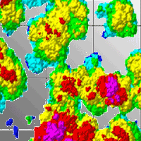
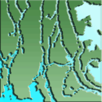
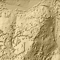
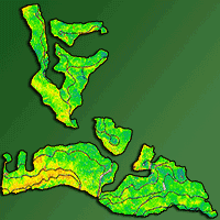
In remote sensing, estimation of the forest stand height is an ever-challenging issue due to the difficulties encountered during the acquisition of data under forest canopies. Stereo optical imaging offers high spatial and spectral resolution; however, the optical correlation is lower in dense forests than in open areas due to an insufficient number of matching points. Therefore, in most cases height information may be missing or faulty. With their long wavelengths of 0.2 to 1.3 m, P-band and L-band synthetic aperture radars are capable of penetrating forest canopies, but their low spatial resolutions restrict the use of single-tree based forest applications. In this study, airborne laser scanning was used as an effective remote sensing technique to produce large-scale maps of forest stand height. This technique produces very high-resolution point clouds and has a high penetration capability that allows for the detection of multiple echoes per laser pulse. A study area with a forest coverage of approximately 60% was selected in Houston, USA, and a three-dimensional color-coded map of forest stands was produced using a normalized digital surface model technique. Rather than being limited to the number of ground control points, the accuracy of the produced map was assessed with a model-to-model approach using terrestrial laser scanning. In the accuracy assessment, the standard deviation was used as the main accuracy indicator in addition to the root mean square error and normalized median absolute deviation. The absolute geo-location accuracy of the generated map was found to be better than 1 cm horizontally and approximately 40 cm in height. Furthermore, the effects of bias and relative standard deviations were determined. The problems encountered during the production of the map, as well as recommended solutions, are also discussed in this paper.
Keywords
Airborne Laser Scanning, Forest Stand Height Map, First Echo, Last Echo, NDSM
Authors’ Info
Authors’ address
Department of Geomatics Engineering, Bulent Ecevit University, 67100 Zonguldak (Turkey)
Department of Forest Engineering, Faculty of Forestry, Bartin University, 74100 Bartin (Turkey)
Corresponding author
Paper Info
Citation
Sefercik UG, Atesoglu A (2017). Three-dimensional forest stand height map production utilizing airborne laser scanning dense point clouds and precise quality evaluation. iForest 10: 491-497. - doi: 10.3832/ifor2039-010
Academic Editor
Piermaria Corona
Paper history
Received: Mar 03, 2016
Accepted: Jan 27, 2017
First online: Apr 12, 2017
Publication Date: Apr 30, 2017
Publication Time: 2.50 months
Copyright Information
© SISEF - The Italian Society of Silviculture and Forest Ecology 2017
Open Access
This article is distributed under the terms of the Creative Commons Attribution-Non Commercial 4.0 International (https://creativecommons.org/licenses/by-nc/4.0/), which permits unrestricted use, distribution, and reproduction in any medium, provided you give appropriate credit to the original author(s) and the source, provide a link to the Creative Commons license, and indicate if changes were made.

Web Metrics
Breakdown by View Type
Article Usage
Total Article Views: 50026
(from publication date up to now)
Breakdown by View Type
HTML Page Views: 40997
Abstract Page Views: 3553
PDF Downloads: 4086
Citation/Reference Downloads: 17
XML Downloads: 1373
Web Metrics
Days since publication: 3363
Overall contacts: 50026
Avg. contacts per week: 104.13
Citation Metrics
Article Citations
Article citations are based on data periodically collected from the Clarivate Web of Science web site
(last update: Mar 2025)
Total number of cites (since 2017): 6
Average cites per year: 0.67
Publication Metrics
by Dimensions ©
Articles citing this article
List of the papers citing this article based on CrossRef Cited-by.
References
ASPRS positional accuracy standards for digital geospatial data. Photogrammetric Engineering and Remote Sensing 81 (3): A1-A26.
Gscholar
Progress in LiDAR sensor technology - chance and challenge for DTM generation and data administration. In: Proceedings of the “51st Photogrammetric Week ’07” (Fritz D ed). Wichmann Verlag, Heidelberg, Germany, pp. 159-169.
Gscholar
Utilization of ALS data for forestry purposes. In: Proceedings of the “6th GI Forum 2012: Geovizualisation, Society and Learning” (Jekel T, Car A, Strobl J, Griesebner G eds). Salzburg (Austria) 2-6 July 2012. H. Wichmann Verlag, VDE Verlag GMBH, Berlin, Offenbach, Germany, pp. 365-375.
Online | Gscholar
Accuracy of crown segmentation and estimation of selected trees and forest stand parameters in order to resolution of used DSM and nDSM models generated from dense small footprint LIDAR data. International Archives of Photogrammetry and Remote Sensing 37 (B6b): 27-32.
Online | Gscholar
Related Content
Smreček R, Michnová Z, Sačkov I, Danihelová Z, Levická M, Tuček J
Vol. 11, pp. 181-188 (online: Feb 2018)
Smreček R, Danihelová Z
Vol. 6, pp. 48-54 (online: Feb 2013)
Shinzato ET, Shimabukuro YE, Coops NC, Tompalski P, Gasparoto EA
Vol. 10, pp. 296-302 (online: Feb 2017)

Ciesielski M, Sterenczak K
Vol. 12, pp. 498-510 (online: Dec 2019)
D’Amico G, Vangi E, Francini S, Giannetti F, Nicolaci A, Travaglini D, Massai L, Giambastiani Y, Terranova C, Chirici G
Vol. 14, pp. 144-154 (online: Apr 2021)
Sačkov I, Hlásny T, Bucha T, Juriš M
Vol. 10, pp. 459-467 (online: Apr 2017)
Martin H, Monnet JM, De Boisvilliers M, Chevalier R, Villar M
Vol. 13, pp. 409-416 (online: Oct 2020)
Ullah S, Adler P, Dees M, Datta P, Weinacker H, Koch B
Vol. 10, pp. 273-280 (online: Feb 2017)

Latifi H, Galos B
Vol. 3, pp. 98-101 (online: Jul 2010)
Spiazzi Favarin JA, Sabadi Schuh M, Marchesan J, Alba E, Soares Pereira R
Vol. 17, pp. 229-235 (online: Aug 2024)


