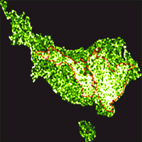
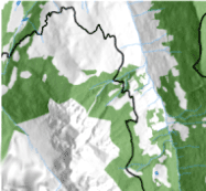
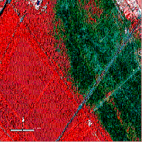
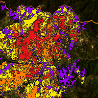
Mediterranean maquis is a complex and widespread ecosystem in the region, intrinsically prone to fire. Many species have developed specific adaptation traits to cope with fire, ensuring resistance and resilience. Due to the recent changes in socio-economy and land uses, fires are more and more frequent in the urban-rural fringe and in the coastlines, both now densely populated. The detection of fires and the monitoring of vegetation regrowth is thus of primary interest for local management and for understanding the ecosystem dynamics and processes, also in the light of the recurrent droughts induced by climate change. Among the main objectives of the COSMO-SkyMed radar constellation mission there is the monitoring of environmental hazards; the very high revisiting time of this mission is optimal for post-hazard response activities. However, very few studies exploited such data for fire and vegetation monitoring. In this research, Cosmo-SkyMed is used in a Mediterranean protected area covered by maquis to detect the burnt area extension and to conduct a mid-term assessment of vegetation regrowth. The positive results obtained in this research highlight the importance of the very high-resolution continuous acquisitions and the multi-polarization information provided by COSMO-SkyMed for monitoring fire impacts on vegetation.
Keywords
, , ,
Citation
Vaglio Laurin G, Avezzano R, Bacciu V, Frate FD, Papale D, Virelli M (2018). COSMO-SkyMed potential to detect and monitor Mediterranean maquis fires and regrowth: a pilot study in Capo Figari, Sardinia, Italy. iForest 11: 389-395. - doi: 10.3832/ifor2623-011
Academic Editor
Davide Ascoli
Paper history
Received: Sep 03, 2017
Accepted: Mar 05, 2018
First online: May 15, 2018
Publication Date: Jun 30, 2018
Publication Time: 2.37 months
© SISEF - The Italian Society of Silviculture and Forest Ecology 2018
Open Access
This article is distributed under the terms of the Creative Commons Attribution-Non Commercial 4.0 International (https://creativecommons.org/licenses/by-nc/4.0/), which permits unrestricted use, distribution, and reproduction in any medium, provided you give appropriate credit to the original author(s) and the source, provide a link to the Creative Commons license, and indicate if changes were made.

Breakdown by View Type
(Waiting for server response...)
Article Usage
Total Article Views: 48620
(from publication date up to now)
Breakdown by View Type
HTML Page Views: 41152
Abstract Page Views: 3368
PDF Downloads: 3081
Citation/Reference Downloads: 13
XML Downloads: 1006
Web Metrics
Days since publication: 2829
Overall contacts: 48620
Avg. contacts per week: 120.30
Article Citations
Article citations are based on data periodically collected from the Clarivate Web of Science web site
(last update: Mar 2025)
Total number of cites (since 2018): 4
Average cites per year: 0.50
Publication Metrics
by Dimensions ©
Articles citing this article
List of the papers citing this article based on CrossRef Cited-by.
(1)
Arnett JT, Coops NC, Daniels LD, Falls RW (2015)Detecting forest damage after a low-severity fire using remote sensing at multiple scales. International Journal of Applied Earth Observation and Geoinformation 35: 239-246.
CrossRef |
Gscholar
(2)
Attema E, Ulaby FT (1978)Vegetation modeled as a water cloud. Radio science 13 (2): 357-364.
CrossRef |
Gscholar
(3)
Bastos A, Gouveia C, Da Camara C, Trigo R (2011)Modelling post-fire vegetation recovery in Portugal. Biogeosciences 8 (12): 3593-3607.
CrossRef |
Gscholar
(4)
Bernhard EM, Twele A, Gähler M (2011)Rapid mapping of forest fires in the European Mediterranean region-a change detection approach using X-band SAR-data. Photogrammetrie-Fernerkundung-Geoinformation 4: 261-270.
CrossRef |
Gscholar
(5)
Bernhard EM, Twele A, Gahler M (2012)Burnt area mapping in the European-Mediterranean: SAR backscatter change analysis and synergistic use of optical and SAR data. In: Proceedings of Geoscience and Remote Sensing Symposium (IGARSS) 22-27 July 2012. IEEE International, Munich, Germany, pp. 2141-2143.
CrossRef |
Gscholar
(6)
Bolton DK, Coops NC, Hermosilla T, Wulder MA, White JC (2017)Assessing variability in post-fire forest structure along gradients of productivity in the Canadian boreal using multi-source remote sensing. Journal of Biogeography 44 (6): 1294-1305.
CrossRef |
Gscholar
(7)
Chen W, Jiang H, Moriya K, Sakai T, Cao C (2018)Monitoring of post-fire forest regeneration under different restoration treatments based on ALOS/PALSAR data. New Forests 49 (1): 105-121.
CrossRef |
Gscholar
(8)
Chu T, Guo X, Takeda K (2016)Remote sensing approach to detect post-fire vegetation regrowth in Siberian boreal larch forest. Ecological Indicators 62: 32-46.
CrossRef |
Gscholar
(9)
Cocke AE, Fulé PZ, Crouse JE (2005)Comparison of burn severity assessments using differenced normalized burn ratio and ground data. International Journal of Wildland Fire 14 (2): 189-198.
CrossRef |
Gscholar
(10)
Corona P, Lamonaca A, Chirici G (2008)Remote sensing support for post fire forest management. iForest - Biogeosciences and Forestry 1 (1): 6-12.
CrossRef |
Gscholar
(11)
Covello F, Battazza F, Coletta A, Lopinto E, Fiorentino C, Pietranera L, Valentini G, Zoffoli S (2010)Cosmo-SkyMed an existing opportunity for observing the earth. Journal of Geodynamics 49 (3): 171-180.
CrossRef |
Gscholar
(12)
Diaz-Delgado R, Pons X (2001)Spatial patterns of forest fires in Catalonia (NE of Spain) along the period 1975-1995: analysis of vegetation recovery after fire. Forest Ecology and Management 147 1: 67-74.
CrossRef |
Gscholar
(13)
Diaz-Delgado R, Lloret F, Pons X (2003)Influence of fire severity on plant regeneration by means of remote sensing imagery. International Journal of Remote Sensing 24 (8): 1751-1763.
CrossRef |
Gscholar
(14)
Engelbrecht J, Theron A, Vhengani L, Kemp J (2017)A simple normalized difference approach to burnt area mapping using multi-polarisation C-Band SAR. Remote Sensing 9 (8): 764.
CrossRef |
Gscholar
(15)
Gimeno M, San-Miguel-Ayanz J (2004)Evaluation of Radarsat-1 data for identification of burnt areas in southern Europe. Remote Sensing of Environment 92 (3): 370-375.
CrossRef |
Gscholar
(16)
Gitas I, Mitri G, Veraverbeke S, Polychronaki A (2012)Advances in remote sensing of post-fire vegetation recovery monitoring - a review. In: “Remote Sensing of Biomass - Principles and Applications” (Fatoyinbo L ed). InTech, London, UK, 143-177.
CrossRef |
Gscholar
(17)
Holecz F, Barbieri M, Eyre C, Mönnig N (2010)Forest management-mapping, monitoring, and inference of biophysical parameters using ALOS PALSAR and Cosmo-SkyMed data. JAXA Kyoto and Carbon Initiative 2010, Tokyo, Japan, pp. 10.
Online |
Gscholar
(18)
Imperatore P, Azar R, Calo F, Stroppiana D, Brivio PA, Lanari R, Pepe A (2017)Effect of the vegetation fire on backscattering: an investigation based on Sentinel-1 observations. IEEE Journal of Selected Topics in Applied Earth Observations and Remote Sensing 10 (10): 4478-4492.
CrossRef |
Gscholar
(19)
Jenkins LK, Bourgeau-Chavez LL, French NH, Loboda TV, Thelen BJ (2014)Development of methods for detection and monitoring of fire disturbance in the Alaskan tundra using a two-decade long record of synthetic aperture radar satellite images. Remote Sensing 6 (7): 6347-6364.
CrossRef |
Gscholar
(20)
Joyce KE, Belliss SE, Samsonov SV, McNeill SJ, Glassey PJ (2009)A review of the status of satellite remote sensing and image processing techniques for mapping natural hazards and disasters. Progress in Physical Geography 33 (2): 183-207.
CrossRef |
Gscholar
(21)
Karteris M (1996)Burned land mapping and post-fire effects. EARSeL eProceedings 4: 90-96.
Online |
Gscholar
(22)
Kasischke E, Hoy E, French N, Turetsky M (2007)Post-fire evaluation of the effects of fire on the environment using remotely-sensed data. In: “6th EARSeL Towards an Operational Use of Remote Sensing in Forest Fire Management”. Thessaloniki (Greece) 27-29 Sept 2007. Office for Official Publications, European Community, Luxembourg, pp. 38-56.
Online |
Gscholar
(23)
Key C, Benson N (2004)Ground measure of severity, the composite burn index. Firemon Landscape Assessment 4: 1-55.
Gscholar
(24)
Kurum M (2015)C-band SAR backscatter evaluation of 2008 Gallipoli forest fire. IEEE Geoscience and Remote Sensing Letters 12 (5): 1091-1095.
CrossRef |
Gscholar
(25)
Lentile LB, Holden ZA, Smith AM, Falkowski MJ, Hudak AT, Morgan P, Lewis SA, Gessler PE, Benson NC (2006)Remote sensing techniques to assess active fire characteristics and post-fire effects. International Journal of Wildland Fire 15 (3): 319-345.
CrossRef |
Gscholar
(26)
Lohberger S, Stängel M, Atwood EC, Siegert F (2017)Spatial evaluation of Indonesia’s 2015 fire affected area and estimated carbon emissions using Sentinel-1. Global Change Biology 24 (2): 644-654.
CrossRef |
Gscholar
(27)
Mari N, Laneve G, Cadau E, Porcasi X (2012)Fire damage assessment in Sardinia: the use of Alos /Palsar data for post fire effects management. European Journal of Remote Sensing 45 (1): 233-241.
CrossRef |
Gscholar
(28)
Miller JD, Knapp EE, Key CH, Skinner CN, Isbell CJ, Creasy RM, Sherlock JW (2009)Calibration and validation of the relative differenced normalized burn ratio (RDNBR) to three measures of fire severity in the Sierra Nevada and Klamath mountains, California, USA. Remote Sensing of Environment 113 (3): 645-656.
CrossRef |
Gscholar
(29)
Minchella A, Del Frate F, Capogna F, Anselmi S, Manes F (2009)Use of multitemporal sar data for monitoring vegetation recovery of Mediterranean burned areas. Remote Sensing of Environment 113 (3): 588-597.
CrossRef |
Gscholar
(30)
Polychronaki A, Gitas IZ, Veraverbeke S, Debien A (2013)Evaluation of Alos Palsar imagery for burned area mapping in Greece using object-based classification. Remote Sensing 5 (11): 5680-5701.
CrossRef |
Gscholar
(31)
Ranson K, Sun G, Kovacs K, Kharuk V (2002)Utility of SAR for mapping forest disturbance in Siberia. In: Proceedings of the “Geoscience and Remote Sensing Symposium”. Toronto (Canada) 24-28 June 2002. IEEE International 4: 2081-2083.
Gscholar
(32)
Richter R, Schläpfer D (2015)Atmospheric/topographic correction for satellite imagery: ATCOR-2/3 user guide, version 9.0.0. Wessling, ReSe Applications Schläpfer, Switzerland, pp. 254.
Gscholar
(33)
Ricotta C, Avena G, Olsen E, Ramsey R, Winn D (1998)Monitoring the landscape stability of Mediterranean vegetation relation to fire with a fractal algorithm. International Journal of Remote Sensing 19 (5): 871-881.
CrossRef |
Gscholar
(34)
Ruffault J, Mouillot F (2017)Contribution of human and biophysical factors to the spatial distribution of forest fire ignitions and large wildfires in a French Mediterranean region. International Journal of Wildland Fire 26 (6): 498-508.
CrossRef |
Gscholar
(35)
Saatchi S, Halligan K, Despain DG, Crabtree RL (2007)Estimation of forest fuel load from radar remote sensing. IEEE Transactions on Geoscience and Remote Sensing 45 (6): 1726-1740.
CrossRef |
Gscholar
(36)
San-Miguel-Ayanz J, Schulte E, Schmuck G, Camia A, Strobl P, Liberta G, Giovando C, Boca R, Sedano F, Kempeneers P, Mcinerney D, Withmore C, De Oliveira SS, Rodrigues M, Durrant T, Corti P, Oehler F, Vilar L, Amatulli G (2012)Comprehensive monitoring of wildfires in Europe: the European Forest Fire Information System (EFFIS). In: “Approaches to Managing Disaster - Assessing Hazards, Emergencies and Disaster Impacts”. InTech, London, UK, pp. 87-108.
CrossRef |
Gscholar
(37)
Shoshany M (2000)Satellite remote sensing of natural Mediterranean vegetation: a review within an ecological context. Progress in Physical Geography 24 (2): 153-178.
CrossRef |
Gscholar
(38)
Stroppiana D, Azar R, Calò F, Pepe A, Imperatore P, Boschetti M, Silva J, Brivio P, Lanari R (2015)Integration of optical and SAR data for burned area mapping in Mediterranean regions. Remote Sensing 7 (2): 1320-1345.
CrossRef |
Gscholar
(39)
Tanase MA, Santoro M, De La Riva J, Perez-Cabello F, Le Toan T (2010a)Sensitivity of X-, C-, and l-band SAR backscatter to burn severity in Mediterranean pine forests. IEEE Transactions on Geoscience and Remote Sensing 48 (10): 3663-3675.
CrossRef |
Gscholar
(40)
Tanase MA, Perez-Cabello F, De La Riva J, Santoro M (2010b)TerraSAR-X data for burn severity evaluation in Mediterranean forests on sloped terrain. IEEE Transactions on Geoscience and Remote Sensing 48 (2): 917-929.
CrossRef |
Gscholar
(41)
Tanase MA, Santoro M, Wegmuller De La Riva J, Perez-Cabello F (2010c)Properties of X-, C- and l-band repeat-pass interferometric SAR coherence in Mediterranean pine forests affected by fires. Remote Sensing of Environment 114 (10): 2182-2194.
CrossRef |
Gscholar
(42)
Tanase MA, De La Riva J, Santoro M, Perez-Cabello F, Kasischke E (2011)Sensitivity of sar data to post-fire forest regrowth in Mediterranean and boreal forests. Remote Sensing of Environment 115 (8): 2075-2085.
CrossRef |
Gscholar
(43)
Tanase MA, Santoro M, Aponte C, De La Riva J (2014)Polarimetric properties of burned forest areas at c- and l-band. IEEE Journal of Selected Topics in Applied Earth Observations and Remote Sensing 7: 267-276.
CrossRef |
Gscholar
(44)
Tanase MA, Kennedy R, Aponte C (2015)Fire severity estimation from space: a comparison of active and passive sensors and their synergy for different forest types. International Journal of Wildland Fire 24 (8): 1062-1075.
CrossRef |
Gscholar
(45)
Ulander L (1996)Radiometric slope correction of synthetic-aperture radar images. IEEE Transactions on Geoscience and Remote Sensing 34: 1115-1122.
CrossRef |
Gscholar
(46)
Van Wagtendonk JW, Root RR, Key CH (2004)Comparison of Aviris and Landsat ETM+ detection capabilities for burn severity. Remote Sensing of Environment 92 (3): 397-408.
CrossRef |
Gscholar
