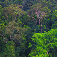
MODIS and VIIRS fire products have been widely used to detect and monitor fire activity at a global scale, as they provide highly relevant information on fire events, on their spatial and seasonal trends. Although these products have some limitations in detecting fires in forested areas due to closed canopy and smoke, they have been widely used to monitor and assess forest fires in many scientific studies. This study analyzes the performance of MODIS (MCD14ML) and VIIRS S-NPP (VNP14IMG) active fire/hotspot products in fire detection in five different land cover types (closed and open forests, shrublands, herbaceous vegetation and croplands) and compares the results to the ground-based fire database from 2015 to end of the 2019 in Turkey. Detected fires with a confidence value above 30% (nominal and high confidence) were used in the study. The land cover was assessed using the European Space Agency (ESA) Copernicus Global Land Service (CGLS) Dynamic Land Cover Layers at 100 m resolution in the study area. The performance assessment of two fire/hotspot products were conducted in three fire size classes, namely: fire size <1 ha, 1 to 10 ha, and >10 ha in five different land cover types. The results indicated that the overall accuracy of MODIS ranged from 0.6% to 16.6% and VIIRS S-NPP ranged from 1.3% to 25.6% of all ground-based fires in five different land cover types. The detection rates increased as the fire size increased. This study indicates that some limitations still exist to use MODIS and VIIRS S-NPP active fire/hotspot data in the assessment of wildfires.
Keywords
, , , , ,
Citation
Coskuner KA (2022). Assessing the performance of MODIS and VIIRS active fire products in the monitoring of wildfires: a case study in Turkey. iForest 15: 85-94. - doi: 10.3832/ifor3754-015
Paper history
Received: Jan 16, 2021
Accepted: Jan 31, 2022
First online: Mar 19, 2022
Publication Date: Apr 30, 2022
Publication Time: 1.57 months
© SISEF - The Italian Society of Silviculture and Forest Ecology 2022
Open Access
This article is distributed under the terms of the Creative Commons Attribution-Non Commercial 4.0 International (https://creativecommons.org/licenses/by-nc/4.0/), which permits unrestricted use, distribution, and reproduction in any medium, provided you give appropriate credit to the original author(s) and the source, provide a link to the Creative Commons license, and indicate if changes were made.

Breakdown by View Type
(Waiting for server response...)
Article Usage
Total Article Views: 62940
(from publication date up to now)
Breakdown by View Type
HTML Page Views: 44521
Abstract Page Views: 8894
PDF Downloads: 8878
Citation/Reference Downloads: 37
XML Downloads: 610
Web Metrics
Days since publication: 1576
Overall contacts: 62940
Avg. contacts per week: 279.56
Article Citations
Article citations are based on data periodically collected from the Clarivate Web of Science web site
(last update: Mar 2025)
Total number of cites (since 2022): 18
Average cites per year: 4.50
Publication Metrics
by Dimensions ©
Articles citing this article
List of the papers citing this article based on CrossRef Cited-by.
(1)
Andela N, Morton DC, Giglio L, Chen Y, Van Der Werf GR, Kasibhatla PS, DeFries RS, Collatz GJ, Hantson S, Kloster S, Bachelet D, Forrest M, Lasslop G, Li F, Mangeon S, Melton JR, Yue C, Randerson JT (2017)A human-driven decline in global burned area 356 (6345): 1356-1362.
CrossRef |
Gscholar
(2)
Barmpoutis P, Papaioannou P, Dimitropoulos K, Grammalidis N (2020)A review on early forest fire detection systems using optical remote sensing. Sensors 20 (22): 2-26.
CrossRef |
Gscholar
(3)
Bilgili E (1999)ATSR world fire validation: Turkey. In: “Along Track Scanning Radiometer World Fire Atlas Validation of the 1997-98 Active Fire Product” (Arino O, Plummer S eds). European Space Agency - ESA, Frascati, Italy, pp. 2-66.
Gscholar
(4)
Bilgili E, Goldammer JG (2000)Fire in the Mediterranean basin: towards an interdisciplinary science program. In: Proceedings of the 1st IUFRO World Congress “Forest and Society: The Role of Research”. Kuala Lumpur (Malaysia) 7-12 Aug 2000, pp. 45-54.
Gscholar
(5)
Bilgili E, Coskuner KA, Usta Y, Saglam B, Kucuk O, Berber T, Goltas M (2019)Diurnal surface fuel moisture prediction model for Calabrian pine stands in Turkey. iForest - Biogeosciences and Forestry 12 (3): 262-271.
CrossRef |
Gscholar
(6)
Buchhorn M, Smets B, Bertels L, De Roo B, Lesiv M, Tsendbazar NE, Herold M, Fritz S (2015)Copernicus Global Land Service: Land Cover 100m: collection 3: epoch 2015: Globe (Version V3.0.1).
CrossRef |
Gscholar
(7)
Buchhorn M, Smets B, Bertels L, De Roo B, Lesiv M, Tsendbazar NE, Herold M,, Fritz S (2016)Copernicus Global Land Service: Land Cover 100m: collection 3: epoch 2016: Globe (Version V3.0.1).
CrossRef |
Gscholar
(8)
Buchhorn M, Smets B, Bertels L, De Roo B, Lesiv M, Tsendbazar NE, Herold M, Fritz S (2017)Copernicus Global Land Service: Land Cover 100m: collection 3: epoch 2017: Globe (Version V3.0.1).
CrossRef |
Gscholar
(9)
Buchhorn M, Smets B, Bertels L, De Roo B, Lesiv M, Tsendbazar NE, Herold M, Fritz S (2018)Copernicus Global Land Service: Land Cover 100m: collection 3: epoch 2018: Globe (Version V3.0.1).
CrossRef |
Gscholar
(10)
Buchhorn M, Smets B, Bertels L, De Roo B, Lesiv M, Tsendbazar NE, Herold M, Fritz S (2019a)Copernicus Global Land Service: Land Cover 100m: collection 3: epoch 2019: Globe (Version V3.0.1).
CrossRef |
Gscholar
(11)
Buchhorn M, Smets B, Bertels L, Lesiv M, Tsendbazar NE, Masiliunas D, Herold M, Fritz S (2019b)Copernicus Global Land Service: Land Cover 100m, Collection 2, epoch 2015 Global (Version V2.0.2).
CrossRef |
Gscholar
(12)
Colak E, Sunar F (2020)Evaluation of forest fire risk in the Mediterranean Turkish forests: a case study of Menderes region, Izmir. International Journal of Disaster Risk Reduction 45 (101479): 2-10.
CrossRef |
Gscholar
(13)
Congalton RG (1991)A review of assessing the accuracy of classifications of remotely sensed data. Remote Sensing of Environment 37 (1): 35-46.
CrossRef |
Gscholar
(14)
Copernicus (2020)Copernicus global land service, land cover 100m: collection 3. Web site.
Online |
Gscholar
(15)
Coskuner KA (2021)Assessing forest fires in the North Eastern Anatolia with long term meteorological parameters. Journal of Natural Hazards and Environment 7 (2): 374-381.
CrossRef |
Gscholar
(16)
Curt T, Aini A, Dupire S (2020)Fire activity in Mediterranean forests (the Algerian case). Fire 3 (58): 3-17.
CrossRef |
Gscholar
(17)
Florec V, Thompson MP, Rodríguez S (2019)Cost of suppression. In: “Encyclopedia of Wildfires and Wildland-Urban Interface (WUI) Fires” (Manzello SL ed). Springer International Publishing, Cham, Switzerland, pp. 1-11.
CrossRef |
Gscholar
(18)
Fornacca D, Ren G, Xiao W (2017)Performance of three MODIS fire products (MCD45A1, MCD 64A1, MCD14ML), and ESA Fire_CCI in a mountainous area of Northwest Yunnan, China, characterized by frequent small fires. Remote Sensing 9 (1131): 2-20.
CrossRef |
Gscholar
(19)
Fusco EJ, Finn JT, Abatzoglou JT, Balch JK, Dadashi S, Bradley BA (2019)Detection rates and biases of fire observations from MODIS and agency reports in the conterminous United States. Remote Sensing of Environment 220: 30-40.
CrossRef |
Gscholar
(20)
GDF (2019)Forestry stats in Turkey. The causes of forest fires in Turkey (1988-2019). General Directorate of Forestry, Ankara, Turkey, pp. 12.
Gscholar
(21)
Giglio L, Van Der Werf GR, Randerson JT, Collatz GJ, Kasibhatla P (2006)Global estimation of burned area using MODIS active fire observations. Atmospheric Chemistry and Physics 6 (4): 957-974.
CrossRef |
Gscholar
(22)
Giglio L, Schroeder W, Justice CO (2016)The collection 6 MODIS active fire detection algorithm and fire products. Remote Sensing of Environment 178: 31-41.
CrossRef |
Gscholar
(23)
Giglio L, Boschetti L, Roy DP, Humber ML, Justice CO (2018)The Collection 6 MODIS burned area mapping algorithm and product. Remote Sensing of Environment 217: 72-85.
CrossRef |
Gscholar
(24)
Giglio L, Schroeder W, Hall JV, Justice CO (2020)MODIS Collection 6 active fire product user’s guide revision C. National Aeronautical and Space Administration - NASA, Washington, DC, USA, pp. 63.
Gscholar
(25)
Hally B, Wallace L, Reinke K, Jones S, Skidmore A (2019)Advances in active fire detection using a multi-temporal method for next-generation geostationary satellite data. International Journal of Digital Earth 12 (9): 1030-1045.
CrossRef |
Gscholar
(26)
Huesca M, Litago J, Palacios-Orueta A, Montes F, Sebastian-Lopez A, Escribano P (2009)Assessment of forest fire seasonality using MODIS fire potential: a time series approach. Agricultural and Forest Meteorology 149 (11): 1946-1955.
CrossRef |
Gscholar
(27)
Justice CO, Giglio L, Korontzi S, Owens J, Morisette JT, Roy D, Descloitres J, Alleaume S, Petitcolin F, Kaufman Y (2002)The MODIS fire products. Remote Sensing of Environment 83 (1): 244-262.
CrossRef |
Gscholar
(28)
Justice CO, Román MO, Csiszar IA, Vermote EF, Wolfe RE, Hook SJ, Friedl M, Wang Z, Schaaf CB, Miura T, Tschudi M, Riggs G, Hall DK, Lyapustin AI, Devadiga S, Davidson C, Masuoka EJ (2013)Land and cryosphere products from Suomi NPP VIIRS: overview and status 118 (17): 9753-9765.
CrossRef |
Gscholar
(29)
Kganyago M, Shikwambana L (2020)Assessment of the characteristics of recent major wildfires in the USA, Australia and Brazil in 2018-2019 using multi-source satellite products. Remote Sensing 12 (11): 2-18.
CrossRef |
Gscholar
(30)
Moreira F, Viedma O, Arianoutsou M, Curt T, Koutsias N, Rigolot E, Barbati A, Corona P, Vaz P, Xanthopoulos G, Mouillot F, Bilgili E (2011)Landscape-wildfire interactions in southern Europe: implications for landscape management. Journal of Environmental Management 92 (10): 2389-2402.
CrossRef |
Gscholar
(31)
Mouillot F, Schultz MG, Yue C, Cadule P, Tansey K, Ciais P, Chuvieco E (2014)Ten years of global burned area products from spaceborne remote sensing - A review: analysis of user needs and recommendations for future developments. International Journal of Applied Earth Observation and Geoinformation 26: 64-79.
CrossRef |
Gscholar
(32)
NASA/FIRMS (2020)Fire information for resource management system (FIRMS). Web site.
Online |
Gscholar
(33)
Oliva P, Schroeder W (2015)Assessment of VIIRS 375 m active fire detection product for direct burned area mapping. Remote Sensing of Environment 160: 144-155.
CrossRef |
Gscholar
(34)
Parajuli A, Gautam AP, Sharma SP, Bhujel KB, Sharma G, Thapa PB, Bist BS, Poudel S (2020)Forest fire risk mapping using GIS and remote sensing in two major landscapes of Nepal. Geomatics, Natural Hazards and Risk 11 (1): 2569-2586.
CrossRef |
Gscholar
(35)
Pausas JG, Vallejo VR (1999)The role of fire in European Mediterranean ecosystems. In: “Remote Sensing of Large Wildfires” (Chuvieco E ed). Springer, Berlin, Heidelberg, Germany, pp. 3-16.
Gscholar
(36)
Randerson JT, Chen Y, Van Der Werf GR, Rogers BM, Morton DC (2012)Global burned area and biomass burning emissions from small fires. Journal of Geophysical Research: Biogeosciences 117 (G4): 1-23.
CrossRef |
Gscholar
(37)
Ruiz-Peinado R, Bravo-Oviedo A, López-Senespleda E, Bravo F, Río MD (2017)Forest management and carbon sequestration in the Mediterranean region: a review. Forest Systems 26 (2): 25.
CrossRef |
Gscholar
(38)
Saglam B, Bilgili E, Durmaz BD, Kadiogullari AI, Kucuk O (2008)Spatio-temporal analysis of forest fire risk and danger using Landsat imagery. Sensors 8 (6): 3970-3987.
CrossRef |
Gscholar
(39)
San-Miguel-Ayanz J, Moreno JM, Camia A (2013)Analysis of large fires in European Mediterranean landscapes: lessons learned and perspectives. Forest Ecology and Management 294: 11-22.
CrossRef |
Gscholar
(40)
San-Miguel-Ayanz J, Durrant T, Boca R, Maianti P, Liberta P, Artes-Vivancos T, Oom D, Branco A, De Rigo D, Ferrari D, Pfeiffer H, Grecchi R, Nuijten D, Leray T (2020)Forest fires in Europe, Middle East and North Africa 2019. JRC122115, Luxemburg, pp. 164.
Gscholar
(41)
Schroeder W, Giglio L (2018)NASA VIIRS land science investigator processing system (SIPS) visible infrared imaging radiometer suite (VIIRS) 375 m and 750 m active fire products. Product User’s Guide Version 1.4, National Aeronautical and Space Administration - NASA, Washington, DC, USA, pp. 23.
Gscholar
(42)
Schroeder W, Oliva P, Giglio L, Csiszar IA (2014)The new VIIRS 375 m active fire detection data product: algorithm description and initial assessment. Remote Sensing of Environment 143: 85-96.
CrossRef |
Gscholar
(43)
Sivrikaya F, Saglam B, Akay AE, Bozali N (2014)Evaluation of forest fire risk with GIS. Polish Journal of Environmental Studies 23 (1): 187-194.
Gscholar
(44)
Sofan P, Bruce D, Schroeder W, Jones E, Marsden J (2020)Assessment of VIIRS 375 m active fire using tropical peatland combustion algorithm applied to Landsat-8 over Indonesia’s peatlands. International Journal of Digital Earth 13 (12): 1695-1716.
CrossRef |
Gscholar
(45)
Tansey K, Beston J, Hoscilo A, Page SE, Hernandez CUP (2008)Relationship between MODIS fire hot spot count and burned area in a degraded tropical peat swamp forest in Central Kalimantan, Indonesia. Journal of Geophysical Research 113 (D23): 955.
CrossRef |
Gscholar
(46)
Vilar L, Camia A, San-Miguel-Ayanz J (2015)A comparison of remote sensing products and forest fire statistics for improving fire information in Mediterranean Europe. European Journal of Remote Sensing 48 (1): 345-364.
CrossRef |
Gscholar
(47)
Wickramasinghe C, Wallace L, Reinke K, Jones S (2020)Intercomparison of Himawari-8 AHI-FSA with MODIS and VIIRS active fire products. International Journal of Digital Earth 13 (4): 457-473.
CrossRef |
Gscholar
(48)
Ying L, Shen Z, Yang M, Piao S (2019)Wildfire detection probability of MODIS fire products under the constraint of environmental factors: a study based on confirmed ground wildfire records. Remote Sensing 11 (24): 3031.
CrossRef |
Gscholar
(49)
Zhang T, Wooster MJ, Xu W (2017a)Approaches for synergistically exploiting VIIRS I- and M-Band data in regional active fire detection and FRP assessment: a demonstration with respect to agricultural residue burning in Eastern China. Remote Sensing of Environment 198: 407-424.
CrossRef |
Gscholar
(50)
Zhang Z, Feng Z, Zhang H, Zhao J, Yu S, Du W (2017b)Spatial distribution of grassland fires at the regional scale based on the MODIS active fire products. International Journal of Wildland Fire 26 (3): 209-218.
CrossRef |
Gscholar