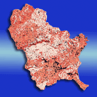
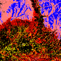
Canopy leaf area, frequently quantified by the Leaf Area Index (LAI), serves as the dominant control over primary production, energy exchange, transpiration, and other physiological attributes related to ecosystem processes. Maps depicting the spatial distribution of LAI across the landscape are of particularly high value for a better understanding of ecosystem dynamics and processes, especially over large and remote areas. Moreover, LAI maps have the potential to be used by process models describing energy and mass exchanges in the biosphere/atmosphere system. In this article we assess the applicability of the RapidEye satellite system, whose sensor is optimized towards vegetation analyses, for mapping LAI along a disturbance gradient, ranging from heavily disturbed shrub land to mature mountain rainforest. By incorporating image texture features into the analysis, we aim at assessing the potential quality improvement of LAI maps and the reduction of uncertainties associated with LAI maps compared to maps based on Vegetation Indexes (VI) solely. We identified 22 out of the 59 image features as being relevant for predicting LAI. Among these, especially VIs were ranked high. In particular, the two VIs using RapidEye’s RED-EDGE band stand out as the top two predictor variables. Nevertheless, map accuracy as quantified by the mean absolute error obtained from a 10-fold cross validation (MAE_CV) increased significantly if VIs and texture features are combined (MAE_CV = 0.56), compared to maps based on VIs only (MAE_CV = 0.62). We placed special emphasis on the uncertainties associated with the resulting map addressing that map users often treat uncertainty statements only in a pro-forma manner. Therefore, the LAI map was complemented with a map depicting the spatial distribution of the goodness-of-fit of the model, quantified by the mean absolute error (MAE), used for predictive mapping. From this an area weighted MAE (= 0.35) was calculated and compared to the unweighted MAE of 0.29. Mapping was done using randomForest, a widely used statistical modeling technique for predictive biological mapping.
Keywords
, , , , , , ,
Citation
Beckschäfer P, Fehrmann L, Harrison RD, Xu J, Kleinn C (2014). Mapping Leaf Area Index in subtropical upland ecosystems using RapidEye imagery and the randomForest algorithm. iForest 7: 1-11. - doi: 10.3832/ifor0968-006
Academic Editor
Giorgio Matteucci
Paper history
Received: Feb 06, 2013
Accepted: May 13, 2013
First online: Oct 07, 2013
Publication Date: Feb 03, 2014
Publication Time: 4.90 months
© SISEF - The Italian Society of Silviculture and Forest Ecology 2014
Open Access
This article is distributed under the terms of the Creative Commons Attribution-Non Commercial 4.0 International (https://creativecommons.org/licenses/by-nc/4.0/), which permits unrestricted use, distribution, and reproduction in any medium, provided you give appropriate credit to the original author(s) and the source, provide a link to the Creative Commons license, and indicate if changes were made.

Breakdown by View Type
(Waiting for server response...)
Article Usage
Total Article Views: 62462
(from publication date up to now)
Breakdown by View Type
HTML Page Views: 50487
Abstract Page Views: 3960
PDF Downloads: 6103
Citation/Reference Downloads: 42
XML Downloads: 1870
Web Metrics
Days since publication: 4505
Overall contacts: 62462
Avg. contacts per week: 97.06
Article Citations
Article citations are based on data periodically collected from the Clarivate Web of Science web site
(last update: Mar 2025)
Total number of cites (since 2014): 23
Average cites per year: 1.77
Publication Metrics
by Dimensions ©
Articles citing this article
List of the papers citing this article based on CrossRef Cited-by.
(1)
Anys H, Bannari A, He D, Morin D (1994)Texture analysis for the mapping of urban areas using airborne MEIS-II images. In: Proceedings of the “First International Airborne Remote Sensing Conference and Exhibition”. Strasbourg (France), vol. 3, pp. 231-245.
Gscholar
(2)
Asner GP, Scurlock JMO, Hicke AJ (2003)Global synthesis of leaf area index observations: implications for ecological and remote sensing studies. Global Ecology and Biogeography 12 (3): 191-205.
CrossRef |
Gscholar
(3)
Barclay HJ (1998)Conversion of total leaf area to projected leaf area in lodgepole pine and douglas-fir. Tree Physiology 18 (3): 185-193.
CrossRef |
Gscholar
(4)
Baret F, Buis S (2008)Estimating canopy characteristics from remote sensing observations: review of methods and associated problems. In: “Advances in Land Remote Sensing: System, Modelling, Inversion and Application” (Liang S ed). Springer, New York, USA, pp. 173-201.
Gscholar
(5)
Baret F, Guyot G (1991)Potentials and limits of vegetation indices for LAI and APAR assessment. Remote Sensing of Environment 35: 161-173.
CrossRef |
Gscholar
(6)
Beaudet M, Messier C (2002)Variation in canopy openness and light transmission following selection cutting in northern hardwood stands: an assessment based on hemispherical photographs. Agricultural and Forest Meteorology 110 (3): 217-228.
CrossRef |
Gscholar
(7)
Beckschäfer P, Seidel D, Kleinn C, Xu J (2013)On the exposure of hemispherical photographs in forests. iForest 6: 228-237.
CrossRef |
Gscholar
(8)
Bonan G (1993)Importance of leaf area index and forest type when estimating photosynthesis in boreal forests. Remote sensing of Environment 43 (3): 303-314.
CrossRef |
Gscholar
(9)
Bréda NJJ (2003)Ground based measurements of leaf area index: a review of methods, instruments and current controversies. Journal of Experimental Botany 54 (392): 2403-2417.
CrossRef |
Gscholar
(10)
Breiman L (2001)Random forests. Machine Learning 45: 5-32.
CrossRef |
Gscholar
(11)
Buschmann C, Nagel E (1993)spectroscopy and internal optics of leaves as basis for remote sensing of vegetation. International Journal of Remote Sensing 14 (4): 711-722.
CrossRef |
Gscholar
(12)
Card D (1982)Using known map category marginal frequencies to improve estimates of thematic map accuracy. Photogrammetric Engineering and Remote Sensing 48: 431-439.
Gscholar
(13)
Cawley GC, Talbot NLC (2010)On over-fitting in model selection and subsequent selection bias in performance evaluation. Journal of Machine Learning Research 11: 2079-2107.
Gscholar
(14)
Chapin III FS, Matson PA, Vitousek P (2011)Principles of terrestrial ecosystem ecology (2 edn). Springer, New York USA, pp. 529.
CrossRef |
Gscholar
(15)
Chen D, Stow DA, Gong P (2004)Examining the effect of spatial resolution and texture window size on classification accuracy: an urban environment case. International Journal of Remote Sensing 25 (11): 2177-2192.
CrossRef |
Gscholar
(16)
Cohen WB, Maiersperger TK, Gower ST, Turner DP (2003)An improved strategy for regression of biophysical variables and Landsat ETM+ data. Remote Sensing of Environment 84(4): 561-571.
CrossRef |
Gscholar
(17)
Colombo R, Bellingeri D, Fasolini D, Marino CM (2003)Retrieval of leaf area index in different vegetation types using high resolution satellite data. Remote Sensing of Environment 86 (1): 120-131.
CrossRef |
Gscholar
(18)
Cutler D, Edwards Jr T, Beard K, Cutler A, Hess K, Gibson J, Lawler J (2007)Random forests for classification in ecology. Ecology 88 (11): 2783-2792.
CrossRef |
Gscholar
(19)
Diaz-Uriarte R, de Andrés S (2005)Variable selection from random forests: application to gene expression data. Technical report.
Online |
Gscholar
(20)
Duveiller G, Defourny P (2010)Batch processing of hemispherical photography using object-based image analysis to derive canopy biophysical variables. The International Archives of the Photogrammetry, Remote Sensing and Spatial Information Sciences, Vol. XXXVIII-4/C7.
Online |
Gscholar
(21)
Fassnacht KS, Cohen WB, Spies TA (2006)Key issues in making and using satellite-based maps in ecology: a primer. Forest Ecology and Management 222: 167-181.
CrossRef |
Gscholar
(22)
Fisher R (1953)Dispersion on a sphere. Proceedings of the Royal Society of London, Series A, Mathematical and Physical Sciences 217 (1130): 295-305.
CrossRef |
Gscholar
(23)
Frazer G, Canham C, Lertzman K (1999)Gap Light Analyzer (GLA), version 2.0: imaging software to extract canopy structure and gap light transmission indices from true-colour fisheye photographs, users manual and program documentation. Simon Fraser University, Burnaby, British Columbia, and the Institute of Ecosystem Studies, Millbrook, New York, USA.
Gscholar
(24)
Frazer G, Fournier R, Trofymow J, Hall R (2001)A comparison of digital and film fisheye photography for analysis of forest canopy structure and gap light transmission. Agricultural and Forest Meteorology 109 (4): 249-263.
CrossRef |
Gscholar
(25)
Fuchs H, Magdon P, Kleinn C, Flessa H (2009)Estimating aboveground carbon in a catchment of the siberian forest tundra: combining satellite imagery and field inventory. Remote Sensing of Environment 113 (3): 518-531.
CrossRef |
Gscholar
(26)
Gamon J, Field C, Goulden M, Griffin K, Hartley A, Joel G, Peñuelas J, Valentini R (1995)Relationships between ndvi, canopy structure, and photosynthesis in three californian vegetation types. Ecological Applications 5 (1): 28-41.
CrossRef |
Gscholar
(27)
Gitelson A, Viña A, Ciganda V, Rundquist D, Arkebauer T (2005)Remote estimation of canopy chlorophyll content in crops. Geophysical Research Letters 32 (8): L08403.
Gscholar
(28)
Gitelson AA, Merzlyak MN (1997)Remote estimation of chlorophyll content in higher plant leaves. International Journal of Remote Sensing 18 (12): 2691-2697.
CrossRef |
Gscholar
(29)
Glenn EP, Huete AR, Nagler PL, Nelson SG (2008)Relationship between remotely-sensed vegetation indices, canopy attributes and plant physiological processes: what vegetation indices can and cannot tell us about the landscape. Sensors 8 (4): 2136-2160.
CrossRef |
Gscholar
(30)
Gonsamo A, Pellikka P (2012)The sensitivity based estimation of leaf area index from spectral vegetation indices. ISPRS Journal of Photogrammetry and Remote Sensing 70: 15-25.
CrossRef |
Gscholar
(31)
Gower S, Norman J (1991)Rapid estimation of leaf area index in conifer and broad-leaf plantations. Ecology 72 (5): 1896-1900.
CrossRef |
Gscholar
(32)
GRASS Development Team (2012)Geographic Resources Analysis Support System (GRASS GIS) Software. Open Source Geospatial Foundation, USA.
Online |
Gscholar
(33)
Grohmann C, Smith M, Riccomini C (2009)Surface roughness of topography: a multi-scale analysis of landform elements in midland valley, Scotland. In: Proceedings of the conference “Geomorphometry 2009” (Purves R, Gruber S, Straumann R, Hengl T eds). University of Zurich (CH), pp. 140-148.
Gscholar
(34)
Haralick RM, Shanmugam K, Dinstein I (1973)Textural features for image classification. Systems, Man and Cybernetics. IEEE Transactions on SMC 3 (6): 610-621.
Gscholar
(35)
Horning N (2010)Random forests: an algorithm for image classification and generation of continuous fields data sets. In: Proceeding of the “International Conference on Geoinformatics for Spatial Infrastructure Development in Earth and Allied Sciences”. Hanoi (Vietnam) 9-11 Dec 2010. JVGC - Japan-Vietnam Geoinformatics Consortium, Institute for Environment and Resources, Vietnam.
Gscholar
(36)
Jonckheere I, Fleck S, Nackaerts K, Muys B, Coppin P, Weiss M, Baret F (2004)Review of methods for leaf area index determination: Part I. Theories, sensors and hemispherical photography. Agricultural and Forest Meteorology 121 (1): 19-35.
CrossRef |
Gscholar
(37)
Kato S, Komiyama A (2000)A calibration method for adjusting hemispherical photographs to appropriate black-and-white images. Journal of Forest Research 5 (2): 109-111.
CrossRef |
Gscholar
(38)
Kursa M, Rudnicki W (2010)Feature selection with the boruta package. Journal of Statistical Software 36 (11): 1-13.
Gscholar
(39)
Latifi H, Galos B (2010)Remote sensing-supported vegetation parameters for regional climate models: a brief review. iForest 3: 98-101
CrossRef |
Gscholar
(40)
Lee K, Park Y, Kim S, Park J, Woo C, Jang K (2004)Remote sensing estimation of forest lai in close canopy situation. In: Proceedings of the 20 ISPRS Congress (Altan O ed). Istanbul (Turkey) 12-23 July 2004. ISPRS Archives, vol. 35, Part B7.
Online |
Gscholar
(41)
Leutner BF, Reineking B, Müller, J, Bachmann, M, Beierkuhnlein, C, Dech, S, Wegmann, M (2012)Modelling forest alpha-diversity and floristic composition on the added value of lidar plus hyperspectral remote sensing. Remote Sensing 4 (9): 2818-2845.
CrossRef |
Gscholar
(42)
Li H, Aide T, Ma Y, Liu W, Cao M (2007)Demand for rubber is causing the loss of high diversity rain forest in sw China. Biodiversity and Conservation 16: 1731-1745.
CrossRef |
Gscholar
(43)
Li H, Ma Y, Liu W, Liu W (2009)Clearance and fragmentation of tropical rain forest in Xishuangbanna, SW, China. Biodiversity and conservation 18 (13): 3421-3440.
CrossRef |
Gscholar
(44)
Liaw A, Wiener M (2002)The randomforest package. R News 2 (3): 18-22.
Gscholar
(45)
Lu D (2005)Aboveground biomass estimation using landsat tm data in the Brazilian amazon. International Journal of Remote Sensing 26 (12): 2509-2525.
CrossRef |
Gscholar
(46)
Magdon P, Fuchs H, Fischer C, Kleinn C (2011)Forest cover monitoring using RapidEye: a case study in costa rica. In: “RapidEye Science Archive”, (RESA)-Erste Ergebnisse, GITO mbH Verlag, pp. 47-56.
Gscholar
(47)
Mitchard E, Saatchi S, Lewis S, Feldpausch T, Gerard F, Woodhouse I, Meir P (2011)Comment on “A first map of tropical africa’s above-ground biomass derived from satellite imagery”. Environmental Research Letters 6 (4): 049001.
CrossRef |
Gscholar
(48)
Morisette J, Baret F, Privette J, Myneni R, Nickeson J, Garrigues S, Shabanov N, Weiss M, Fernandes R, Leblanc S, Kalacska M, Sanchez-Azofeifa G, Chubey M, Rivard B, Stenberg P, Rautiainen M, Voipio P, Manninen T, Pilant A, Lewis T, Iiames J, Colombo R, Meroni M, Busetto L, Cohen W, Turner D, Warner E, Petersen G, Seufert G, Cook R (2006)Validation of global moderate-resolution lai products: a framework proposed within the ceos land product validation subgroup. Geoscience and Remote Sensing, IEEE Transactions 44 (7): 1804-1817.
CrossRef |
Gscholar
(49)
Muukkonen P, Heiskanen J (2005)Estimating biomass for boreal forests using aster satellite data combined with standwise forest inventory data. Remote Sensing of Environment 99 (4): 434-447.
CrossRef |
Gscholar
(50)
Pierce L, Running S (1988)Rapid estimation of coniferous forest leaf area index using a portable integrating radiometer. Ecology 69 (6): 1762-1767.
CrossRef |
Gscholar
(51)
Prasad A, Iverson L, Liaw A (2006)Newer classification and regression tree techniques: bagging and random forests for ecological prediction. Ecosystems 9: 181-199.
CrossRef |
Gscholar
(52)
Prewitt JMS, Mendelsohn ML (1966)The analysis of cell images. Annals of the New York Academy of Sciences 128 (3): 1035-1053.
CrossRef |
Gscholar
(53)
Reunanen J (2003)Overfitting in making comparisons between variable selection methods. Journal of Machine Learning Research 3: 1371-1382.
Gscholar
(54)
Rich P (1989)A manual for analysis of hemispherical canopy photography. Technical report, Los Alamos National Lab, New Mexico, USA.
Gscholar
(55)
Roberts J, Gash J, Tani M (2004)Controls on evaporation in lowland tropical rainforest. In: “Forests, Water and People in the Humid Tropics: Past, Present and Future Hydrological Research for Integrated Land and Water Management” (Bonell M, Bruijnzeel LA eds), Cambridge University Press, Cambridge, UK, pp. 287.
Gscholar
(56)
Schneider C, Rasband W, Eliceiri K (2012)NIH image to ImageJ: 25 years of image analysis. Nature Methods 9 (7): 671-675.
CrossRef |
Gscholar
(57)
Schuster C, Förster M, Kleinschmit B (2012)Testing the red edge channel for improving land-use classifications based on high-resolution multi-spectral satellite data. International Journal of Remote Sensing 33 (17): 5583-5599.
CrossRef |
Gscholar
(58)
Stehman SV, Czaplewski RL (1998)Design and analysis for thematic map accuracy assessment: Fundamental principles. Remote Sensing of Environment 64 (3): 331-344.
CrossRef |
Gscholar
(59)
Strobl C, Boulesteix A, Zeileis A, Hothorn T (2007)Bias in random forest variable importance measures: Illustrations, sources and a solution. BMC bioinformatics 8 (1): 25.
CrossRef |
Gscholar
(60)
Strobl C, Boulesteix AL, Kneib T, Augustin T, Zeileis A (2008)Conditional variable importance for random forests. BMC Bioinformatics 9 (1): 307.
CrossRef |
Gscholar
(61)
Svetnik V, Liaw A, Tong C, Wang T (2004)Application of Breiman’s random forest to modeling structure-activity relationships of pharmaceutical molecules. In: “Multiple classifier systems” (Roli F, Kittler J, Windeatt T eds). Lecture Notes in Computer Science, vol. 3077, Springer, Berlin, Heidelberg, pp. 334-343.
Gscholar
(62)
Tagle MAG, Jimenez Perez J, Himmelsbach W (2011)Impact of firewood extraction on leaf area index and canopy openness in mixed pine-oak forests in northeast mexico. Forstarchiv 82 (1): 20-25.
Gscholar
(63)
Tang H, Dubayah R, Swatantran A, Hofton M, Sheldon S, Clark DB, Blair B (2012)Retrieval of vertical lai profiles over tropical rain forests using waveform lidar at La Selva, Costa Rica. Remote Sensing of Environment 124: 242-250.
CrossRef |
Gscholar
(64)
Tapsall B, Milenov P, Tasdemir K (2010)Analysis of RapidEye imagery for annual landcover mapping as an aid to European Union (EU) common agricultural policy. In: “ISPRS TC VII Symposium - 100 Years ISPRS” (Wagner W, Székely B eds). IAPRS ,Vienna, Austria, pp. 568-573.
Gscholar
(65)
Turner D, Cohen W, Kennedy R, Fassnacht K, Briggs J (1999)Relationships between leaf area index and Landsat TM spectral vegetation indices across three temperate zone sites. Remote sensing of environment 70 (1): 52-68.
CrossRef |
Gscholar
(66)
Vermote E, Tanré D, Deuze J, Herman M, Morcette J (1997)Second simulation of the satellite signal in the solar spectrum, 6s: an overview. Geoscience and Remote Sensing, IEEE Transactions 35 (3): 675-686.
CrossRef |
Gscholar
(67)
Viña A, Gitelson AA (2005)New developments in the remote estimation of the fraction of absorbed photosynthetically active radiation in crops. Geophysical Research Letters 32 (17): L17403.
Gscholar
(68)
Vuolo F, Atzberger C, Richter K, D’Urso G, Dash J (2010)Retrieval of biophysical vegetation products from RapidEye imagery. In: “ISPRS TC VII Symposium - 100 Years ISPRS” (Wagner W, Székely B eds). IAPRS, Vienna, Austria, vol. 38, pp. 281-286.
Gscholar
(69)
Weiss M, Baret F, Smith G, Jonckheere I, Coppin P (2004)Review of methods for leaf area index (LAI) determination: Part II. Estimation of lai, errors and sampling. Agricultural and Forest Meteorology 121 (1): 37-53.
CrossRef |
Gscholar
(70)
Wulder MA, LeDrew EF, Franklin SE, Lavigne MB (1998)Aerial image texture information in the estimation of northern deciduous and mixed wood forest leaf area index (LAI). Remote Sensing of Environment 64 (1): 64-76.
CrossRef |
Gscholar
(71)
Xu J, Fox J, Vogler J, Yongshou Z, Lixin Y, Jie Q, Leisz S (2005)Land-use and land-cover change and farmer vulnerability in Xishuangbanna prefecture in southwestern China. Environmental Management 36 (3): 404-413.
CrossRef |
Gscholar
(72)
Xu J, Grumbine RE, Beckschäfer P (2013)Landscape transformation through the use of ecological and socioeconomic indicators in Xishuangbanna, Southwest China, Mekong region. Ecological Indicators.
CrossRef |
Gscholar
(73)
Zhang J, Cao M (1995)Tropical forest vegetation of Xishuangbanna, SW China and its secondary changes, with special reference to some problems in local nature conservation. Biological Conservation 73 (3): 229-238.
CrossRef |
Gscholar
(74)
Zhao K, Popescu S (2009)Lidar-based mapping of leaf area index and its use for validating globcarbon satellite lai product in a temperate forest of the southern Usa. Remote Sensing of Environment 113 (8): 1628-1645.
CrossRef |
Gscholar
