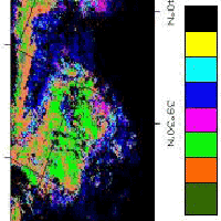
Fuel type characterization based on coarse resolution MODIS satellite data
iForest - Biogeosciences and Forestry, Volume 1, Issue 1, Pages 60-64 (2008)
doi: https://doi.org/10.3832/ifor0451-0010060
Published: Feb 28, 2008 - Copyright © 2008 SISEF
Research Articles
Abstract
Fuel types is one of the most important factors that should be taken into consideration for computing spatial fire hazard and risk and simulating fire growth and intensity across a landscape. In the present study, forest fuel mapping is considered from a remote sensing perspective. The purpose is to delineate forest types by exploring the use of coarse resolution satellite remote sensing MODIS imagery. In order to ascertain how well MODIS data can provide an exhaustive classification of fuel properties a sample area characterized by mixed vegetation covers and complex topography was analysed. The study area is located in the South of Italy. Fieldwork fuel type recognitions, performed before, after and during the acquisition of remote sensing MODIS data, were used as ground-truth dataset to assess the obtained results. The method comprised the following three steps: (I) adaptation of Prometheus fuel types for obtaining a standardization system useful for remotely sensed classification of fuel types and properties in the considered Mediterranean ecosystems; (II) model construction for the spectral characterization and mapping of fuel types based on two different approach, maximum likelihood (ML) classification algorithm and spectral Mixture Analysis (MTMF); (III) accuracy assessment for the performance evaluation based on the comparison of MODIS-based results with ground-truth. Results from our analyses showed that the use of remotely sensed MODIS data provided a valuable characterization and mapping of fuel types being that the achieved classification accuracy was higher than 73% for ML classifier and higher than 83% for MTMF.
Keywords
Authors’ Info
Authors’ address
R Lasaponara
Italian National Council of Research (CNR), Institute of Methodologies of Environmental Analysis, C. da S. Loja, I-85050, Tito Scalo, PZ (Italy)
Corresponding author
Paper Info
Citation
Lanorte A, Lasaponara R (2008). Fuel type characterization based on coarse resolution MODIS satellite data. iForest 1: 60-64. - doi: 10.3832/ifor0451-0010060
Paper history
Received: Feb 16, 2006
Accepted: Apr 23, 2007
First online: Feb 28, 2008
Publication Date: Feb 28, 2008
Publication Time: 10.37 months
Copyright Information
© SISEF - The Italian Society of Silviculture and Forest Ecology 2008
Open Access
This article is distributed under the terms of the Creative Commons Attribution-Non Commercial 4.0 International (https://creativecommons.org/licenses/by-nc/4.0/), which permits unrestricted use, distribution, and reproduction in any medium, provided you give appropriate credit to the original author(s) and the source, provide a link to the Creative Commons license, and indicate if changes were made.
Web Metrics
Breakdown by View Type
Article Usage
Total Article Views: 57460
(from publication date up to now)
Breakdown by View Type
HTML Page Views: 46919
Abstract Page Views: 3411
PDF Downloads: 5853
Citation/Reference Downloads: 69
XML Downloads: 1208
Web Metrics
Days since publication: 6549
Overall contacts: 57460
Avg. contacts per week: 61.42
Citation Metrics
Article Citations
Article citations are based on data periodically collected from the Clarivate Web of Science web site
(last update: Mar 2025)
Total number of cites (since 2008): 7
Average cites per year: 0.39
Publication Metrics
by Dimensions ©
Articles citing this article
List of the papers citing this article based on CrossRef Cited-by.
References
Estimating wildfire behaviour and effects. General Technical Report. USDA Forest Service, Intermountain Forest and Range Experiment Station INT-30. Ogden, Utah, pp. 1-92.
Gscholar
Leveraging the high dimensionality of AVIRIS data for improved sub-pixel target unmixing and rejection of false positives: mixture tuned matched filtering. Summaries of the Seventh JPL Airborne Geoscience Workshop. JPL Publication 97-1, 55-56. NASA Jet Propulsion Lab., Pasadena, California, USA.
Gscholar
BEHAVE: fire behaviour prediction and fuel modelling system-FUEL subsystem. USDA Forest Service General Technical Report INT-167, pp. 126.
Gscholar
Modelling Forest Fire danger From Geographic Information System. Geocarto International, 13: 15-23.
Gscholar
Remote sensing of large wildfires in European Mediterranean basin. Springer-Verlag, Berlin, pp. 122.
Gscholar
Potential utility of the TM tasseled cap multispectral data transformation for crown fire hazard assessment. ASPRS/ACSM annual convention proceedings: Agenda for the 90’s. Volume 3. Baltimore, Maryland, pp. 118-127.
Gscholar
Assessing the accuracy of remotely sensed data. CRC Press, Lewis Publishers, Boca Raton, Florida, USA.
Gscholar
A review of mixture modelling techniques for sub-pixel land cover estimation. Remote Sensing Reviews 13: 161-186.
Gscholar
Remote sensing and image interpretation. John Wiley & Sons, New York, USA.
Gscholar
Operational fire fuels mapping with NOAA-AVHRR data. American Society for Photogrammetry and Remote Sensing, Falls Church, Virginia, pp. 295-304.
Gscholar
Glossary of forest fire management terms. National Research Council of Canada, Committee for Forest Fire Management, Ottawa.
Gscholar
Photo inventory of fine logging slash. Photogrammetric Engineering 36: 1252-1256.
Gscholar
Slash fuel inventories from 70 mm low-level photography. Ottawa, Ontario, Canadian Forest Service: 63.
Gscholar
Geographic information system for wildland fire risk mapping. Wildfire 3 (2): 7-13.
Gscholar

