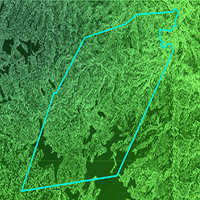
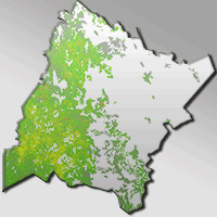
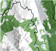
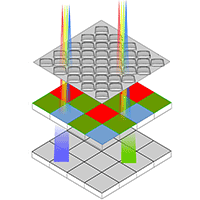
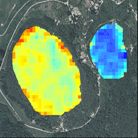
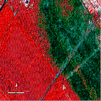
Remote sensors can be used as a robust and effective means of monitoring isolated or inaccessible forest sites. In the present study, the multivariate adaptive regression splines (MARS) technique was successfully applied to remotely sensed data collected by the Landsat-8 satellite to estimate mean diameter at breast height (R2 = 0.73), mean crown cover (R2 = 0.55), mean volume (R2 = 0.57) and total volume per plot (R2 = 0.41) in the forest monitoring sites. However, the spectral data yielded poor estimates of tree number per plot (R2 = 0.22), the mean height (R2 = 0.25) and the mean diameter at base (R2 = 0.38). Seven spectral bands (band 1 to band 7), six vegetation indexes and other derived parameters (NDVI, SAVI, LAI, FPAR. ALB and ASR) and eight terrain variables derived from the digital elevation model (elevation, slope, aspect, plan curvature, profile curvature, transformed aspect, terrain shape index and wetness index) were used as predictors in the fitted models. To prevent over-parameterization only some of the predictor variables considered were included in each model. The results indicate the MARS technique is potentially suitable for estimating dasometric variables from using spectral data obtained by the Landsat-8 OLI sensor.
Keywords
, , , , ,
Citation
López-Sánchez CA, García-Ramírez P, Resl R, Hernández-Díaz JC, López-Serrano PM, Wehenkel C (2017). Modelling dasometric attributes of mixed and uneven-aged forests using Landsat-8 OLI spectral data in the Sierra Madre Occidental, Mexico. iForest 10: 288-295. - doi: 10.3832/ifor1891-009
Academic Editor
Alessandro Montaghi
Paper history
Received: Oct 01, 2015
Accepted: Oct 12, 2016
First online: Feb 11, 2017
Publication Date: Feb 28, 2017
Publication Time: 4.07 months
© SISEF - The Italian Society of Silviculture and Forest Ecology 2017
Open Access
This article is distributed under the terms of the Creative Commons Attribution-Non Commercial 4.0 International (https://creativecommons.org/licenses/by-nc/4.0/), which permits unrestricted use, distribution, and reproduction in any medium, provided you give appropriate credit to the original author(s) and the source, provide a link to the Creative Commons license, and indicate if changes were made.

Breakdown by View Type
(Waiting for server response...)
Article Usage
Total Article Views: 52246
(from publication date up to now)
Breakdown by View Type
HTML Page Views: 42285
Abstract Page Views: 4013
PDF Downloads: 4693
Citation/Reference Downloads: 25
XML Downloads: 1230
Web Metrics
Days since publication: 3287
Overall contacts: 52246
Avg. contacts per week: 111.26
Article Citations
Article citations are based on data periodically collected from the Clarivate Web of Science web site
(last update: Mar 2025)
Total number of cites (since 2017): 11
Average cites per year: 1.22
Publication Metrics
by Dimensions ©
Articles citing this article
List of the papers citing this article based on CrossRef Cited-by.
(1)
Aertsen W, Kint V, Orshoven JV, Ozkan K, Muys B (2010)Comparison and ranking of different modeling techniques for prediction of site index in Mediterranean mountain forests. Ecological Modeling 221: 1119-1130.
CrossRef |
Gscholar
(2)
Agarwal R, Ranjan P, Chipman H (2014)A new Bayesian ensemble of trees approach for land cover classification of satellite imagery. Canadian Journal of Remote Sensing 39 (6): 507-520.
CrossRef |
Gscholar
(3)
Alonso-Fernández JR, García-Nieto PJ, Díaz Muñiza C, Antón JC (2014)Modelling eutrophication and risk prevention in a reservoir in the Northwest of Spain by using multivariate adaptive regression splines analysis. Ecological Engineering 68: 80-89.
CrossRef |
Gscholar
(4)
Asrar G (1989)Theory and applications of optical remote sensing. John Wiley and Sons, New York, USA, pp. 734.
Online |
Gscholar
(5)
Asrar G, Fuchs M, Kanemasu ET, Hatfield JL (1984)Estimating absorbed photosynthetically active radiation and leaf area index from spectral reflectance in wheat. Agronomy Journal 76 (2): 300-306.
CrossRef |
Gscholar
(6)
Baret F, Guyot G (1991)Potentials and limits of vegetation indices for LAI and PAR assessment. Remote Sensing of Environment 35 (2-3): 161- 173.
CrossRef |
Gscholar
(7)
Brutsaert W (1975)On a derivable formula for long-wave radiation from clear skies. Water Resources Research 11 (5): 742-744.
CrossRef |
Gscholar
(8)
Corral-Rivas JJ, Diéguez-Aranda U, Corral-Rivas S, Castedo-Dorado F (2007)A merchantable volume system for major pine species in El Salto, Durango (Mexico). Forest Ecology and Management 238 (2007) 118-129.
CrossRef |
Gscholar
(9)
Coulston JW, Moisen GG, Wilson BT, Finco MV, Cohen WB, Brewer CK (2012)Modeling percent tree canopy cover: a pilot study. Photogrammetric Engineering and Remote Sensing 78 (7): 715-727.
CrossRef |
Gscholar
(10)
Cruz-Leyva IA, Valdez-Lazalde JR, Pérez G, Santos-Posadas HM (2010)Modelación espacial de área basal y volumen de madera en bosques manejados de
Pinus patula y
P. teocote en el ejido Atopixco, Hidalgo [Spatial modeling of basal area and tree volume in managed
Pinus patula and
P. teocote forests in the ejido Atopixco, Hidalgo]. Madera y Bosques 16 (3): 75-97. [in Spanish]
Online |
Gscholar
(11)
Donoghue DNM, Watt PJ, Dunford RW, Wilson J, Staples S, Smith S, Batts A, Wooding MJ (2004)An evaluation of the use of satellite data for monitoring
Picea sitchensis plantation forest establishment and growth. Forestry 7 (5): 384-396.
CrossRef |
Gscholar
(12)
Dube T, Mutanga O (2015)Evaluating the utility of the medium-spatial resolution Landsat 8 multispectral sensor in quantifying aboveground biomass in Mgeni catchment, South Africa. ISPRS Journal of Photogrammetry and Remote Sensing 101: 36-46.
CrossRef |
Gscholar
(13)
ERDAS (2013)Erdas Imagine 2013. Hexago AB, Intergraph Corporation, Madison, AL, USA.
Online |
Gscholar
(14)
ESRI (2012)ArcGIS for Desktop 10. Redwoods, CA, USA.
Online |
Gscholar
(15)
Fassnacht FE, Hartig F, Latifi H, Berger C, Hernández J, Corvalán V, Koch B (2014)Importance of sample size, data type and prediction method for remote sensing-based estimations of aboveground forest biomass. Remote Sensing of Environment 154: 102-114.
CrossRef |
Gscholar
(16)
Franklin S, Hall R, Smith L, Gerylo G (2003)Discrimination of conifer height, age and crown closure classes using Landsat-5 TM imagery in the Canadian Northwest Territories. International Journal of Remote Sensing 24 (9): 1823-1834.
CrossRef |
Gscholar
(17)
Frescino TS, Gretchen GM (2002)Predictive mapping of forest attributes on the Fishlake National Forest. In: Proceedings of the “4th Annual Forest Inventory and Analysis Symposium”. New Orleans (LA, USA) 19-21 Nov 2002. Gen. Tech. Rep. NC-252, North Central Research Station, USDA Forest Service, St. Paul, MN, USA, pp. 257.
Online |
Gscholar
(18)
Friedman JH (1991)Multivariate adaptive regression splines. The Annals of Statistic 19 (1): 1-141.
CrossRef |
Gscholar
(19)
Gadow K, Sanchez S, Aguirre OA (2004)Manejo forestal con base científica [Science-based forest management]. Madera y Bosques 10 (2): 3-16. [in Spanish]
Gscholar
(20)
García-Martín A, Pérez-Cabello F, Riva-Fernández J (2006)Evaluación de los recursos de biomasa residual forestal mediante imágenes del satélite Landsat y SIG [Resource assessment of residual forest biomass by Landsat satellite images and GIS]. GeoFocus 6: 205-230. [in Spanish]
Online |
Gscholar
(21)
Gleason CJ, Im J (2011)A review of remote sensing of forest biomass and biofuel: options for small-area applications. Giscience and Remote Sensing 48 (2): 141-170.
CrossRef |
Gscholar
(22)
González-Elizondo MS, González-Elizondo M, Tena-Flores JA, Ruacho-González L, López-Enríquez L (2012)Vegetación de la Sierra Madre Occidental, México: una síntesis [Vegetation of the Sierra Madre Occidental, Mexico: a synthesis]. Acta Botánica Mexicana 100: 351-403. [in Spanish]
Online |
Gscholar
(23)
Hall RJ, Skakun RS, Arsenault EJ, Case BS (2006)Modeling forest stand structure attributes using Landsat ETM+ data: application to mapping of aboveground biomass and stand volume. Forest Ecology and Management 225 (1): 378-390.
CrossRef |
Gscholar
(24)
Hastie T, Tibshirani R, Friedman J (2009)The elements of statistical learning: data mining, inference, and prediction (2nd edn). Springer-Verlag, New York, USA, pp. 745.
Gscholar
(25)
Huete AR (1988)A soil-adjusted vegetation index (SAVI). Remote Sensing of Environment 25 (3): 295-309.
CrossRef |
Gscholar
(26)
INEGI (2014)Continuo de elevaciones mexicano 3.0 (CEM 3.0) [Continuous elevation 3.0 (CEM 3.0)]. Instituto Nacional de Estadística Geográfica e Informática, DF, México.
Online |
Gscholar
(27)
Ji L, Wylie BK, Nossov DR, Peterson B, Waldrop MP, McFarland JW, Rover J, Hollingsworth TN (2012)Estimating aboveground biomass in interior Alaska with Landsat data and field measurements. International. Journal of applied Earth Observation and Geoinformation 18: 451-461.
CrossRef |
Gscholar
(28)
Law B, Waring R (1994)Remote sensing of leaf area index and radiation intercepted by understory vegetation. Ecological Applications 4 (2): 272-279.
CrossRef |
Gscholar
(29)
Li A, Huang C, Sun G, Shi H, Toney C, Zhu Z, Rollins MG, Goward SN, Masek JG (2011)Modeling the height of young forests regenerating from recent disturbances in Mississippi using Landsat and ICESat data. Remote Sensing of Environment 115 (8): 1837-1849.
CrossRef |
Gscholar
(30)
López-Serrano PM, López Sánchez CA, Solís-Moreno R, Corral-Rivas JJ (2016)Geospatial Estimation of above Ground Forest Biomass in the Sierra Madre Occidental in the State of Durango, Mexico. Forests 7: 70.
CrossRef |
Gscholar
(31)
Luther JE, Fournier RA, Piercey DE, Guindon L, Hall RJ (2006)Biomass mapping using forest type and structure derived from Landsat TM imagery. International Journal of applied Earth Observation and Geoinformation 8 (3): 173-187.
CrossRef |
Gscholar
(32)
McNab WH (1989)Terrain shape index: quantifying effect of minor landforms on tree height. Forest Science 35: 91-104.
Online |
Gscholar
(33)
Martínez-Antúnez P, Wehenkel C, Hernández-Díaz JC, Corral-Rivas JJ (2015)Use of the Weibull function to model maximum probability of abundance of tree species in northwest Mexico. Annals of Forest Science 72 (2): 243-251.
CrossRef |
Gscholar
(34)
Moisen GG, Frescino TS (2002)Comparing five modelling techniques for predicting forest characteristics. Ecological Modelling 157: 209-225.
CrossRef |
Gscholar
(35)
Moore ID, Nieber JL (1989)Landscape assessment of soil erosion and non-point source pollution. Journal of the Minnesota Academy of Science 55 (1): 18-24.
Gscholar
(36)
Ozdemir I, Karnieli A (2011)Predicting forest structural parameters using the image texture derived from WorldView-2 multispectral imagery in a dryland forest, Israel, International Journal of Applied Earth Observation and Geoinformation 13: 701-710.
CrossRef |
Gscholar
(37)
Poulain M, Peña M, Schmidt A, Schmidt H, Schulte A (2010)Relationships between forest variables and remote sensing data in a
Nothofagus pumilio forest. Geocarto Internacional 25 (1): 25-43.
CrossRef |
Gscholar
(38)
Pflugmacher D, Cohen WB, Kennedy RE, Yang Z (2014)Using Landsat-derived disturbance and recovery history and lidar to map forest biomass dynamics. Remote Sensing of Environment 151: 124-137.
CrossRef |
Gscholar
(39)
R Core Team (2015)R: A language and environment for statistical computing. R Foundation for Statistical Computing. Vienna, Austria, pp. 3551.
Online |
Gscholar
(40)
Roberts DW, Cooper SV (1989)Concepts and techniques of vegetation mapping. In: “Land classifications based on vegetation: applications for resource management” (Ferguson D, Morgan P, Johnson FD eds). Gen. Tech. Rep. INT-257, Intermountain Forest and Range Experiment Station, USDA Forest Service, Ogden, UT, USA, pp. 90-96.
Gscholar
(41)
Rouse JW, Haas RH, Schiell JA, Deferino DW, Harlan JC (1974)Monitoring the vernal advancement of retrogradation of natural vegetation. NASA/OSFC, Type III Final Report, Remote Sensing Center, Texas A&M University, College Station, TX, USA, pp. 87.
Online |
Gscholar
(42)
SRNyMA-CONAFOR (2007)Plan estrátegico forestal 2030 [Strategic forest plan 2030]. Gobierno del estado de Durango, Durango, México, pp. 242. [in Spanish]
Gscholar
(43)
Trotter CM, Dymond JR, Goulding CJ (1997)Estimation of timber volume in a coniferous plantation forest using Landsat TM. International Journal Remote Sensing 18: 2209-2223.
CrossRef |
Gscholar
(44)
Venables WN, Ripley BD (2002)Modern applied statistics with S (4th edn). Springer, New York, USA, pp. 498.
Gscholar
(45)
Vidoli F (2011)Evaluating the water sector in Italy through a two stage method using the conditional robust nonparametric frontier and multivariate adaptive regression splines. European Journal of Operational Research 212: 583-595.
CrossRef |
Gscholar
(46)
Wehenkel C, Corral-Rivas JJ, Hernández-Díaz JC, Gadow KV (2011)Estimating balanced structure areas in multi-species forests on the Sierra Madre Occidental, Mexico. Annals of Forest Science 68: 385-394.
CrossRef |
Gscholar
(47)
Wilson JP, Gallant JC (2000)Digital terrain analysis. In: “Terrain Analysis: Principles and Applications” (Wilson JP, Gallant JC eds). John Wiley and Sons, Inc, New York, USA, pp. 1-28.
Online |
Gscholar
(48)
Wu C, Shen H, Wang K, Shen A, Deng J, Gan M (2016)Landsat imagery-based above ground biomass estimation and change investigation related to human activities. Sustainability 8 (2): 159.
CrossRef |
Gscholar
(49)
Zevenbergen LW, Thorne CR (1987)Quantitative analysis of land surface topography. Earth Surface Processes and Landforms 12: 47-56.
CrossRef |
Gscholar
(50)
Zhang J, Huang S, Hogg EH, Lieffers V, Qin Y, He F (2014)Estimating spatial variation in Alberta forest biomass from a combination of forest inventory and remote sensing data. Biogeosciencies 11: 2793-2808.
CrossRef |
Gscholar
(51)
Zheng HL, Chen X, Han X, Zhao X, Ma Y (2009)Classification and regression tree (CART) for analysis of soybean yield variability among fields in Northeast China: the importance of phosphorus application rates under drought conditions. Agriculture, Ecosystems and Environment 132: 98-105.
CrossRef |
Gscholar
(52)
Zhu X, Liu D (2015)Improving forest aboveground biomass estimation using seasonal Landsat NDVI time-series. ISPRS Journal of Photogrammetry and Remote Sensing 102: 222-231.
CrossRef |
Gscholar
