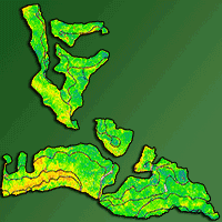
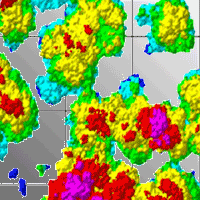
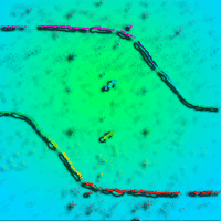
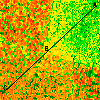
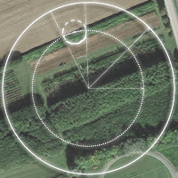
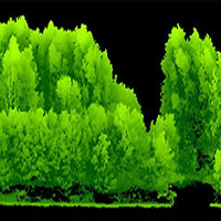
Airborne laser scanning (ALS) has recently gained increasing attention in forestry, as ALS data may facilitate the efficient assessment of forest inventory attributes and ecological indicators related to forest stand structure. This paper presents a novel workflow for individual tree detection and tree crown delineation using ALS data. The developed point-based approach included several tree allometry rules on permissible tree heights and crown dimensions to increase the likelihood of detecting the actual tree profiles. The accuracy of the method was assessed in a heterogeneous forest with a complex stand structure in Slovakia (Central Europe). ALS measurements were taken using a RIEGL Q680i scanner at 700 m of height with a point density of 20 echoes per m2. The ground reference data included the measured positions and dimensions of 1332 trees in nine plots distributed across the region. We found that the number of individual trees detected by the algorithm using ALS data was systematically underestimated by 34 ± 15% relative to the reference data. The delineated crown coverage was underestimated by 2 ± 6% as well, but the latter difference was not statistically significant (p>0.05).
Keywords
, , ,
Citation
Sačkov I, Hlásny T, Bucha T, Juriš M (2017). Integration of tree allometry rules to treetops detection and tree crowns delineation using airborne lidar data. iForest 10: 459-467. - doi: 10.3832/ifor2093-010
Academic Editor
Davide Travaglini
Paper history
Received: Apr 25, 2016
Accepted: Jan 16, 2017
First online: Apr 04, 2017
Publication Date: Apr 30, 2017
Publication Time: 2.60 months
© SISEF - The Italian Society of Silviculture and Forest Ecology 2017
Open Access
This article is distributed under the terms of the Creative Commons Attribution-Non Commercial 4.0 International (https://creativecommons.org/licenses/by-nc/4.0/), which permits unrestricted use, distribution, and reproduction in any medium, provided you give appropriate credit to the original author(s) and the source, provide a link to the Creative Commons license, and indicate if changes were made.

Breakdown by View Type
(Waiting for server response...)
Article Usage
Total Article Views: 51679
(from publication date up to now)
Breakdown by View Type
HTML Page Views: 43818
Abstract Page Views: 2679
PDF Downloads: 4137
Citation/Reference Downloads: 27
XML Downloads: 1018
Web Metrics
Days since publication: 2944
Overall contacts: 51679
Avg. contacts per week: 122.88
Article Citations
Article citations are based on data periodically collected from the Clarivate Web of Science web site
(last update: Mar 2025)
Total number of cites (since 2017): 22
Average cites per year: 2.44
Publication Metrics
by Dimensions ©
Articles citing this article
List of the papers citing this article based on CrossRef Cited-by.
(1)
Andersen HE, Strunk J, Temesgen H, Atwood D, Winterberger K (2011)Using multi-level remote sensing and ground data to estimate forest biomass resources in remote regions: a case study in the boreal forests of interior Alaska. Canadian Journal of Remote Sensing 37: 596-611.
CrossRef |
Gscholar
(2)
Bottalico F, Travaglini D, Chirici G, Marchetti M, Marchi E, Nocentini S, Corona P (2014)Classifying silvicultural systems (coppices
vs. high forests) in Mediterranean oak forests by Airborne Laser Scanning data. European Journal of Remote Sensing 47: 437-460.
Online |
Gscholar
(3)
Ene L, Naesset E, Gobakken T (2012)Single tree in heterogeneous boreal forests using airborne laser scanning and area-based stem number estimates. International Journal of Remote Sensing 33: 5171-5193.
CrossRef |
Gscholar
(4)
Eysn L, Hollaus M, Lindberg E, Berger F, Monnet JM, Dalponte M, Kobal M, Pellegrini M, Lingua E, Mongus D, Pfeifer N (2015)A benchmark of LiDAR-based single tree detection methods using heterogeneous forest data from the Alpine space. Forests 6: 1721-1747.
CrossRef |
Gscholar
(5)
Ferraz A, Bretar F, Jacquemoud S, Gonçalves G, Pereira L, Tomé M, Soares P (2012)3-D mapping of a multi-layered Mediterranean forest using ALS data. Remote Sensing of Environment 121: 210-223.
CrossRef |
Gscholar
(6)
Frank AU (2005)Map algebra extended with functors for temporal data. In: “Perspectives in Conceptual Modeling Akoka” (Liddle SW, Song IY eds). Springer-Verlag, Berlin, Heidelberg, Germany, pp. 194-207.
CrossRef |
Gscholar
(7)
Frazer GW, Magnussen S, Wulder MA, Niemann KO (2011)Simulated impact of sample plot size and co-registration error on the accuracy and uncertainty of LiDAR-derived estimates of forest stand biomass. Remote Sensing of Environment 115: 636-649.
CrossRef |
Gscholar
(8)
Gupta S, Weinacker H, Koch B (2010)Comparative analysis of clustering-based approaches for 3-D single tree detection using airborne fullwave LiDAR data. Remote Sensing 2: 968-989.
CrossRef |
Gscholar
(9)
Heinzel J, Weinecker H, Koch B (2010)Prior-knowledge based single tree extraction. International Journal of Remote Sensing 32: 4990-5020.
Gscholar
(10)
Hernandez-Marin S, Wallace AM, Gibson GJ (2007)Bayesian analysis of Lidar signals with multiple returns. Pattern Analysis and Machine Intelligence, IEEE Transactions on Pattern Analysis and Machine Intelligence 29: 2170-2180.
CrossRef |
Gscholar
(11)
Hollaus M, Werner M, Roncat A, Pfeifer N, Briese C (2014)Full-waveform airborne laser scanning systems and their possibilities in forest applications. In: “Forestry Application of Airborne Laser Scanning: Concept and Case Studies” (Maltamo M, Naesset E, Vauhkonen J eds). Springer Netherlands, Dordrecht, Netherlands, pp. 1-16.
CrossRef |
Gscholar
(12)
Holmgren J, Johansson F, Olofsson K, Olsson H, Glimskär A (2008)Estimation of crown coverage using airborne laser scanning. In: Proceedings of the “SilviLaser 2008” (Hill RA, Suárez J eds). Edinburgh (Scotland, UK), 17-19 Sept 2008, pp. 11.
Online |
Gscholar
(13)
Hyyppä J, Inkinen M (1999)Detecting and estimating attributes for single trees using laser scanner. The Photogrammetric Journal of Finland 16: 27-42.
Gscholar
(14)
Hyyppä J, Yu X, Hyyppä H, Hyyppä M, Holopainen M, Kukko A, Kaartinen H, Jaakkola A, Vaaja M, Koskinen J, Alho P (2007)Advances in forest inventory using Airborne Laser Scanning. Remote Sensing: 1190-1207.
CrossRef |
Gscholar
(15)
Kaartinen H, Hyyppä J (2008)Tree Extraction. EuroSDR Project Report, Dublin, Ireland, pp. 60.
Gscholar
(16)
Kaartinen H, Hyyppä J, Yu X, Vastaranta M, Hyyppä H, Kukko A, Holopainen M, Heipke CH, Hirschmugl M, Morsdorf F, Pitkänen J, Popescu S, Solberg S, Wolf BM, Wu JCH (2012)An international comparison of individual tree detection and extraction using Airborne Laser Scanning. Remote Sensing 4: 950-974.
CrossRef |
Gscholar
(17)
Kandare K, Orka HO, Chan JCW, Dalponte M (2016)Effects of forest structure and airborne laser scanning point cloud density on 3D delineation of individual tree crowns. European Journal of Remote Sensing 49: 337-359.
CrossRef |
Gscholar
(18)
Kania A, Lindberg E, Schroiff A, Mücke W, Holmgren J, Pfeifer N (2014)Individual tree detection as input information for Natura 2000 habitat quality mapping. In: Proceedings of the “Remote Sensing and GIS for Monitoring Habitat Quality” (Pfeifer N, Zlinszky A eds). Vienna (AT), 24-25 September 2014. Vienna, Austria, pp. 3.
Online |
Gscholar
(19)
Kankare V, Vastaranta M, Holopainen M, Räty M, Yu X, Hyypä J, Hyppä H, Alho P, Viitala R (2013)Retrieval of forest aboveground biomass and stem volume with airborne scanning LiDAR. Remote Sensing 5: 2257-2274.
CrossRef |
Gscholar
(20)
Koch B, Heyder U, Weinecker H (2006)Detection of individual tree crowns in airborne lidar data. Photogrammetric Engineering and Remote Sensing 4: 357-363.
CrossRef |
Gscholar
(21)
Koch B, Kattenborn T, Straub CH, Vauhkonen J (2014)Segmentation of forest to tree objects. In: “Forestry Application of Airborne Laser Scanning: Concept and Case Studies” (Maltamo M, Naesset E, Vauhkonen J eds). Springer Netherlands, Dordrecht, Netherlands, pp. 1-16.
CrossRef |
Gscholar
(22)
Lähivaara T, Seppänen A, Kaipio JP, Vauhkonen J, Korhonen L, Tokola T, Maltamo M (2014)Bayesian approach to tree detection based on airborne laser scanning data. IEEE Transactions on Geoscience and Remote Sensing 52: 2690-2699.
CrossRef |
Gscholar
(23)
Lindberg E, Hollaus M (2012)Comparison of methods for estimation of stem volume, stem number and basal area from airborne laser scanning data in a hemi-boreal forest. Remote Sensing 4: 1004-1023.
CrossRef |
Gscholar
(24)
Longley PA, Goodchild MF, Maguire DJ, Rhind DW (2005)Geographic information systems and science (3rd edn). John Wiley, Chichester, UK, pp. 560.
Online |
Gscholar
(25)
Maltamo M, Packalén P, Peuhkurinen J, Suvanto A, Pesonen A, Hyyppä J (2007)Experiences and possibilities of ALS based forest inventory in Finland. In: Proceedings of the “ISPRS Workshop on Laser Scanning 2007 and SilviLaser 2007” (Rönnholm P, Hyyppä H, Hyyppä J eds). Espoo (Finland), 12-14 Sept 2007, pp. 9.
Online |
Gscholar
(26)
Maltamo M, Packalén P, Suvanto A, Korhonen KT, Mehtätalo P (2009)Combining ALS and NFI training data for forest management planning: a case study in Kuortane, Western Finland. European Journal of Forest Research 128: 305-317.
CrossRef |
Gscholar
(27)
Means JE, Acker SS, Fitt BJ, Renslow M, Emerson L, Hendrix CJ (2000)Predicting forest stand characteristics with airborne scanning lidar. Photogrammetry Engineering and Remote Sensing 66: 1367-1371.
Online |
Gscholar
(28)
Mikita T, Klimánek M, Cibulka M (2013)Evaluation of airborne laser scanning data for tree parameters and terrain modelling in forest environment. Acta Universitatis Agriculturae et Silviculturae Mendelianae Brunensis 61: 1339-1347.
CrossRef |
Gscholar
(29)
Morsdorf F, Meier E, Kötz B, Itten KI, Dobbertin M, Allgöwer B (2004)LIDAR-based geometric reconstruction of boreal type forest stands at single tree level for forest and wildland fire management. Remote Sensing of Environment 92: 353-362.
CrossRef |
Gscholar
(30)
Naesset E (1997)Estimating timber volume of forest stands using airborne laser scanner data. Remote Sensing of Environment 51: 246-253.
CrossRef |
Gscholar
(31)
Packalén P, Maltamo M (2007)The k-MSN method for the prediction of species-specific stand attributes using airborne laser scanning and aerial photographs. Remote Sensing of Environment 109: 328-341.
CrossRef |
Gscholar
(32)
Packalén P, Maltamo M (2008)The estimation of species-specific diameter distribution using airborne laser scanning and aerial photographs. Canadian Journal of Forest Research 38: 1750-1760.
CrossRef |
Gscholar
(33)
Pirotti F (2010)Assessing a template matching approach for tree height and position extraction from lidar-derived canopy height models of
Pinus pinaster stands. Forests 1: 194-208.
CrossRef |
Gscholar
(34)
Popescu SC, Zhao K (2008)A voxel-based lidar method for estimating crown base height for deciduous and pine trees. Remote Sensing of Environment 112: 767-7810.
CrossRef |
Gscholar
(35)
Reitberger J, Schnörr C, Krzystek P, Stilla U (2009)3D Segmentation of single trees exploiting full waveform LiDAR data. ISPRS Journal of Photogrammetry and Remote Sensing 64: 561-574.
CrossRef |
Gscholar
(36)
Ruiz LA, Hermosilla T, Mauro F, Godino M (2014)Analysis of the influence of plot size and LiDAR density on forest structure attribute estimates. Forests 5: 936-951.
CrossRef |
Gscholar
(37)
Salas C, Ene L, Gregoire TG, Naesset E, Gobakken T (2010)Modelling tree diameter from airborne laser scanning derived variables: a comparison of spatial statistics models. Remote Sensing of Environment 114: 1277-1285.
CrossRef |
Gscholar
(38)
Sheridan RD, Popescu SC, Gatziolis D, Morgan CL, Ku NW (2015)Modelling forest aboveground biomass and volume using airborne LiDAR metrics and forest inventory and analysis data in the Pacific Northwest. Remote Sensing 7: 229-255.
CrossRef |
Gscholar
(39)
Swetnam TL, Falk DA (2014)Application of metabolic scaling theory to reduce error in local maxima tree segmentation from aerial LiDAR. Forest Ecology and Management 323: 158-167.
CrossRef |
Gscholar
(40)
Smelko S, Sebn V, Bosel’a M, Sačkov I, Kulla L (2014)New variants of methods for multi-purpose inventory and monitoring of forest ecosystems using progressive technologies. NLC-LVÚ Zvolen, Zvolen, Slovakia, pp. 368. [in Slovak]
Gscholar
(41)
Tiede D, Hoffmann C (2006)Process oriented object-based algorithms for single tree detection using laser scanning data. In: Proceedings of the “Workshop on 3D Remote Sensing in Forestry” (Koukal T, Schneider W ed). Vienna (Austria), 14-15 Feb 2006, pp. 5.
Online |
Gscholar
(42)
Tuominen S, Pitkänen J, Balazs A, Korhonen KT, Hyvönen P, Muinonen E (2014)NFI plots as complementary reference data in forest inventory based on airborne laser scanning and aerial photography in Finland. Silva Fennica 48: article id. 983.
CrossRef |
Gscholar
(43)
Vauhkonen J, Mehtätalo L, Packalén P (2011a)Combining tree height samples produced by airborne laser scanning and stand management records to estimate plot volume in Eucalyptus plantations. Canadian Journal of Forest Research 41: 1649-1658.
CrossRef |
Gscholar
(44)
Vauhkonen J, Ene L, Gupta S, Heinzel J, Holmgren J, Pitkänen J, Solberg S, Wang Y, Weinacker H, Hauglin KM, Lien V, Packalén P, Globaken T, Koch B, Naesset E, Tokola T, Maltamo M (2011b)Comparative testing of single-tree detection algorithms under different types of forest. Forestry 85: 27-40.
CrossRef |
Gscholar
(45)
Vauhkonen J, Maltamo M, McRoberts RE, Naesset E (2014)Introduction to forestry applications of airborne laser scanning. In: “Forestry Application of Airborne Laser Scanning: Concept and Case Studies” (Maltamo M, Naesset E, Vauhkonen J eds). Springer Netherlands, Dordrecht, Netherlands, pp. 1-16.
CrossRef |
Gscholar
(46)
Vega C, Hamrouni A, Mokhtari SE, Morel J, Bock J, Renaud JP, Bouvier M, Durrieu S (2014)PTrees: a point-based approach to forest tree extraction from lidar data. International Journal of Applied Earth Observation 33: 98-108.
CrossRef |
Gscholar
(47)
Xu Q, Hou Z, Maltamo M, Tokola T (2014)Calibration of area based diameter distribution with individual tree based diameter estimates using airborne laser scanning. ISPRS Journal of Photogrammetry and Remote Sensing 93: 65-75.
CrossRef |
Gscholar
(48)
Yao W, Krull J, Krzystek P, Heurich M (2014)Sensitivity analysis of 3D individual tree detection from LiDAR point clouds of temperate forests. Forests 5: 1122-1142.
CrossRef |
Gscholar
(49)
Yu X, Hyyppä J, Vastaranta M, Holopainen M, Viitala R (2011)Predicting individual tree attributes from airborne laser point clouds based on random forests technique. ISPRS Journal of Photogrammetry and Remote Sensing 66: 28-37.
CrossRef |
Gscholar
(50)
Zhang C, Zhou Y, Qiu F (2015)Individual tree segmentation from LiDAR point clouds for urban forest inventory. Remote Sensing 7: 7892-7913.
CrossRef |
Gscholar
