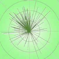
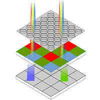
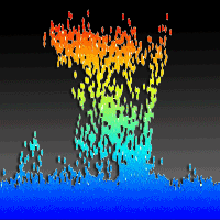
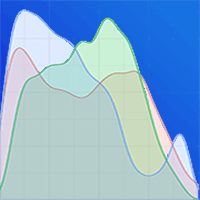
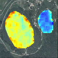
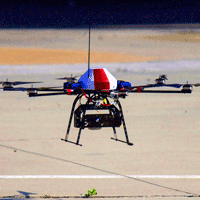
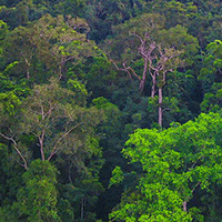
To obtain precise cartometric measurements of forests is always a challenge and high-resolution data from Unmanned Aerial Vehicle (UAV) is currently the quickest method. Generation of a fine quality orthomosaic of the acquired image series is a pre-requisite for full exploitation of such data. This study examines six of the most frequently used photogrammetric software for popular and inexpensive UAV systems. It is assumed that ground control points (GCPs) are not required. The average Root Mean Square Error (RMSE) for raw orthophoto was 1.24 m and around 0.2 m precision for both X and Y axes. Additionally, the accuracy of UAV internal GNSS receiver was checked on reference points which slightly exceeds 2 m RMSE. The range of accuracy and precision of orthomosaic are provided as a valuable reference for the use of low-cost UAV in forest inventory.
Keywords
, , , , ,
Citation
Brach M, Chan JC-W, Szymanski P (2019). Accuracy assessment of different photogrammetric software for processing data from low-cost UAV platforms in forest conditions. iForest 12: 435-441. - doi: 10.3832/ifor2986-012
Academic Editor
Luca Salvati
Paper history
Received: Oct 31, 2018
Accepted: Jun 22, 2019
First online: Sep 01, 2019
Publication Date: Oct 31, 2019
Publication Time: 2.37 months
© SISEF - The Italian Society of Silviculture and Forest Ecology 2019
Open Access
This article is distributed under the terms of the Creative Commons Attribution-Non Commercial 4.0 International (https://creativecommons.org/licenses/by-nc/4.0/), which permits unrestricted use, distribution, and reproduction in any medium, provided you give appropriate credit to the original author(s) and the source, provide a link to the Creative Commons license, and indicate if changes were made.

Breakdown by View Type
(Waiting for server response...)
Article Usage
Total Article Views: 50729
(from publication date up to now)
Breakdown by View Type
HTML Page Views: 40521
Abstract Page Views: 4782
PDF Downloads: 4536
Citation/Reference Downloads: 9
XML Downloads: 881
Web Metrics
Days since publication: 2446
Overall contacts: 50729
Avg. contacts per week: 145.18
Article Citations
Article citations are based on data periodically collected from the Clarivate Web of Science web site
(last update: Mar 2025)
Total number of cites (since 2019): 15
Average cites per year: 2.14
Publication Metrics
by Dimensions ©
Articles citing this article
List of the papers citing this article based on CrossRef Cited-by.
(1)
Abdollahnejad A, Panagiotidis D, Surovy P (2018)Estimation and extrapolation of tree parameters using spectral correlation between UAV and Pléiades data. Forests 9: 85.
CrossRef |
Gscholar
(2)
Agüera-Vega F, Carvajal-Ramírez F, Martínez-Carricondo P (2017)Assessment of photogrammetric mapping accuracy based on variation ground control points number using unmanned aerial vehicle. Measurement 98: 221-227.
CrossRef |
Gscholar
(3)
Agüera-Vega F, Carvajal-Ramírez F, Martínez-Carricondo P, Sánchez-Hermosilla López J, Mesas-Carrascosa FJ, García-Ferrer A, Pérez-Porras FJ (2018)Reconstruction of extreme topography from UAV structure from motion photogrammetry. Measurement 121: 127-138.
CrossRef |
Gscholar
(4)
Aicardi I, Dabove P, Lingua A, Piras M (2017)Integration between TLS and UAV photogrammetry techniques for forestry applications. iForest - Biogeosciences and Forestry 10: 41-47.
CrossRef |
Gscholar
(5)
Alonzo M, Andersen H-E, Morton D, Cook B (2018)Quantifying boreal forest structure and composition using UAV structure from motion. Forests 9: 119.
CrossRef |
Gscholar
(6)
Becker R, Keefe R, Anderson N (2017)Use of real-time GNSS-RF data to characterize the swing movements of forestry equipment. Forests 8: 44.
CrossRef |
Gscholar
(7)
Bemis SP, Micklethwaite S, Turner D, James MR, Akciz S, Thiele ST, Bangash HA (2014)Ground-based and UAV-Based photogrammetry: a multi-scale, high-resolution mapping tool for structural geology and paleoseismology. Journal of Structural Geology 69: 163-178.
CrossRef |
Gscholar
(8)
Bosy J, Graszka W, Leonczyk M (2007)ASG-EUPOS - a multifunctional precise satellite positioning system in Poland. European Journal of Navigation 5: 2-6.
Online |
Gscholar
(9)
Chiang K-W, Tsai M-L, Chu C-H (2012)The development of an UAV borne direct georeferenced photogrammetric platform for ground control point free applications. Sensors 12: 9161-9180.
CrossRef |
Gscholar
(10)
Clapuyt F, Vanacker V, Van Oost K (2016)Reproducibility of UAV-based earth topography reconstructions based on Structure-from-Motion algorithms. Geomorphology 260: 4-15.
CrossRef |
Gscholar
(11)
Clark A (2017)Small unmanned aerial systems comparative analysis for the application to coastal erosion monitoring. GeoResJ 13: 175-185.
CrossRef |
Gscholar
(12)
Colomina I, Molina P (2014)Unmanned aerial systems for photogrammetry and remote sensing: a review. ISPRS Journal of Photogrammetry and Remote Sensing 92: 79-97.
CrossRef |
Gscholar
(13)
Cook KL (2017)An evaluation of the effectiveness of low-cost UAVs and structure from motion for geomorphic change detection. Geomorphology 278: 195-208.
CrossRef |
Gscholar
(14)
Cruzan MB, Weinstein BG, Grasty MR, Kohrn BF, Hendrickson EC, Arredondo TM, Thompson PG (2016)Small unmanned aerial vehicles (micro-UAVs, drones) in plant ecology. Applications in Plant Sciences 4: 1600041.
CrossRef |
Gscholar
(15)
Dash JP, Watt MS, Pearse GD, Heaphy M, Dungey HS (2017)Assessing very high resolution UAV imagery for monitoring forest health during a simulated disease outbreak. ISPRS Journal of Photogrammetry and Remote Sensing 131: 1-14.
CrossRef |
Gscholar
(16)
Dawidowicz K, Krzan G (2014)Accuracy of single receiver static GNSS measurements under conditions of limited satellite availability. Survey Review 46: 278-287.
CrossRef |
Gscholar
(17)
Dempewolf J, Nagol J, Hein S, Thiel C, Zimmermann R (2017)Measurement of within-season tree height growth in a mixed forest stand using UAV imagery. Forests 8: 231.
CrossRef |
Gscholar
(18)
Gruszczynski W, Matwij W, Cwiakala P (2017)Comparison of low-altitude UAV photogrammetry with terrestrial laser scanning as data-source methods for terrain covered in low vegetation. ISPRS Journal of Photogrammetry and Remote Sensing 126: 168-179.
CrossRef |
Gscholar
(19)
Guerra-Hernández J, González-Ferreiro E, Monleón V, Faias S, Tomé M, Díaz-Varela R (2017)Use of multi-temporal UAV-derived imagery for estimating individual tree growth in
Pinus pinea stands. Forests 8: 300.
CrossRef |
Gscholar
(20)
Hird J, Montaghi A, McDermid G, Kariyeva J, Moorman B, Nielsen S, McIntosh A (2017)Use of unmanned aerial vehicles for monitoring recovery of forest vegetation on petroleum well sites. Remote Sensing 9: 413.
CrossRef |
Gscholar
(21)
Hofmann-Wellenhof B, Lichtenegger H, Wasle E (2008)GNSS - global navigation satellite systems: GPS, GLONASS, Galileo, and more. Springer, Wien, New York, pp. 516.
Gscholar
(22)
James MR, Robson S, D’Oleire-Oltmanns S, Niethammer U (2017)Optimising UAV topographic surveys processed with structure-from-motion: ground control quality, quantity and bundle adjustment. Geomorphology 280: 51-66.
CrossRef |
Gscholar
(23)
Jaworski L, Swiatek A (2012)Comparison of coordinates of Polref - the first order Polish national network - obtained from campaigns in 1994/95 and 2008/2010. Artificial Satellites 47.
CrossRef |
Gscholar
(24)
Kedzierski M, Wierzbicki D (2015)Radiometric quality assessment of images acquired by UAVs in various lighting and weather conditions. Measurement 76: 156-169.
CrossRef |
Gscholar
(25)
Matese A, Di Gennaro SF, Berton A (2017)Assessment of a canopy height model (CHM) in a vineyard using UAV-based multispectral imaging. International Journal of Remote Sensing 38: 2150-2160.
CrossRef |
Gscholar
(26)
Muscolo A, Settineri G, Bagnato S, Mercurio R, Sidari M (2017)Use of canopy gap openings to restore coniferous stands in Mediterranean environment. iForest - Biogeosciences and Forestry 10: 322-327.
CrossRef |
Gscholar
(27)
Ota T, Ogawa M, Mizoue N, Fukumoto K, Yoshida S (2017)Forest structure estimation from a UAV-based photogrammetric point cloud in managed temperate coniferous forests. Forests 8: 343.
CrossRef |
Gscholar
(28)
Otero V, Van De Kerchove R, Satyanarayana B, Martínez-Espinosa C, Fisol MAB, Ibrahim MRB, Sulong I, Mohd-Lokman H, Lucas R, Dahdouh-Guebas F (2018)Managing mangrove forests from the sky: forest inventory using field data and Unmanned Aerial Vehicle (UAV) imagery in the Matang Mangrove Forest Reserve, peninsular Malaysia. Forest Ecology and Management 411: 35-45.
CrossRef |
Gscholar
(29)
Pfeifer N, Glira P, Briese C (2012)Direct georeferencing with on board navigation components of light weight UAV platforms. ISPRS - International Archives of the Photogrammetry, Remote Sensing and Spatial Information Sciences XXXIX-B7: 487-492.
CrossRef |
Gscholar
(30)
Puliti S, Talbot B, Astrup R (2018)Tree-stump detection, segmentation, classification, and measurement using unmanned aerial vehicle (UAV) imagery. Forests 9: 102.
CrossRef |
Gscholar
(31)
Rusnák M, Sládek J, Kidová A, Lehotsky M (2018)Template for high-resolution river landscape mapping using UAV technology. Measurement 115: 139-151.
CrossRef |
Gscholar
(32)
Ruzgiene B, Berteška T, Gečyte S, Jakubauskiene E, Aksamitauskas VÄŒ (2015)The surface modelling based on UAV Photogrammetry and qualitative estimation. Measurement 73: 619-627.
CrossRef |
Gscholar
(33)
Sálek L, Zahradník D, Marušák R, Jerábková L, Merganič J (2013)Forest edges in managed riparian forests in the eastern part of the Czech Republic. Forest Ecology and Management 305: 1-10.
CrossRef |
Gscholar
(34)
Sankey T, Donager J, McVay J, Sankey JB (2017)UAV lidar and hyperspectral fusion for forest monitoring in the southwestern USA. Remote Sensing of Environment 195: 30-43.
CrossRef |
Gscholar
(35)
Schirrmann M, Hamdorf A, Giebel A, Gleiniger F, Pflanz M, Dammer K-H (2017)Regression kriging for improving crop height models fusing ultra-sonic sensing with UAV imagery. Remote Sensing 9: 665.
CrossRef |
Gscholar
(36)
Tian J, Wang L, Li X, Gong H, Shi C, Zhong R, Liu X (2017)Comparison of UAV and WorldView-2 imagery for mapping leaf area index of mangrove forest. International Journal of Applied Earth Observation and Geoinformation 61: 22-31.
CrossRef |
Gscholar
(37)
Tomaštík J, Tomaštík J, Salon S, Piroh R (2016)Horizontal accuracy and applicability of smartphone GNSS positioning in forests. Forestry 90: 187-198.
CrossRef |
Gscholar
(38)
Tomaštík J, Mokroš M, Salon S, Chudy F, Tunák D (2017)Accuracy of photogrammetric UAV-based point clouds under conditions of partially-open forest canopy. Forests 8: 151.
CrossRef |
Gscholar
(39)
Torresan C, Berton A, Carotenuto F, Di Gennaro SF, Gioli B, Matese A, Miglietta F, Vagnoli C, Zaldei A, Wallace L (2017)Forestry applications of UAVs in Europe: a review. International Journal of Remote Sensing 38: 2427-2447.
CrossRef |
Gscholar
(40)
Torres-Sánchez J, López-Granados F, Borra-Serrano I, Peña JM (2018)Assessing UAV-collected image overlap influence on computation time and digital surface model accuracy in olive orchards. Precision Agriculture 19: 115-133.
CrossRef |
Gscholar
(41)
Turner D, Lucieer A, Wallace L (2014)Direct georeferencing of ultrahigh-resolution UAV imagery. IEEE Transactions on Geoscience and Remote Sensing 52: 2738-2745.
CrossRef |
Gscholar
(42)
Turner D, Lucieer A, Watson C (2012)An automated technique for generating georectified mosaics from ultra-high resolution unmanned aerial vehicle (UAV) imagery, based on Structure from Motion (SfM) point clouds. Remote Sensing 4: 1392-1410.
CrossRef |
Gscholar
(43)
Uysal M, Toprak AS, Polat N (2015)DEM generation with UAV Photogrammetry and accuracy analysis in Sahitler hill. Measurement 73: 539-543.
CrossRef |
Gscholar
(44)
Wallace L, Lucieer A, Malenovsky Z, Turner D, Vopenka P (2016)Assessment of forest structure using two UAV techniques: a comparison of airborne laser scanning and Structure from Motion (SfM) point clouds. Forests 7: 62.
CrossRef |
Gscholar
(45)
Walther BA, Moore JL (2005)The concepts of bias, precision and accuracy, and their use in testing the performance of species richness estimators, with a literature review of estimator performance. Ecography 28: 815-829.
CrossRef |
Gscholar
(46)
Watson JEM, Evans T, Venter O, Williams B, Tulloch A, Stewart C, Thompson I, Ray JC, Murray K, Salazar A, McAlpine C, Potapov P, Walston J, Robinson JG, Painter M, Wilkie D, Filardi C, Laurance WF, Houghton RA, Maxwell S, Grantham H, Samper C, Wang S, Laestadius L, Runting RK, Silva-Chávez GA, Ervin J, Lindenmayer D (2018)The exceptional value of intact forest ecosystems. Nature Ecology and Evolution 2: 599-610.
CrossRef |
Gscholar
(47)
Wierzbicki D, Kedzierski M, Fryskowska A (2015)Assesment of the influence of uav image quality on the orthophoto production. ISPRS - International Archives of the Photogrammetry, Remote Sensing and Spatial Information Sciences XL-1/W 4: 1-8.
CrossRef |
Gscholar
(48)
Willmott CJ, Matsuura K (2005)Advantages of the mean absolute error (MAE) over the root mean square error (RMSE) in assessing average model performance. Climate Research 30: 79-82.
CrossRef |
Gscholar