Monitoring of damage from cedar shoot moth Dichelia cedricola Diakonoff (Lep.: Tortricidae) by multi-temporal Landsat imagery
H Oguz Çoban , Ramazan Özçelik, Mustafa Avci
iForest - Biogeosciences and Forestry, Volume 7, Issue 2, Pages 126-131 (2014)
doi: https://doi.org/10.3832/ifor1014-007
Published: Jan 13, 2014 - Copyright © 2014 SISEF
Research Articles
Abstract
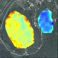
In this study defoliation damage in Taurus cedar (Cedrus libani A. Rich) stands in Turkey (Isparta region) caused by cedar shoot moth (Dichelia cedricola Diakonoff - Lep.: Tortricidae) was examined using multi-temporal Landsat data. Undamaged, low-damaged and heavily-damaged areas were located by assessing the variation of the Normalized Difference Vegetation Index derived from satellite imagery. Threshold boundaries for different damage levels were defined using mean NDVI values obtained from sub-areas spanning over the whole range of NDVI values. The reliability of the classification based on damages was statistically tested by comparing mean annual ring widths measured on increment cores extracted from sample trees exposed to different damage levels. Significant differences were found in mean annual ring widths among different areas previously classified based on NDVI data. Mean annual ring width in 2001 (an outbreak year) was 1.64 mm for undamaged area, 1.04 mm for low-damaged area, and 0.54 mm for heavily-damaged area. These findings indicate that damage mapping and monitoring mass damage caused by insect defoliation in Taurus cedar stands can be performed remotely by using NDVI values and Landsat TM data.
Keywords
Insect Defoliation, Remote Sensing, Dichelia cedricola, Landsat
Authors’ Info
Authors’ address
Ramazan Özçelik
Mustafa Avci
Faculty of Forestry, Süleyman Demirel University, East Campus, 32260, Isparta (Turkey)
Corresponding author
Paper Info
Citation
Çoban HO, Özçelik R, Avci M (2014). Monitoring of damage from cedar shoot moth Dichelia cedricola Diakonoff (Lep.: Tortricidae) by multi-temporal Landsat imagery. iForest 7: 126-131. - doi: 10.3832/ifor1014-007
Academic Editor
Massimo Faccoli
Paper history
Received: Apr 22, 2013
Accepted: Oct 13, 2013
First online: Jan 13, 2014
Publication Date: Apr 02, 2014
Publication Time: 3.07 months
Copyright Information
© SISEF - The Italian Society of Silviculture and Forest Ecology 2014
Open Access
This article is distributed under the terms of the Creative Commons Attribution-Non Commercial 4.0 International (https://creativecommons.org/licenses/by-nc/4.0/), which permits unrestricted use, distribution, and reproduction in any medium, provided you give appropriate credit to the original author(s) and the source, provide a link to the Creative Commons license, and indicate if changes were made.
Web Metrics
Breakdown by View Type
Article Usage
Total Article Views: 54099
(from publication date up to now)
Breakdown by View Type
HTML Page Views: 45710
Abstract Page Views: 2651
PDF Downloads: 4056
Citation/Reference Downloads: 70
XML Downloads: 1612
Web Metrics
Days since publication: 4399
Overall contacts: 54099
Avg. contacts per week: 86.09
Citation Metrics
Article Citations
Article citations are based on data periodically collected from the Clarivate Web of Science web site
(last update: Mar 2025)
Total number of cites (since 2014): 4
Average cites per year: 0.33
Publication Metrics
by Dimensions ©
Articles citing this article
List of the papers citing this article based on CrossRef Cited-by.
References
Biology, damage and natural enemies of a new Cedar pest in Turkey Dichelia cedricola (Diakonoff) 1974 (Lep.: Tortricidae). In: Proceedings of the “4th Turkish National Congress of Entomology”. Aydin (Turkey), 12-15 September 2000, pp. 447-454.
Gscholar
Two important harmful insect species for Turkish cedar forests. Forest Engineering Periodical, Chamber of Forest Engineers publishing, Ankara, Turkey, vol. 41, pp. 7-9.
Gscholar
Identification and monitoring the damage of Dichelia cedricola (Diakonoff) by using multi-temporal Landsat imagery. In: Proceedings of the “1st Forest Entomology and Pathology Symposium”. Antalya (Turkey), 23-25 October 2011, pp. 178.
Gscholar
Remotely sensed data in the mapping of insect defoliation. In: “Understanding Forest Disturbance and Spatial Pattern: Remote Sensing and GIS Approaches” (Wulder MA, Franklin SE eds). Taylor & Francis, CRC Press, Boca Raton, FL, USA.
Gscholar
Introductory digital image processing (2nd edition). Prentice-Hall Publisher, Series in Geographic Information Science, USA.
Gscholar
Remote sensing and image interpretation (4th edn). John Wiley & Sons Inc., Hoboken, NJ, USA, pp. 804.
Gscholar
Monitoring vegetation systems in the great plains with ERTS. In: Proceedings of the “Third Earth Resources Technology Satellite-1 Symposium” (Freden SC, Mercanti EP, Becker MA eds). Washington (DC, USA) 10-14 December 1973. NASA, Goddard Space Flight Center, MD, USA, pp. 309-317.
Online | Gscholar
Spectral mixture analysis to monitor defoliation in mixed-aged Eucalyptus globulus Labill plantations in southern Australia using Landsat 5-TM and EO-1 Hyperion data. International Journal of Applied Earth Observation and Geoinformation 12: 270-277.
CrossRef | Gscholar

