Spatial and temporal changes of Hyrcanian forest in Iran
M Poorzady (1) , F Bakhtiari (2)
iForest - Biogeosciences and Forestry, Volume 2, Issue 5, Pages 198-206 (2009)
doi: https://doi.org/10.3832/ifor0515-002
Published: Oct 15, 2009 - Copyright © 2009 SISEF
Research Articles
Abstract
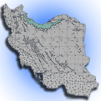
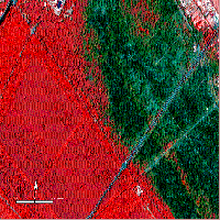
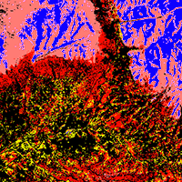
Original old-growth northern forests of Iran are essential sources of genetic variation, biodiversity, commercial woody products, and various environmental services (e.g., ground water reservation, auxiliary forest products provision, wildlife habitation, and erosion control). Today, the forests are depleting rapidly due to population growth, and associated socio-economic problems, industrial development, urbanism, and more recently intensive/irregular tourism. Satellite image processing and other geo-spatial tools have been used in Iran from the early 80’s to map the vegetative attributes of forests for environmental resource monitoring. This paper aims to build up a basic assumption of when and how the spectral, spatial and temporal features of satellite-borne remote sensing have been applied for the sustainable resource monitoring of the Caspian forests of Iran. To this end, available literature will be reviewed, specific features of the studies discussed in brief, and the future prospects for remote sensing-aided delineation of structural and functional characteristics of the forests will be outlined.
Keywords
Iranian Caspian forests, Natural resource monitoring and management, Remote Sensing, Satellite-borne image analysis
Authors’ Info
Authors’ address
Department of Forestry and Forest Economy, University of Tehran, Karaj, Iran
Department of Environmental Science, University of Tehran, Karaj, Iran
Corresponding author
Paper Info
Citation
Poorzady M, Bakhtiari F (2009). Spatial and temporal changes of Hyrcanian forest in Iran. iForest 2: 198-206. - doi: 10.3832/ifor0515-002
Academic Editor
Agostino Ferrara
Paper history
Received: Apr 19, 2009
Accepted: Aug 24, 2009
First online: Oct 15, 2009
Publication Date: Oct 15, 2009
Publication Time: 1.73 months
Copyright Information
© SISEF - The Italian Society of Silviculture and Forest Ecology 2009
Open Access
This article is distributed under the terms of the Creative Commons Attribution-Non Commercial 4.0 International (https://creativecommons.org/licenses/by-nc/4.0/), which permits unrestricted use, distribution, and reproduction in any medium, provided you give appropriate credit to the original author(s) and the source, provide a link to the Creative Commons license, and indicate if changes were made.

Web Metrics
Breakdown by View Type
Article Usage
Total Article Views: 64268
(from publication date up to now)
Breakdown by View Type
HTML Page Views: 51791
Abstract Page Views: 4651
PDF Downloads: 6586
Citation/Reference Downloads: 29
XML Downloads: 1211
Web Metrics
Days since publication: 6106
Overall contacts: 64268
Avg. contacts per week: 73.68
Citation Metrics
Article Citations
Article citations are based on data periodically collected from the Clarivate Web of Science web site
(last update: Mar 2025)
Total number of cites (since 2009): 24
Average cites per year: 1.41
Publication Metrics
by Dimensions ©
Articles citing this article
List of the papers citing this article based on CrossRef Cited-by.
References
Investigating the possibility of Fagus orientalis stand type mapping using ETM+ data in Chalir district-Nowshahr. M.Sc dissertation, Faculty of Natural Resources, University of Tehran-Iran, pp. 114. [In Persian]
Gscholar
Climatic partitioning of Iran. University of Tehran press, Tehran, Iran. [in Persian].
Gscholar
Forest area assessment and change detection using satellite information and aerial photographs. Bulletin No.24, Statistics & Information Office of the Ministry of Agriculture and the Faculty of Natural Resources-University of Tehran-Iran. [In Persian]
Gscholar
Landuse mapping of Guilan/Mazandaran provinces. Bulletin No. 23, Statistics & Information Office of the Ministry of Agriculture, Tehran-Iran. [in Persian]
Gscholar
Investigating the application of RS/GIS to detect and manage natural resources in Shahroud-Semnan province. Remote sensing and GIS group, Forest, Rangelands and Watershed Organization of Iran. [in Persian]
Gscholar
Investigating the application of remotely sensed data to quantitative/qualitative evaluation of coastal areas in Chalus-Mazandaran. Remote sensing and GIS group, Forest, Rangelands and Watershed Organization of Iran. [in Persian]
Gscholar
Investigation and application of RS/GIS to natural resource management, map generation and change detection in Golestan province. Remote sensing and GIS group, Forest, Rangelands and Watershed Organization of Iran. [in Persian]
Gscholar
land use mapping and change detection of coastal areas in Northern Iran using aerial orthophotographs. Remote sensing and GIS group, Forest, Rangelands and Watershed Organization of Iran. [in Persian]
Gscholar
Providing the 1:250 000 vegetation map of the entire country using Landsat5-TM data acquired on 1998. Remote sensing and GIS group, Forest, Rangelands and Watershed Organization of Iran. [in Persian]
Gscholar
Quantitative and qualitative assessment of Northern forests of Iran using ETM+, SPOT5, IRS, and determining their capability. Remote sensing and GIS group, Forest, Rangelands and Watershed Organization of Iran. [in Persian]
Gscholar
Forest canopy density estimating, using satellite images. Commission VIII, WG VIII/11, Proceedings of ISPRS, Beijing (China) 2008. pp. 4.
Gscholar
Studying the possibility of the use of Landsat satellite imagery in separating Fagus orientalis and Carpinus betulus mixture in the northern forests of Iran (Case study of Choa Jie forest). Commission PS, WG VII/3, Proceedings of ISPRS2004, Istanbul-Turkey, pp. 4.
Gscholar
Remote sensing. M.Sc booklet, Dept. of Forestry, Faculty of Natural Resources, University of Tehran, Iran, pp. 164. [in Persian]
Gscholar
Accuracy assessment of satellite based maps using sampling. M.Sc Dissertation, Faculty of Natural Resources, University of Tehran, Iran, pp. 86. [in Persian]
Gscholar
Investigation of the application of satellite data for classifying forest types in the forests managed by mazandaran wood and paper company. M.Sc. dissertation, Faculty of Forestry, University of Gorgan, Iran, pp. 124. [in Persian]
Gscholar
Investigating the forest stand changes in western Guilan using satellite data. M.Sc. thesis, Faculty of Natural Resources, University of Guilan, pp. 120. [in Persian]
Gscholar
Interpretation of forest changes from satellite scanner imagery. In: “Satellite imageries for forest inventory and monitoring; experiences, methods, perspectives”, Research Notes No. 21. Department of forest mensuration and management, University of Helsinki, Helsinki, Finland, pp. 31- 42.
Gscholar
Investigation and determination of harvested forest areas using satellite images and aerial photography. M.Sc. dissertation, Faculty of Natural Resources, University of Guilan, Iran, pp. 130. [in Persian]
Gscholar
Change detection of vegetation cover over Sari-Ghaemshahr region (1955-1990) using 1:55 000 aerial and 1:50 000 Cosmus space photographs. M.Sc. dissertation, Faculty of natural resources, University of Tehran, Iran, pp. 71. [in Persian]
Gscholar
Landuse mapping using ETM+ data (case study of Chamestan area,Iran). Proceedings of ISPRS2004, Istanbul-Turkey, pp. 3.
Gscholar
Evaluation modeling of periodic forest degradation using GIS techniques and its application in forest conservation. Proceedings of the conference on forest conservation in sustainable management. Faculty of natural resources, University of Tehran, Iran, pp. 208-219. [in Persian]
Gscholar
Evaluating ETM+ data to assess the standing tree volume on Fagus orientalis stands (a case study of Sangdeh forests). M.Sc. dissertation, Faculty of Natural Resources, University of Tehran, Iran, pp. 80. [in Persian]
Gscholar
Remote sensing and image interpretation. John Wiley & Sons, New York, USA, pp. 735.
Gscholar
Investigating IRS-1C-PAN data potential to produce forest maps in Northwestern Guilan. M.Sc. dissertation, Faculty of Natural Resources, University of Tehran, Iran, pp. 98. [in Persian]
Gscholar
Environmental evaluation and planning by Geographic Information System. University of Tehran Press, Tehran, Iran, pp. 304. [in Persian]
Gscholar
Silviculture.University of Tehran Press, Tehran, Iran, pp. 387. [in Persian]
Gscholar
Land cover/land use mapping of the Northern forests of Iran using Landsat ETM+ data. Iranian Journal of Forest and Poplar Research 11. [in Persian]
Gscholar
Forest canopy density estimation using remote sensing data. Iranian Journal of Forest and Poplar Research 13. [in Persian]
Gscholar
Investigation on boundary changes of northern forests of Iran using remotely sensed data. Final report, Iranian Research Institute of Forest and Rangelands, Tehran, Iran. [in Persian]
Gscholar
The assessment of biophysical FCD model to evaluate forest density using Landsat 7 data. M.Sc. dissertation, Faculty of natural resources, University of Tehran, Iran, pp. 95. [in Persian]
Gscholar
The Preliminary comprehensive plan of Caspian forests (Vol. 1: Summary). Technical forestry office, The ministry of Jahad-e-Sazandegi, Tehran, Iran. [in Persian]
Gscholar
Stydying the capability of forest area mapping using satellite images featuring appropriate spectral/spatial resolution (a case study of Kodkuy, Golestan). Proceedings of the Conference of Iran Forests Future, Faculty of natural resources, University of Tehran, Iran. [in Persian]
Gscholar
Studying the spectral reflection of tress (beech and oak species) with use of satellite data. M.Sc. dissertation, Faculty of Natural Resources, University of Tarbiat Modarres, Iran, pp. 120. [in Persian]
Gscholar
The application of satellite image processing methods in vegetation studies of Guilan province. Proceedings of national conference on the management of northern forests of Iran and sustainable development. Faculty of natural resources, University of Tehran, Iran, pp. 501-525. [in Persian]
Gscholar
Change detection of forest area related to topographic and human- induced factors (a case study of eastern Guilan). M.Sc dissertation, Faculty of natural resources, University of Tehran-Iran. pp. 136. [in Persian]
Gscholar
Separating the northern border of Caspian forests using multitemporal satellite images (a case study of Chaboksar-Mazandaran). M.Sc. dissertation, Faculty of Natural Resources, University of Tehran, Iran, pp. 93. [in Persian]
Gscholar
Preparing forest covetype map using digital satellite information in Kheiroudkenar Forest- Nowshahr. MS.c. Dissertation, Faculty of Natural Resources, University of Tehran, Iran, pp. 96. [in Persian]
Gscholar
Vegetative societies of northern forests of Iran. Forestry Institution Bulletin, Tehran, Iran. [in Persian]
Gscholar
Slight notion about forests of Iran. Tehran Forestry Office Press. Tehran, Iran. [in Persian]
Gscholar
A look to the forests of Iran. Iranian Research Institute of Forest and Rangelands, Tehran, Iran. [in Persian]
Gscholar
Forest Type and Density Mapping Using ETM+ Imagery. MS.c. Thesis, Faculty of Forestry, University of Gorgan, Iran, pp. 124. [in Persian]
Gscholar
Forest types classification using ETM+ data in the north of Iran/comparison of object-oriented with pixel-based classification techniques. C- Commission PS, Working Group VII/1, Proceedings of ISPRS2004, Istanbul-Turkey. pp. 6.
Gscholar
Forest mapping aided by digital satellite data. M.Sc. dissertation, Faculty of natural resources, University of Tehran, Iran, pp. 120. [in Persian]
Gscholar
Investigation of the possibility of forest type mapping using satellite information (a case study of Kheiroudkenar forest - Nowshahr). PhD thesis, Faculty of Natural Resources, University of Tehran, Iran, pp. 155. [in Persian]
Gscholar
Vegetation mapping of Golestan national park using GIS and Landsat TM data. M.Sc. dissertation, Faculty of Range and Watershed Management, University of Gorgan, Iran, pp. 99. [in Persian]
Gscholar
Monitoring of forest felling through analysis of artificial satellite’s information. Proc. 17<sup>th</sup> IUFRO Congr. Div. 6, Ibaraki, Japan, pp. 496.
Gscholar
Related Content
Corona P, Lamonaca A, Chirici G
Vol. 1, pp. 6-12 (online: Feb 2008)

Jackson CM, Adam E
Vol. 13, pp. 286-300 (online: Aug 2020)

Ciesielski M, Sterenczak K
Vol. 12, pp. 498-510 (online: Dec 2019)
Cavalli A, Francini S, Cecili G, Cocozza C, Congedo L, Falanga V, Spadoni GL, Maesano M, Munafò M, Chirici G, Scarascia Mugnozza G
Vol. 15, pp. 220-228 (online: Aug 2022)

Latifi H, Galos B
Vol. 3, pp. 98-101 (online: Jul 2010)
El Moussaoui EH, Moumni A, Lahrouni A
Vol. 17, pp. 100-108 (online: Apr 2024)
Tavankar F, Nikooy M, Picchio R, Venanzi R, Lo Monaco A
Vol. 10, pp. 652-658 (online: Jun 2017)
Jayasekara D, Dhananjani T, Mendis V, Jayawickrama H, Prasad T, Gunarathna MM, Gunarathna P, Mahaulpatha D
Vol. 18, pp. 45-53 (online: Apr 2025)
Granke O, Kenter B, Kriebitzsch WU, Köhl M, Köhler R, Olschofsky K
Vol. 2, pp. 1-3 (online: Jan 2009)
Martin H, Labbé S, Baldet P, Archaux F, Philippe G
Vol. 10, pp. 215-219 (online: Feb 2017)


