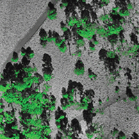
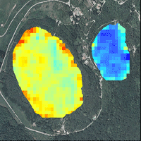
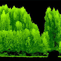
Forest degradation has increased in recent years due to biotic, abiotic, and anthropogenic factors. Parasitic plants are some of the main disturbance agents affecting forest resources. In temperate forests, the most frequent pest such as parasitic plants are from the genus Loranthaceae spp. Monitoring parasitic plants through traditional methods requires a large amount of time and human resources. Unmanned aerial vehicles (UAV) as a remote sensing tool have increased in popularity in different regions. UAV were used to assess the degree of infestation of Yellow Dwarf Mistletoe (YDM). In the present study, the presence of Yellow Dwarf Mistletoe (Arceuthobium globosum Hawksw. & Wiens) was identified using two information collection methods to estimate the level of infestation in a Pinus hartwegii Lindl. forest. First, the traditional method (Hawksworth) was used to estimate the degree of infestation per individual tree. Second, a remote sensing method using UAV was used to capture information at the crown level. Then, the Colorimetric Ranges at the Pixel Level (CRPL) method was used in conjunction with the decomposition of pixels with the RGB (Red-Green-Blue) model to define areas with the presence of infestation. The result of the methods was compared by calculating the pixels equivalence percentages identified as infested per level of infestation. The Hawksworth’s method was used by determining three levels: level 0 (healthy) = 0-2% pixels; Level 1 (medium) = 3-5% pixels; and Level 2 (high) ≥ 5% pixels. The methods coincided in detecting a high level of infestation while were biased in detecting healthy trees and low levels of infestation. Nonetheless, the remote sensing method using UAV remains a viable alternative in the monitoring of mistletoe for its capacity to present an overall diagnosis of the level of infestation.
Keywords
, , ,
Citation
León-Bañuelos LA, Endara-Agramont AR, Nava-Bernal EG, Gómez-Demetrio W (2023). Use of unmanned aerial vehicles for the diagnosis of parasitic plant infestation at the crown level in Pinus hartwegii. iForest 16: 282-289. - doi: 10.3832/ifor4002-016
Academic Editor
Davide Travaglini
Paper history
Received: Oct 21, 2021
Accepted: Aug 16, 2023
First online: Oct 28, 2023
Publication Date: Oct 31, 2023
Publication Time: 2.43 months
© SISEF - The Italian Society of Silviculture and Forest Ecology 2023
Open Access
This article is distributed under the terms of the Creative Commons Attribution-Non Commercial 4.0 International (https://creativecommons.org/licenses/by-nc/4.0/), which permits unrestricted use, distribution, and reproduction in any medium, provided you give appropriate credit to the original author(s) and the source, provide a link to the Creative Commons license, and indicate if changes were made.

Breakdown by View Type
(Waiting for server response...)
Article Usage
Total Article Views: 16620
(from publication date up to now)
Breakdown by View Type
HTML Page Views: 12887
Abstract Page Views: 2034
PDF Downloads: 1371
Citation/Reference Downloads: 0
XML Downloads: 328
Web Metrics
Days since publication: 840
Overall contacts: 16620
Avg. contacts per week: 138.50
Article Citations
Article citations are based on data periodically collected from the Clarivate Web of Science web site
(last update: Mar 2025)
(No citations were found up to date. Please come back later)
Publication Metrics
by Dimensions ©
Articles citing this article
List of the papers citing this article based on CrossRef Cited-by.
(1)
Adao T, Hruska J, Padua L, Bessa J, Peres E, Morais R, Sousa JJ (2017)Hyperspectral Imaging: a review on UAV-based sensors, data processing and applications for agriculture and forestry. Remote Sensing 9 (11): 1110.
CrossRef |
Gscholar
(2)
Aicardi I, Dabove P, Lingua AM, Piras M (2017)Integration between TLS and UAV photogrammetry techniques for forestry applications. iForest 10 (1): 41-47.
CrossRef |
Gscholar
(3)
Allen CD, Macalady AK, Chenchouni H, Bachelet D, Mcdowell N, Vennetier M, Kitzberger T, Rigling A, Breshears Dd Hogg Eh Gonzalez P, Fensham R, Zhang Z, Castro J, Demidova N, Lim Jh Allard G, Running Sw Semerci A, Cobb N (2010)A global overview of drought and heat-induced tree mortality reveals emerging climate change risks for forests. Forest Ecology and Management 259 (4): 660-684.
CrossRef |
Gscholar
(4)
Barnoaiea I, Iacobescu O (2008)Using pixel and object based IKONOS image analysis for studying decay in silver fir stands. Annals of Forest Research 52 (1): 151-162.
Gscholar
(5)
Bastin JF, Berrahmouni N, Grainger A, Maniatis D, Mollicone D, Moore R, Patriarca C, Picard N, Sparrow B, Abraham EM, Aloui K, Atesoglu A, Attore F, Bassüllü Ç, Bey A, Garzuglia M, García-Montero LG, Groot N, Guerin G, Laestadius L, Lowe AJ, Mamane B, Marchi G, Patterson P, Rezende M, Ricci S, Salcedo I, Diaz AS, Stolle F, Surappaeva V, Castro R (2017)The extent of forest in dryland biomes. Science 356 (6338): 635-638.
CrossRef |
Gscholar
(6)
Cedillo AM (2017)Análisis espacial del nivel de infestación por muérdago enano en el bosque de pino del área de protección de flora y fauna nevado de Toluca [Spatial analysis of the level of infestation by dwarf mistletoe in the pine forest of the Nevado de Toluca flora and fauna protection area]. Master’s thesis, Universidad Autónoma del Estado de México, México, pp. 40-74.
Online |
Gscholar
(7)
Christie KS, Gilbert SL, Brown CL, Hatfield M, Hanson L (2016)Unmanned aircraft systems in wildlife research: current and future applications of a transformative technology. Frontiers in Ecology and the Environment 14 (15): 241-251.
CrossRef |
Gscholar
(8)
Dainelli R, Toscano P, Di Gennaro SF, Matese A (2021)Recent advances in unmanned aerial vehicle forest remote sensing - A systematic review. Part I: a general framework. Forest 12 (3): 327.
CrossRef |
Gscholar
(9)
Dandois JP, Olano M, Ellis EC (2015)Optimal altitude, overlap, and weather conditions for computer vision UAV estimates of forest structure. Remote Sensing 7 (10): 13895-13920.
CrossRef |
Gscholar
(10)
Dash JP, Watt MS, Pearse GD, Heaphy M, Dungey HS (2017)Assessing very high-resolution UAV imagery for monitoring forest health during a simulated disease outbreak. ISPRS Journal of Photogrammetry and Remote Sensing 131: 1-14.
CrossRef |
Gscholar
(11)
Dobbertin M, Rigling A (2006)Pine mistletoe (
Viscum album ssp.
austriacum) contributes to Scots pine (
Pinus sylvestris) mortality in the Rhone valley of Switzerland. Forest Pathology 36 (5): 309-322.
CrossRef |
Gscholar
(12)
DOF (2016)Acuerdo por el que se da a conocer el Resumen del Programa de Manejo del Área Natural Protegida con categoría de Área de Protección de Flora y Fauna Nevado de Toluca [Agreement by which the Summary of the Management Program of the Protected Natural Area with the category of Nevado de Toluca Flora and Fauna Protection Area is disclosed]. SEGOB, Secretaria de Medio Ambiente y Recursos Naturales. México, pp. 1. [in Spanish]
Online |
Gscholar
(13)
Duarte A, Borralho N, Cabral P, Caetano M (2022)Recent advances in forest insect pests and diseases monitoring using UAV-based data: a systematic review. Forests 13: 911.
CrossRef |
Gscholar
(14)
Endara AAR, Calderón CR, Nava BG, Franco MS (2013)Analysis of fragmentation processes in high-mountain forests of the centre of Mexico. American Journal of Plant Sciences 4: 697-704.
CrossRef |
Gscholar
(15)
Ecke S, Dempewolf J, Frey J, Schwaller A, Endres E, Klemmt HJ, Tiede D, Seifert T (2022)UAV-based forest health monitoring: a systematic review. Remote Sensing 14 (13): 3205.
CrossRef |
Gscholar
(16)
Fan GF, Guo YH, Zheng JM, Hong WC (2019)Application of the weighted k-nearest neighbor algorithm for short-term load forecasting. Energies 12 (5): 916.
CrossRef |
Gscholar
(17)
FAO/PNUMA (2020)El estado de los bosques del mundo 2020: los bosques, la biodiversidad y las personas [The State of the World’s Forests 2020: Forests, Biodiversity and People]. Food and Agriculture Organization of the United Nations - FAO, Rome, Italy, pp. 16-24. [in Spanish]
CrossRef |
Gscholar
(18)
Fritz A, Kattenborn T, Koch B (2013)Uav-based photogrammetric point clouds tree STEM mapping in open stfritands in comparison to terrestrial laser scanner point clouds. ISPRS 41: 141-146.
CrossRef |
Gscholar
(19)
Geils BW, Cibrián JT, Moody B (2002)Mistletoes of North American conifers. Gen. Tech. Rep. RMRS-GTR-98, USDA Forest Service, Rocky Mountain Research Station, Ogden, UT, USA, pp. 123.
Online |
Gscholar
(20)
Guerra-Hernández J, González-Ferreiro E, Monleón VJ, Faias SP, Tomé M, Díaz-Varela RA (2017)Use of multi-temporal UAV-derived imagery for estimating individual tree growth in Pinus pinea stands. Forests 8: 300.
CrossRef |
Gscholar
(21)
Hall RJ, Castilla G, White JC, Cooke BJ, Skakun RS (2016)Remote sensing of forest pest damage: a review and lessons learned from a Canadian perspective. The Canadian Entomologist 148 (S1): S296-S356.
CrossRef |
Gscholar
(22)
Hawksworth FG (1977)The 6-class dwarf mistletoe rating system. USDA Forest Service, Rocky Mountain Forest and Range Experiment Station, Ogden, UT, USA, pp. 6.
Online |
Gscholar
(23)
Iglhaut J, Cabo C, Puliti S, Piermattei L, O’Connor J, Rosette J (2019)Structure from motion photogrammetry in forestry: a review. Current Forestry Reports 5 (3): 155-168.
CrossRef |
Gscholar
(24)
Korpela I, Heikkinen V, Honkavaara E, Rohrbach F, Tokola T (2011)Variation and directional anisotropy of reflectance at the crown scale Implications for tree species classification in digital aerial images. Remote Sensing of Environment 115 (8): 2062-2074.
CrossRef |
Gscholar
(25)
Krause S, Raffa K (1996)Differential growth and recovery rates following defoliation in related deciduous and evergreen trees. Trees - Structure and Function 10 (5): 308-316.
CrossRef |
Gscholar
(26)
Lehmann JRK, Nieberding F, Prinz T, Knoth C (2015)Analysis of unmanned aerial system-based CIR images in forestry - A new perspective to monitor pest infestation levels. Forests 6: 594-612.
CrossRef |
Gscholar
(27)
León-Bañuelos LA, Endara-Agramont AR, Gómez-Demetrio W, Martínez-García CG, Nava-Bernal EG (2020)Identification of
Arceuthobium globosum using unmanned aerial vehicle images in a high mountain forest of central Mexico. Journal of Forestry Research 31 (5): 1759-1771.
CrossRef |
Gscholar
(28)
Lim CL, Prescott GW, De Alban JDT, Ziegler AD, Webb EL (2017)Untangling the proximate causes and underlying drivers of deforestation and forest degradation in Myanmar. Conservation Biology 31 (6): 1362-1372.
CrossRef |
Gscholar
(29)
López-García J, Prado-Molina J, Manzo Delga- do L, Peralta-Higuera A (2016)Monitoring changes of forest canopy density in a temperature forest using high-resolution aerial digital photography. Investigaciones Geográficas 90: 59-74.
CrossRef |
Gscholar
(30)
López-de-Buen L, Ornelas JF, Franco JG (2002)Mistletoe infection of trees located at fragmented forest edges in the cloud forest of Central Veracruz, Mexico. Forest Ecology and Management 164 (1-3): 293-302.
CrossRef |
Gscholar
(31)
Maes WH, Huete AR, Avino M, Boer MM, Dehaan R, Pendall E, Steppe K (2018)Can UAV-based infrared thermography be used to study plant-parasite interactions between mistletoe and eucalypt trees? Remote Sensing 10 (12): 2062.
CrossRef |
Gscholar
(32)
McRoberts RE, Tomppo EO (2007)Remote sensing support for national forest inventories. Remote Sensing of Environment 110 (4): 412-419.
CrossRef |
Gscholar
(33)
Miraki M, Sohrabi H, Fatehi P (2021)Detection of mistletoe infected trees using UAV high spatial resolution images. Journal of Plant Diseases and Protection 128 (6): 1679-1689.
CrossRef |
Gscholar
(34)
Näsi R, Honkavaara E, Lyytikäinen-Saarenmaa P, Blomqvist M, Litkey P, Hakala T, Viljanen N, Kantola T, Tanhuanpää T, Holopainen M (2015)Using UAV-based photogrammetry and hyperspectral imaging for mapping bark beetle damage at tree-level. Remote Sensing 7 (11): 15467-15493.
CrossRef |
Gscholar
(35)
Nevalainen O, Honkavaara E, Tuominen S, Viljanen N, Hakala T, Yu X, Tommaselli AM (2017)Individual tree detection and classification with UAV-based photogrammetric point clouds and hyperspectral imaging. Remote Sensing 9 (3): 185.
CrossRef |
Gscholar
(36)
Otsu K, Pla M, Vayreda J, Brotons L (2018)Calibrating the severity of forest defoliation by Pine Processionary Moth with Landsat and UAV imagery. Sensors 18 (10): 3278.
CrossRef |
Gscholar
(37)
Poblete-Echeverría C, Olmedo GF, Ingram B, Bardeen M (2017)Detection and segmentation of vine canopy in ultra-high spatial resolution RGB imagery obtained from Unmanned Aerial Vehicle (UAV): a case study in a commercial vineyard. Remote Sensing 9 (3): 268.
CrossRef |
Gscholar
(38)
Puliti S, Saarela S, Gobakken T, Ståhl G (2017)Combining UAV and Sentinel-2 auxiliary data for forest growing stock volume estimation through hierarchical model-based inference. Remote Sensing of Environment 204: 1-13.
CrossRef |
Gscholar
(39)
Puttonen E, Litkey P, Hyyppä J (2010)Individual tree species classification by illuminated-shaded area separation. Remote Sensing 2: 19-35.
CrossRef |
Gscholar
(40)
Ramírez-Dávila JF, Porcayo-Camargo E (2009)Estudio de la distribución espacial del muérdago enano (
Arceuthobium sp.) en el Nevado de Toluca México, utilizando el Método del SADIE [Spatial distribution study of the mistletoe (
Arceuthobium sp.) in the El Nevado de Toluca, Mexico, using the SADIE method]. Madera y Bosques 15 (2): 93-112. [in Spanish]
CrossRef |
Gscholar
(41)
Richardson L, Loomis J (2009)The total economic value of threatened, endangered and rare species: an updated meta-analysis. Ecological Economics 68 (5): 1535-1548.
CrossRef |
Gscholar
(42)
Robinson D, Geils B (2006)Modelling dwarf mistletoe at three scales: life history, ballistics and contagion. Ecological Modelling 199 (1): 23-38.
CrossRef |
Gscholar
(43)
Rojas-García F, Fredericksen TS, Vazquez Lozada S, Endara Agramont AR (2019)Impact of timber harvesting on carbon storage in montane forests of central Mexico. New Forests 50 (6): 1043-1061.
CrossRef |
Gscholar
(44)
Saarinen N, Vastaranta M, Näsi R, Rosnell T, Hakala T, Honkavaara E, Hyyppä J (2018)Assessing biodiversity in boreal forests with UAV-based photogrammetric point clouds and hyperspectral imaging. Remote Sensing 10 (2): 338.
CrossRef |
Gscholar
(45)
Seifert E, Seifert S, Vogt H, Drew D, Van Aardt J, Kunneke A, Seifert T (2019)Influence of drone altitude, image overlap, and optical sensor resolution on multi-view reconstruction of forest images. Remote Sensing 11 (10): 1252.
CrossRef |
Gscholar
(46)
Singh KK, Frazier AE (2018)A meta-analysis and review of unmanned aircraft system (UAS) imagery for terrestrial applications. International Journal of Remote Sensing 39 (15-16): 5078-5098.
CrossRef |
Gscholar
(47)
Thamizhmathi M, Usharani S (2014)A survey of forest fire detection techniques. International Journal of Advanced Research in Computer Science and Applications 2 (12): 31-37.
Online |
Gscholar
(48)
Tuominen J, Lipping T, Kuosmanen V, Haapane R (2009)Remote sensing of forest health. In: “Geoscience and Remote Sensing” (Pei-Gee PH ed). InTechOpen Ltd., London, UK, pp. 29-52.
CrossRef |
Gscholar
(49)
Wingfield MJ, Garnas JR, Hajek A, Hurley BP, De Beer ZW, Taerum SJ (2016)Novel and co-evolved associations between insects and microorganisms as drivers of forest pestilence. Biological Invasions 18 (4): 1045-1056.
CrossRef |
Gscholar
(50)
Yuan Y, Hu X (2016)Random forest and objected-based classification for forest pest extraction from UAV aerial imagery. International Archives of the Photogrammetry, Remote Sensing and Spatial Information Sciences - ISPRS Archives 41: 1093-1098.
CrossRef |
Gscholar
