Determining Pleiades satellite data capability for tree diversity modeling
iForest - Biogeosciences and Forestry, Volume 10, Issue 1, Pages 348-352 (2016)
doi: https://doi.org/10.3832/ifor1884-009
Published: Nov 19, 2016 - Copyright © 2016 SISEF
Short Communications
Abstract
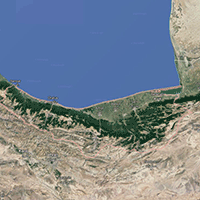
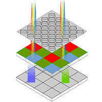
Modeling of the spatial distribution of tree species based on survey data has recently been applied to conservation planning. Numerous methods have been developed for building species habitat suitability models. The aim of this study was to investigate the suitability of Pleiades satellite data for modeling tree species diversity of Hyrcanian forests in northern Iran (Mazandaran Province). One-hundred sample plots were established over an area of 2.600 ha and surveyed for tree diversity, and the Simpson’s index (D), Shannon’s index (H’) and the reciprocal of Simpson’s index (1/D) were calculated for each plot. Spectral variables and several parameters derived by texture analysis were obtained from multispectral images of the study area and used as predictors of tree diversity of sample plots. Two different methods, including generalized additive models (GAMs) and multivariate adaptive regression splines (MARS), were used for modeling. The results revealed a fairly good prediction of plot tree diversity obtained using the developed models (adj-R2 = 0.542-0.731). Shannon’s H’ and Simpson’s 1/D indices were more accurately predicted using GAM-based methods, while MARS models were more suitable for predicting Simpson’s D. We concluded that Pleiades satellite data can be conveniently used for estimating, assessing and monitoring tree species diversity in the mixed hardwood Hyrcanian forest of northern Iran.
Keywords
Pleiades, Tree Species Diversity, Modeling, Darabkola Forest
Authors’ Info
Authors’ address
Siavash Kalbi
Sari Agriculture and Natural Resource University, Forestry Department, Sari 578 (Iran)
Corresponding author
Paper Info
Citation
Akbari H, Kalbi S (2016). Determining Pleiades satellite data capability for tree diversity modeling. iForest 10: 348-352. - doi: 10.3832/ifor1884-009
Academic Editor
Alessandro Montaghi
Paper history
Received: Sep 27, 2015
Accepted: Jul 18, 2016
First online: Nov 19, 2016
Publication Date: Feb 28, 2017
Publication Time: 4.13 months
Copyright Information
© SISEF - The Italian Society of Silviculture and Forest Ecology 2016
Open Access
This article is distributed under the terms of the Creative Commons Attribution-Non Commercial 4.0 International (https://creativecommons.org/licenses/by-nc/4.0/), which permits unrestricted use, distribution, and reproduction in any medium, provided you give appropriate credit to the original author(s) and the source, provide a link to the Creative Commons license, and indicate if changes were made.

Web Metrics
Breakdown by View Type
Article Usage
Total Article Views: 49914
(from publication date up to now)
Breakdown by View Type
HTML Page Views: 41273
Abstract Page Views: 3218
PDF Downloads: 4056
Citation/Reference Downloads: 50
XML Downloads: 1317
Web Metrics
Days since publication: 3541
Overall contacts: 49914
Avg. contacts per week: 98.67
Citation Metrics
Article Citations
Article citations are based on data periodically collected from the Clarivate Web of Science web site
(last update: Jul 2026)
Total number of cites (since 2017): 3
Average cites per year: 0.30
Publication Metrics
by Dimensions ©
Articles citing this article
List of the papers citing this article based on CrossRef Cited-by.
References
Comparison and ranking of different modelling techniques for prediction of site index in Mediterranean mountain forests. Ecological Modelling 221: 1119-1130.
Gscholar
Using and comparing two nonparametric (CART and RF) and SPOT-HRG satellite data to predictive tree diversity distribution methods. Nusantara Bioscience 6 (1): 57-62.
Gscholar
Generalized linear models (2nd edn). Chapman and Hall, London, UK, pp. 194.
Gscholar
Ecology workbook. Oxford and IBH Publishing Co., New Delhi, India, pp. 244-245.
Gscholar
Related Content

Latifi H, Galos B
Vol. 3, pp. 98-101 (online: Jul 2010)

Ciesielski M, Sterenczak K
Vol. 12, pp. 498-510 (online: Dec 2019)
Martin H, Labbé S, Baldet P, Archaux F, Philippe G
Vol. 10, pp. 215-219 (online: Feb 2017)

Jackson CM, Adam E
Vol. 13, pp. 286-300 (online: Aug 2020)
Mancino G, Nolè A, Urbano V, Amato M, Ferrara A
Vol. 2, pp. 154-161 (online: Jul 2009)
Cavalli A, Francini S, Cecili G, Cocozza C, Congedo L, Falanga V, Spadoni GL, Maesano M, Munafò M, Chirici G, Scarascia Mugnozza G
Vol. 15, pp. 220-228 (online: Aug 2022)
Martin H, Monnet JM, De Boisvilliers M, Chevalier R, Villar M
Vol. 13, pp. 409-416 (online: Oct 2020)
Corona P, Lamonaca A, Chirici G
Vol. 1, pp. 6-12 (online: Feb 2008)
Kantola T, Lyytikäinen-Saarenmaa P, Coulson RN, Holopainen M, Tchakerian MD, Streett DA
Vol. 9, pp. 178-186 (online: Apr 2016)
Hernández-Ramos A, Valdez-Lazalde JR, De Los Santos-Posadas HM, Reyes-Hernández VJ, López-Serrano PM, Cano-Pineda A, Flores-Magdaleno H
Vol. 18, pp. 357-365 (online: Dec 2025)


