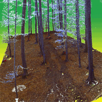
Use of terrestrial laser scanning to evaluate the spatial distribution of soil disturbance by skidding operations
Milan Koren (1) , Martin Slančík (2), Jozef Suchomel (2), Juraj Dubina (3)
iForest - Biogeosciences and Forestry, Volume 8, Issue 3, Pages 386-393 (2015)
doi: https://doi.org/10.3832/ifor1165-007
Published: Oct 08, 2014 - Copyright © 2015 SISEF
Research Articles
Abstract
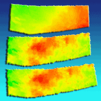
We investigated the disturbance to the surface of a skid trail caused by removing cut timber from inside the forest to the roadside by dragging using terrestrial laser scanning technology. We scanned the study site prior to taking any action, after skidding and after implementing post-harvesting reinstatement to the surface of the skid trail. From the point cloud obtained, we derived an irregular point field. We generated a triangulated irregular network which we then interpolated into a raster digital terrain model with a resolution of 1cm. By comparing the digital terrain models, we analysed the influence of skidding the timber and the influence of post-harvesting reinstatement upon the surface of the skid trail. The surface of the skid trail was most significantly affected in the area where the harvested logs were extracted and stacked for hauling. In the centre section of the trail, where the logs were dragged by a tractor, quite deep tracks were created and the intensity of soil disturbance was comparable to the handling section. The lowest intensity of soil disturbance was found in the area where the skid trail met the roadside. The post-harvesting reinstatement of the working area resulted in levelling the surface of the skid trail and the deepest tracks were filled in. The post-harvesting reinstatement caused a 12% increase of the volume of ruts, a 49% decrease of the volume of mounds of soil and a 6% increase of total soil volume change.
Keywords
Terrestrial Laser Scanning, Skidding Operation, Soil Disturbance, Precision Forestry
Authors’ Info
Authors’ address
Department of Forest Management and Geodesy, Faculty of Forestry, Technical University in Zvolen, T. G. Masaryka 24, 960 53 Zvolen (Slovakia)
Jozef Suchomel
Department of Forest Harvesting, Logistics and Amelioration, Faculty of Forestry, Technical University in Zvolen, T. G. Masaryka 24, 960 53 Zvolen (Slovakia)
Forests of the Slovak Republic, Námestie SNP 8, 975 66 Banská Bystrica (Slovakia)
Corresponding author
Paper Info
Citation
Koren M, Slančík M, Suchomel J, Dubina J (2015). Use of terrestrial laser scanning to evaluate the spatial distribution of soil disturbance by skidding operations. iForest 8: 386-393. - doi: 10.3832/ifor1165-007
Academic Editor
Enrico Marchi
Paper history
Received: Oct 26, 2013
Accepted: Aug 15, 2014
First online: Oct 08, 2014
Publication Date: Jun 01, 2015
Publication Time: 1.80 months
Copyright Information
© SISEF - The Italian Society of Silviculture and Forest Ecology 2015
Open Access
This article is distributed under the terms of the Creative Commons Attribution-Non Commercial 4.0 International (https://creativecommons.org/licenses/by-nc/4.0/), which permits unrestricted use, distribution, and reproduction in any medium, provided you give appropriate credit to the original author(s) and the source, provide a link to the Creative Commons license, and indicate if changes were made.
Web Metrics
Breakdown by View Type
Article Usage
Total Article Views: 54253
(from publication date up to now)
Breakdown by View Type
HTML Page Views: 44646
Abstract Page Views: 3774
PDF Downloads: 4404
Citation/Reference Downloads: 29
XML Downloads: 1400
Web Metrics
Days since publication: 4118
Overall contacts: 54253
Avg. contacts per week: 92.22
Citation Metrics
Article Citations
Article citations are based on data periodically collected from the Clarivate Web of Science web site
(last update: Mar 2025)
Total number of cites (since 2015): 22
Average cites per year: 2.00
Publication Metrics
by Dimensions ©
Articles citing this article
List of the papers citing this article based on CrossRef Cited-by.
References
Analysis of the information content of terrestrial laserscanner point clouds for the automatic determination of forest inventory parameters. In: Proceedings of the “Workshop on 3D Remote Sensing in Forestry”. Vienna (Austria) 14-15 February 2006. University of Natural Resources and Applied Life Sciences (BOKU), Vienna, Austria, pp. 1-6.
Online | Gscholar
Different methodologies for calculating crown volumes of Platanus hispanica trees using terrestrial laser scanner and a comparison with classical dendrometric measurements. Computers and Electronics in Agriculture 90: 176-185.
CrossRef | Gscholar
Investigation of forest soil disturbance caused by rubber-tired skidder traffic. International Journal of Natural and Engineering Sciences 3 (1): 79-82.
Gscholar

