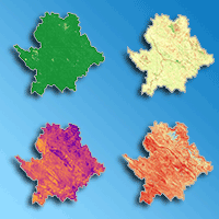
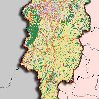
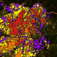
Over the past few decades, wildfire activity has increased globally. In the Central Zagros Mountains of Iran, widespread oak decline has significantly altered fuel structures and raised ecological concerns. However, the specific contribution of long-term vegetation degradation to wildfire burn severity remains under-quantified. This study addresses this gap by investigating whether decadal declines in the Normalized Difference Vegetation Index (NDVI) are associated with higher burn severity, while assessing their relative importance against short-term pre-fire environmental conditions, fuel types, topography, and human access gradients. Focusing on a major wildfire in June 2024 in the Kashkan Watershed, we mapped burn severity using the differenced Normalized Burn Ratio (dNBR) derived from Sentinel-2 imagery. A comprehensive suite of predictors was evaluated, including the long-term NDVI trend (May- September 2014-2023), pre-fire Normalized Difference Moisture Index (NDMI), Land Surface Temperature (LST), fuel categories based on ESA WorldCover, slope, aspect, spatial texture contrast, and distance to roads and settlements. A stratified sampling design supported statistical inference using ordinary least squares regression and predictive modeling via Random Forest and XGBoost algorithms with five-fold cross-validation. XGBoost demonstrated the highest predictive performance (cross-validated R2 = 0.70; RMSE = 0.11), outperforming Random Forest (R2 = 0.64) and linear regression (R2 = 0.34). Fuel moisture (NDMI) and thermal stress (LST) emerged as the primary drivers of severity, followed by land cover, topography, and spatial texture. While the long-term NDVI decline showed a small but consistent positive association with dNBR at the landscape scale, the results highlight a distinct multi-scale mechanism. In this dynamic, pre-fire moisture and temperature establish the broad watershed-scale environmental susceptibility, whereas specific fuel types and their spatial configurations drive the local-level amplification or damping of burn severity. These findings provide a framework for proactive vulnerability mapping in Zagros oak woodlands, suggesting that integrating dynamic fire-weather data and field-based fuel measurements could further refine future predictability.
Keywords
, , , , ,
Citation
Shahidinejad F, Jourgholami M, Pourhanifeh MM, Esfandyar A (2026). Multi-scale drivers of wildfire burn severity in Central Zagros: insights from remote sensing and machine learning. iForest 19: 359-368. - doi: 10.3832/ifor5027-019
Academic Editor
Davide Ascoli
Paper history
Received: Nov 02, 2025
Accepted: Jul 28, 2026
First online: Sep 08, 2026
Publication Date: Oct 31, 2026
Publication Time: 1.40 months
© SISEF - The Italian Society of Silviculture and Forest Ecology 2026
Open Access
This article is distributed under the terms of the Creative Commons Attribution-Non Commercial 4.0 International (https://creativecommons.org/licenses/by-nc/4.0/), which permits unrestricted use, distribution, and reproduction in any medium, provided you give appropriate credit to the original author(s) and the source, provide a link to the Creative Commons license, and indicate if changes were made.

Breakdown by View Type
(Waiting for server response...)
Article Usage
Total Article Views: 1451
(from publication date up to now)
Breakdown by View Type
HTML Page Views: 413
Abstract Page Views: 491
PDF Downloads: 488
Citation/Reference Downloads: 0
XML Downloads: 59
Web Metrics
Days since publication: 46
Overall contacts: 1451
Avg. contacts per week: 220.80
Article Citations
Article citations are based on data periodically collected from the Clarivate Web of Science web site
(last update: Jul 2026)
(No citations were found up to date. Please come back later)
Publication Metrics
by Dimensions ©
Articles citing this article
List of the papers citing this article based on CrossRef Cited-by.
(1)
Abatzoglou JT, Lasslop G, Bachelet D (2020)Climate, land use, and fire: can models inform management? Frontiers in Earth Science 8: 624171.
CrossRef |
Gscholar
(2)
Alegria C (2022)Vegetation monitoring and post-fire recovery: a case study in the centre inland of Portugal. Sustainability 14: 12698.
CrossRef |
Gscholar
(3)
Breiman L (2001)Random forests. Machine Learning 45: 5-32.
CrossRef |
Gscholar
(4)
Charles FE, Reside AE, Smith AL (2025)The influence of changing fire regimes on specialized plant-animal interactions. Philosophical Transactions of the Royal Society B: Biological Sciences 380: 20230448.
CrossRef |
Gscholar
(5)
Chen T, Guestrin C (2016)XGBoost: a scalable tree boosting system. In: Proceedings of the “22nd ACM SIGKDD International Conference on Knowledge Discovery and Data Mining”. ACM (San Francisco, CA, USA) 13-17 Aug 2016, pp. 785-794.
CrossRef |
Gscholar
(6)
Collins L, Griffioen P, Newell G, Mellor A (2018)The utility of random forests for wildfire severity mapping. Remote Sensing of Environment 216: 374-384.
CrossRef |
Gscholar
(7)
Collins L, McCarthy G, Mellor A, Newell G, Smith L (2020)Training data requirements for fire severity mapping using Landsat imagery and random forest. Remote Sensing of Environment 245: 111839.
CrossRef |
Gscholar
(8)
Costa-Saura JM, Bacciu V, Sirca C, Cappelluti O, Spano D, Elia M (2025)The growing link between heatwaves and megafires: evidence from southern Mediterranean countries of Europe. Natural Hazards 121: 17731-17742.
CrossRef |
Gscholar
(9)
Darvishi Boloorani A, Ranjbareslamloo S, Mirzaie S, Bahrami HA, Mirzapour F, Abbaszadeh Tehrani N (2020)Spectral behavior of Persian oak under compound stress of water deficit and dust storm. International Journal of Applied Earth Observation and Geoinformation 88: 102082.
CrossRef |
Gscholar
(10)
Escuin S, Navarro R, Fernández P (2008)Fire severity assessment by using NBR (Normalized Burn Ratio) and NDVI (Normalized Difference Vegetation Index) derived from LANDSAT TM/ETM images. International Journal of Remote Sensing 29: 1053-1073.
CrossRef |
Gscholar
(11)
Eskandari S, Jaafari MR, Oliva P, Ghorbanzadeh O, Blaschke T (2020)Mapping land cover and tree canopy cover in Zagros forests of Iran: application of Sentinel-2, Google Earth, and field data. Remote Sensing 12: 1912.
CrossRef |
Gscholar
(12)
Eskandari S, Pourghasemi HR, Tiefenbacher JP (2021)Fire-susceptibility mapping in the natural areas of Iran using new and ensemble data-mining models. Environmental Science and Pollution Research 28: 47395-47406.
CrossRef |
Gscholar
(13)
Giglio L, Schroeder W, Justice CO (2016)The collection 6 MODIS active fire detection algorithm and fire products. Remote Sensing of Environment 178: 31-41.
CrossRef |
Gscholar
(14)
Goss M, Swain DL, Abatzoglou JT, Sarhadi A, Kolden CA, Williams AP, Diffenbaugh NS (2020)Climate change is increasing the likelihood of extreme autumn wildfire conditions across California. Environmental Research Letters 15: 094016.
CrossRef |
Gscholar
(15)
He K, Shen X, Merow C, Nikolopoulos E, Gallagher RV, Yang F, Anagnostou EN (2024)Improving fire severity prediction in south-eastern Australia using vegetation-specific information. Natural Hazards and Earth System Sciences 24: 3337-3355.
CrossRef |
Gscholar
(16)
Huang Y, Jin Y, Schwartz MW, Thorne JH (2020)Intensified burn severity in California’s northern coastal mountains by drier climatic condition. Environmental Research Letters 15: 104033.
CrossRef |
Gscholar
(17)
Hultquist C, Chen G, Zhao K (2014)A comparison of Gaussian process regression, random forests and support vector regression for burn severity assessment in diseased forests. Remote Sensing Letters 5: 723-732.
CrossRef |
Gscholar
(18)
Ismayilov S (2024)Wildfires engulf forests in multiple Iranian provinces. Report.az, Global Media Group, Azerbaijan, website.
Online |
Gscholar
(19)
James G, Witten D, Hastie T, Tibshirani R (2021)An introduction to statistical learning: with applications in R (2nd edn). Series “Springer Text in Statistics”, Springer Science+Business Media, pp. 607.
CrossRef |
Gscholar
(20)
Jolly WM, Cochrane MA, Freeborn PH, Holden ZA, Brown TJ, Williamson GJ, Bowman DM (2015)Climate-induced variations in global wildfire danger from 1979 to 2013. Nature Communications 6 (1): 481.
CrossRef |
Gscholar
(21)
Kelly LT, Giljohann KM, Duane A, Aquilué N, Archibald S, Batllori E, Bennett AF, Buckland ST, Canelles Q, Clarke MF, Fortin M-J, Hermoso V, Herrando S, Keane RE, Lake FK, McCarthy MA, Morán-Ordóñez A, Parr CL, Pausas JG, Brotons L (2020)Fire and biodiversity in the Anthropocene. Science 370: eabb0355.
CrossRef |
Gscholar
(22)
Key CH, Benson NC (2006)Landscape assessment (LA). In: “FIREMON: Fire effects monitoring and inventory system” (Lutes DC, Keane RE, Caratti JF, Key CH, Benson NC, Sutherland S, Gangi LJ eds). Gen. Tech. Rep. RMRS-GTR-164-CD, USDA Forest Service, Rocky Mountain Research Station, Fort Collins, CO, USA, pp. LA-1-55.
Gscholar
(23)
Lambert J, Drenou C, Denux JP, Balent G, Cheret V (2013)Monitoring forest decline through remote sensing time series analysis. GIScience and Remote Sensing 50: 437-457.
CrossRef |
Gscholar
(24)
Li W, Xu Q, Yi J, Liu J (2022)Predictive model of spatial scale of forest fire driving factors: a case study of Yunnan Province, China. Scientific Reports 12: 19029.
CrossRef |
Gscholar
(25)
Long JS, Ervin LH (2000)Using heteroscedasticity consistent standard errors in the linear regression model. The American Statistician 54: 217-224.
CrossRef |
Gscholar
(26)
Marcoulides KM, Raykov T (2019)Evaluation of variance inflation factors in regression models using latent variable modeling methods. Educational and Psychological Measurement 79: 874-882.
CrossRef |
Gscholar
(27)
McCarty JL, Aalto J, Paunu VV, Arnold SR, Eckhardt S, Klimont Z, Fain JJ, Evangeliou N, Venäläinen A, Tchebakova NM, Parfenova EI, Kupiainen K, Soja AJ, Huang L, Wilson S (2021)Reviews and syntheses: arctic fire regimes and emissions in the 21st century. Biogeosciences 18: 5053-5083.
CrossRef |
Gscholar
(28)
Mehri S, Alesheikh AA, Lotfata A (2024)Abiotic factors impact on oak forest decline in Lorestan Province, Western Iran. Scientific Reports 14: 545516.
CrossRef |
Gscholar
(29)
Miller JD, Thode AE (2007)Quantifying burn severity in a heterogeneous landscape with a relative version of the delta Normalized Burn Ratio (dNBR). Remote Sensing of Environment 109: 66-80.
CrossRef |
Gscholar
(30)
Miller CW, Harvey BJ, Kane VR, Moskal LM, Alvarado E (2023)Different approaches make comparing studies of burn severity challenging: a review of methods used to link remotely sensed data with the Composite Burn Index. International Journal of Wildland Fire 32: 449-475.
CrossRef |
Gscholar
(31)
Modugno S, Balzter H, Cole B, Borrelli P (2016)Mapping regional patterns of large forest fires in wildland-urban interface areas in Europe. Journal of Environmental Management 172: 112-126.
CrossRef |
Gscholar
(32)
Mohammed, Khan A, Kuri A, Ahammed S, Abir KAM, Arfin-Khan MAS (2025)A Google Earth Engine approach for anthropogenic forest fire assessment with remote sensing data in Rema-Kalenga Wildlife Sanctuary, Bangladesh. Geology, Ecology, and Landscapes 9 (1): 45-66.
CrossRef |
Gscholar
(33)
Moradi MJ, Kiadaliri H, Kafaky SB, Bakhoda H (2023)Investigation of the efficiency of MaxEnt, TOPSIS and InVEST models on site suitability and decline potential of Persian oak forests in Zagros, Iran (Ilam Province). Cerne 29: e13135.
CrossRef |
Gscholar
(34)
Moreira F, Viedma O, Arianoutsou M, Curt T, Koutsias N, Rigolot E, Barbati A, Corona P, Vaz P, Xanthopoulos G, Mouillot F, Bilgili E (2011)Landscape-wildfire interactions in southern Europe: implications for landscape management. Journal of Environmental Management 92: 2389-2402.
CrossRef |
Gscholar
(35)
Moreira F, Ascoli D, Safford H, Adams MA, Moreno JM, Pereira JM, Fernandes PM (2020)Wildfire management in Mediterranean-type regions: paradigm change needed. Environmental Research Letters 15: 011001.
CrossRef |
Gscholar
(36)
Muhammad S, Ali A, Mehmood K, Ahmad H, Hayat M, Khan MT, Arbab N, Nizami M, Fahad S (2024)Temporal variations in burn severity among various vegetation layers in subtropical
Pinus roxburghii (Chir pine) forest of Hindu Kush mountain range. Trees, Forests and People 18: 100664.
CrossRef |
Gscholar
(37)
Novo-Fernández A, Franks S, Wehenkel C, López-Serrano PM, Molinier M, López-Sánchez CA (2018)Landsat time series analysis for temperate forest cover change detection in the Sierra Madre Occidental, Durango, Mexico. International Journal of Applied Earth Observation and Geoinformation 73: 230-244.
CrossRef |
Gscholar
(38)
Novo A, Regos A, Fernández C (2025)Machine learning-based predictions of soil burn severity using spectral and LiDAR remote sensing data. Forest Ecology and Management 596: 123094.
CrossRef |
Gscholar
(39)
Parks SA, Holsinger LM, Panunto MH, Jolly WM, Dobrowski SZ, Dillon GK (2018)High-severity fire: evaluating its key drivers and mapping its probability across western US forests. Environmental Research Letters 13: 044037.
CrossRef |
Gscholar
(40)
Parks S, Holsinger L, Koontz M, Collins L, Whitman E, Parisien M-A, Loehman R, Barnes J, Bourdon J-F, Boucher J, Boucher Y, Caprio A, Collingwood A, Hall R, Park J, Saperstein L, Smetanka C, Smith R, Soverel N (2019)Giving ecological meaning to satellite-derived fire severity metrics across North American forests. Remote Sensing 11: 1735.
CrossRef |
Gscholar
(41)
Povak NA, Prichard SJ, Hessburg PF, Griffey V, Salter RB, Furniss TJ, Cova G, Gray RW (2025)Evidence for strong bottom-up controls on fire severity during extreme events. Fire Ecology 21: 00368-1.
CrossRef |
Gscholar
(42)
Radeloff VC, Helmers DP, Kramer HA, Mockrin MH, Alexandre PM, Bar-Massada A, Butsic V, Hawbaker TJ, Martinuzzi S, Syphard AD, Stewart SI (2018)Rapid growth of the US wildland-urban interface raises wildfire risk. Proceedings of the National Academy of Sciences USA 115: 3314-3319.
CrossRef |
Gscholar
(43)
Rahimi I, Duarte L, Teodoro AC (2024)Zagros Grass Index - A new vegetation index to enhance fire fuel mapping: case study in Zagros Mountains. Preprints 2024: 202403.0453.v1.
CrossRef |
Gscholar
(44)
Ruscalleda-Alvarez J, Moro D, Van Dongen R (2021)A multi-scale assessment of fire scar mapping in the Great Victoria Desert of Western Australia. International Journal of Wildland Fire 30: 886-898.
CrossRef |
Gscholar
(45)
Sadeghi A, Ahmadi Nadoushan M, Ahmadi Sani N (2024)Segment-level modeling of wildfire susceptibility in Iranian semi-arid oak forests: unveiling the pivotal impact of human activities. Trees, Forests and People 15: 100496.
CrossRef |
Gscholar
(46)
Seidl R, Thom D, Kautz M, Martin-Benito D, Peltoniemi M, Vacchiano G, Wild J, Ascoli D, Petr M, Honkaniemi J, Lexer MJ, Trotsiuk V, Mairota P, Svoboda M, Fabrika M, Nagel TA, Reyer CP (2017)Forest disturbances under climate change. Nature Climate Change 7 (6): 395-402.
CrossRef |
Gscholar
(47)
Seydi ST, Abatzoglou JT, AghaKouchak A, Pourmohamad Y, Mishra A, Sadegh M (2024)Predictive understanding of links between vegetation and soil burn severities using physics-informed machine learning. Earth’s Future 12: e2024EF004873.
CrossRef |
Gscholar
(48)
Smith CW, Panda SK, Bhatt US, Meyer FJ, Badola A, Hrobak JL (2021)Assessing wildfire burn severity and its relationship with environmental factors: a case study in Interior Alaska boreal forest. Remote Sensing 13: 1966.
CrossRef |
Gscholar
(49)
Turco M, Rosa-Cánovas JJ, Bedia J, Jerez S, Montávez JP, Llasat MC, Provenzale A (2018)Exacerbated fires in Mediterranean Europe due to anthropogenic warming projected with non-stationary climate-fire models. Nature Communications 9: 3821.
CrossRef |
Gscholar
(50)
USGS (2017)Landsat normalized burn ratio (NBR). Landsat missions, US Geological Survey - USGS, website.
Online |
Gscholar
(51)
Van Der Werf GR, Randerson JT, Giglio L, Van Leeuwen TT, Chen Y, Rogers BM, Mu M, Van Marle MJE, Morton DC, Collatz GJ, Yokelson RJ, Kasibhatla PS (2017)Global fire emissions estimates during 1997-2016. Earth System Science Data 9 (2): 697-720.
CrossRef |
Gscholar
(52)
Vanderhoof MK, Menick CE, Picotte JJ, Robertson KM, Nowell HK, Matechik C, Hawbaker TJ (2025)Modelling and mapping burn severity of prescribed and wildfires across the Southeastern United States (2000-2022). International Journal of Wildland Fire 34.
CrossRef |
Gscholar
(53)
Viana-Soto A, Aguado I, Salas J, García M (2020)Identifying post-fire recovery trajectories and driving factors using Landsat time series in fire-prone Mediterranean pine forests. Remote Sensing 12: 1499.
CrossRef |
Gscholar
(54)
Viedma O, Chico F, Fernández JJ, Madrigal C, Safford HD, Moreno JM (2020)Disentangling the role of prefire vegetation
vs. burning conditions on fire severity in a large forest fire in SE Spain. Remote Sensing of Environment 247: 111891.
CrossRef |
Gscholar
(55)
Wang W, Wang X, Wu W, Guo F, Park J, Wang G (2022)Burn severity in Canada’s Mountain National Parks: patterns, drivers, and predictions. Geophysical Research Letters 49: e2022GL0 97945.
CrossRef |
Gscholar
(56)
Wilson JP, Gallant JC (2000)Terrain analysis: principles and applications. Wiley, New York, USA, pp. 479.
Online |
Gscholar
(57)
Withanage NC, Mishra PK, Abdelrahman K, Singh R (2024)Monitoring deforestation, forest health, and environmental criticality in a protected area periphery using geospatial techniques. PeerJ 12: e17714.
CrossRef |
Gscholar
(58)
Zahabnazouri S, Belmont P, David S, Wigand PE, Elia M, Capolongo D (2025)Detecting burn severity and vegetation recovery after fire using dNBR and dNDVI indices: insight from the Bosco Difesa Grande, Gravina in Southern Italy. Sensors 25: 3097.
CrossRef |
Gscholar
(59)
Zanaga D, Van De Kerchove R, De Keersmaecker W, Souverijns N, Brockmann C, Quast R, Wevers J, Cara C, Kapur M (2022)ESA WorldCover 10 m 2021 v200. European Space Agency - ESA. [dataset]
CrossRef |
Gscholar
(60)
Zheng Z, Zeng Y, Li S, Huang W (2016)A new burn severity index based on land surface temperature and enhanced vegetation index. International Journal of Applied Earth Observation and Geoinformation 45: 84-94.
CrossRef |
Gscholar
(61)
Zhou B, Gao S, Yin Y, Zhong Y (2024)Enhancing active fire detection in Sentinel-2 imagery using GLCM texture features in random forest models. Scientific Reports 14 (1): 5629.
CrossRef |
Gscholar